From Lake Titicaca to Cuzco
In Khasani on Lake Titicaca I crossed from Bolivia to Peru. Bolivian customs was completed in 15 minutes. The 200 m between the two customs stations was a small marketplace. No idea what rules applied here.
Peruvian customs also went quickly, but I thought it would be like in Bolivia. Unfortunately not, I had to dispose of vegetables, fruit and sausages with pork. All of a sudden my plans for Easter were thrown out the window, as the nearest large supermarket was only in Puno, 1.5 hours away by car.
I had driven my alternative 2 in Bolivia. From the petrol station in Arica, along the R11 and over the Fronterizo Tambo Quemado. It was finally 600 km to La Paz. My tank was just over 1/4 full in El Alto when I left La Paz. Before San Pablo de Tiquina, I had poured my first jerrycan into the tank. I finally filled up in Yunguyo with a range of 80 km on display and another jerrycan. The fuel consumption of the Sprinter was almost 18 liters. The altitude, the road profile and finally the traffic had taken their toll.
About 2 km after the border there was my hardly needed petrol station and a few offices to change money, but it wasn't until Pomata, 22 km further on, that I found a useful mum and pop shop. So I drove to Puno to do my shopping.
Along the Ruta 130, diesel and gasoline in 20 liter canisters were offered on many corners. The diesel black market was booming between Bolivia & Peru, as well as Bolivia & Argentina, as cheap as the fuel was in Bolivia. The price of diesel in Peru was less than €1.00 per liter. A dream for a European.
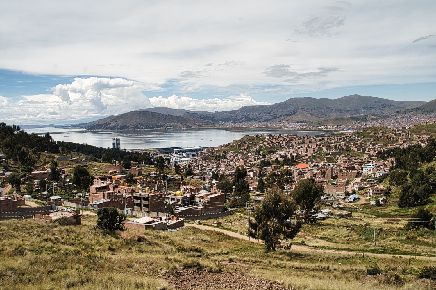
Puno, which has around 150'000 inhabitants, is the largest city on Lake Titicaca and was pretty much deserted on Good Friday. The street market was busy, but that was about it. In Plaza Vea, the shopping center, there was almost nothing going on and the stores nearby were already closed.
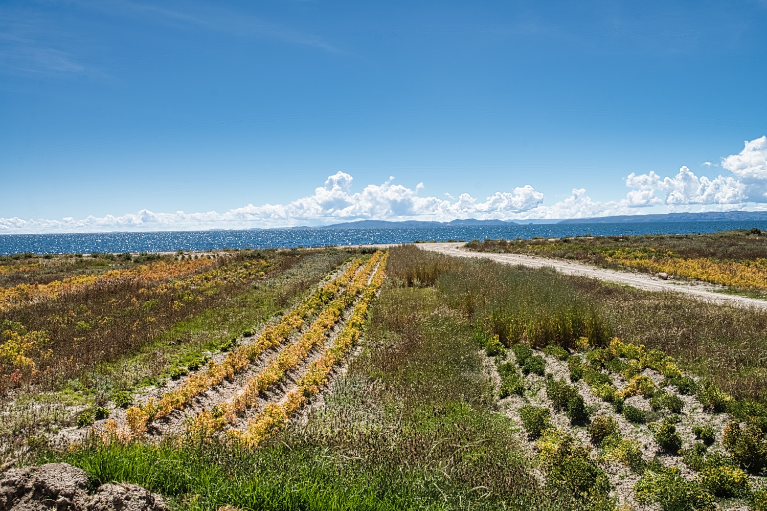
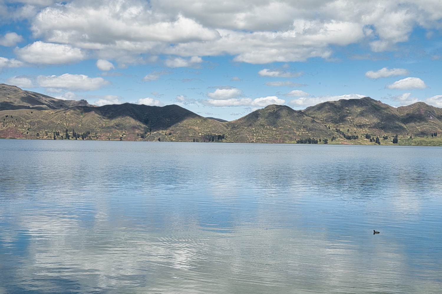
I drove along the coast to the Mirador Capura and spent the late afternoon looking at the floating islands, the Uros Islands. They looked interesting from a distance, but the stories about them varied widely.
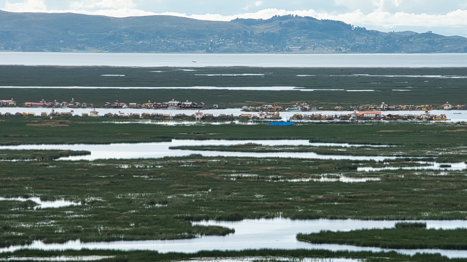
Peru doesn't have daylight saving time, so it was already getting dark by 18:00 local time. The weather forecast was not good, as it was supposed to rain the whole Easter weekend. As I'm not a fan of the top #10 locations anyway, I decided to drive on to Juliaca and skip the floating islands. Juliaca is the little sister of Puno, except that the Tienda Real Plaza was really a shopping mall. When I set off, it started to rain in Puno
The route to Juliaca was not much different to the route to Puno, farms, small villages and towns
I didn't get a parking space at the mall in Juliaca, but after some creative driving, I parked in a side street together with locals. I was not nervous leaving my van alone, as so far South America was not that dangerous. The mall had all the telecom providers and so I tried to buy a SIM for tourists.
The purchase had been easy in Argentina, the activation a challenge. In Chile it was done in 10 minutes and in Peru I felt like I was buying Movistar, I had to sign so many pages. But the SIM only costed 1 Sol, which is €0.25. For that I got 650 MB for 5 days. After the SIM was active, I realized my problem, because the top-up was via an app that I couldn't download as a German from Google Play. You need to be registered as Peruvian on Google Play to download.
But I searched long enough and found this on movistar.com.pe. You can order a package by texting the number 515 and the package name, e.g. A21 <3.5 GB for 30 days and unlimited WhatsApp>. I was able to top it up at Western Union, pharmacies and supermarkets.
When I left the mall, it started to rain here too. As I don't stay overnight in towns with my van, I continued into the mountains. At my pitch, it hailed 1.5 hours later and the world ended for the next hour.
I had been thinking for a long time about what I wanted to see in southern Peru. The Altiplano and the Rainbow Mountains were at the top of my list. Reserva Nacional de Salinas y Aguada Blanca was also on the list, but I had already seen a few salt lakes and the detour was considerable.
Besides, I didn't want to get stuck in the mud in bad weather.
So I took the Ruta 34A to Imata (4'500 m.a.s.l.). The mountains were green and along Ruta 113 the holes in the track were filled with water. It was definitely more like the Altiplano in Jujuy. No desert and rather fresh at 12 to 15 Celsius.
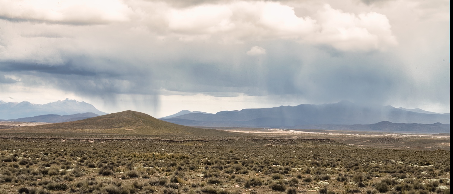
The Ruta 113 was my first Peruvian dirt road with ripio at the beginning, passages through water holes and stony passages. The sky was and remained gray and I didn't have much visibility. From time to time I could see Mt Misti in the distance.
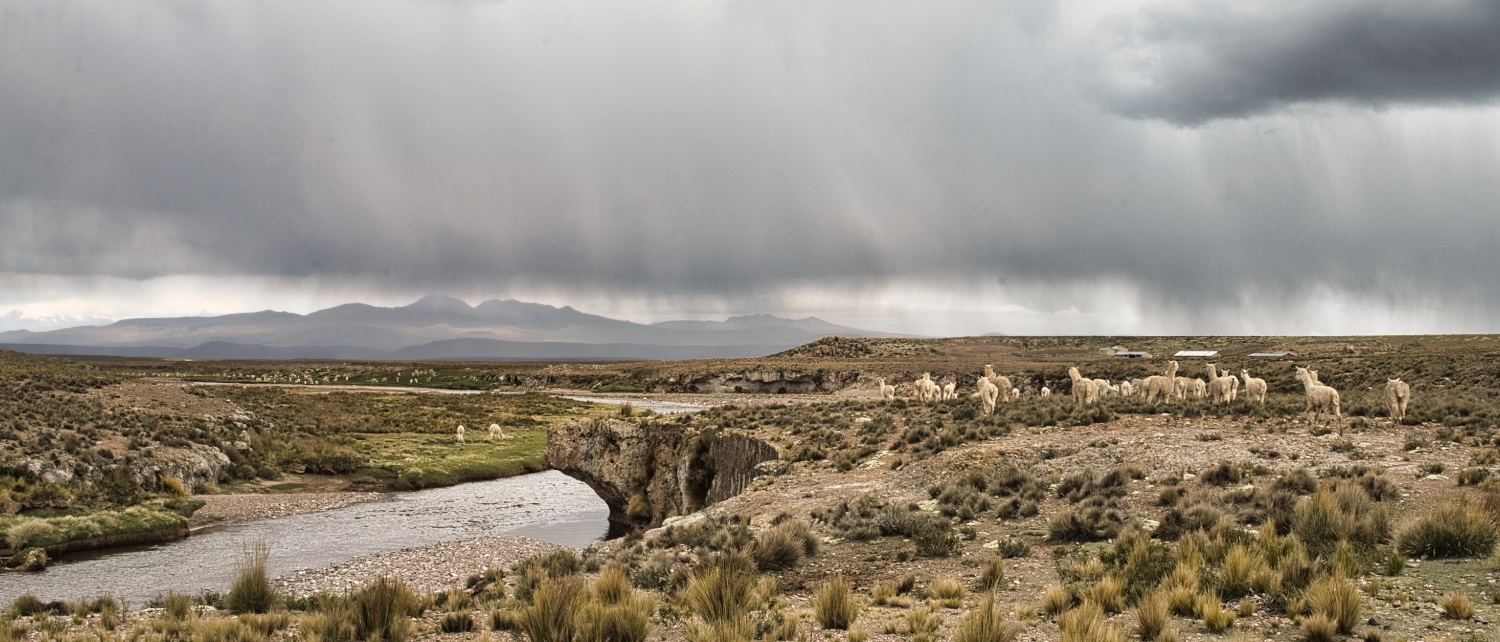
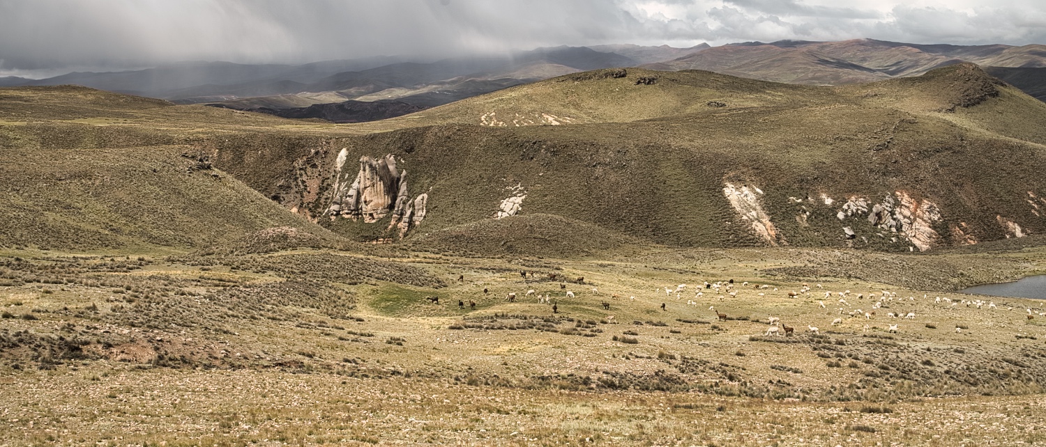
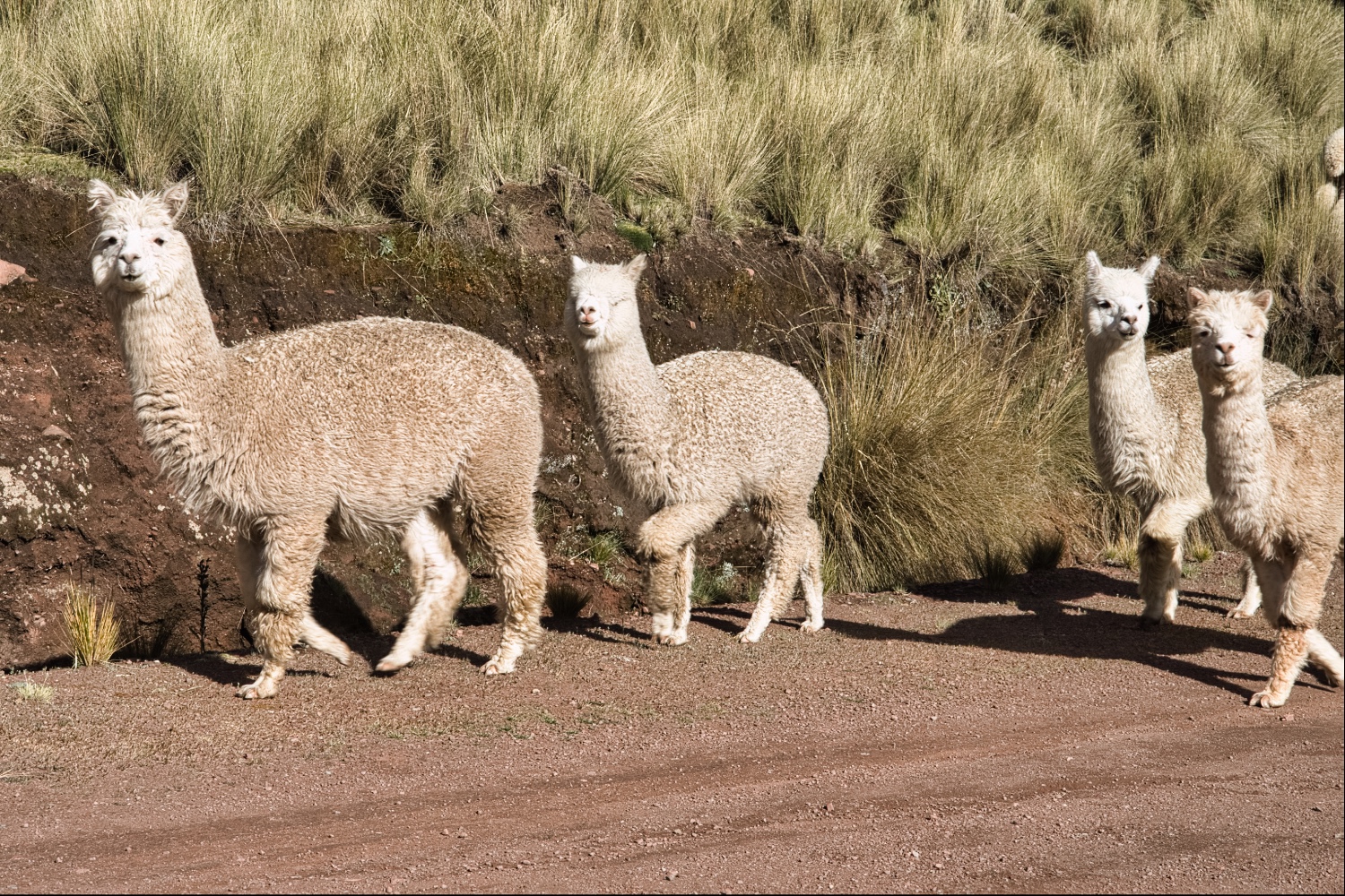
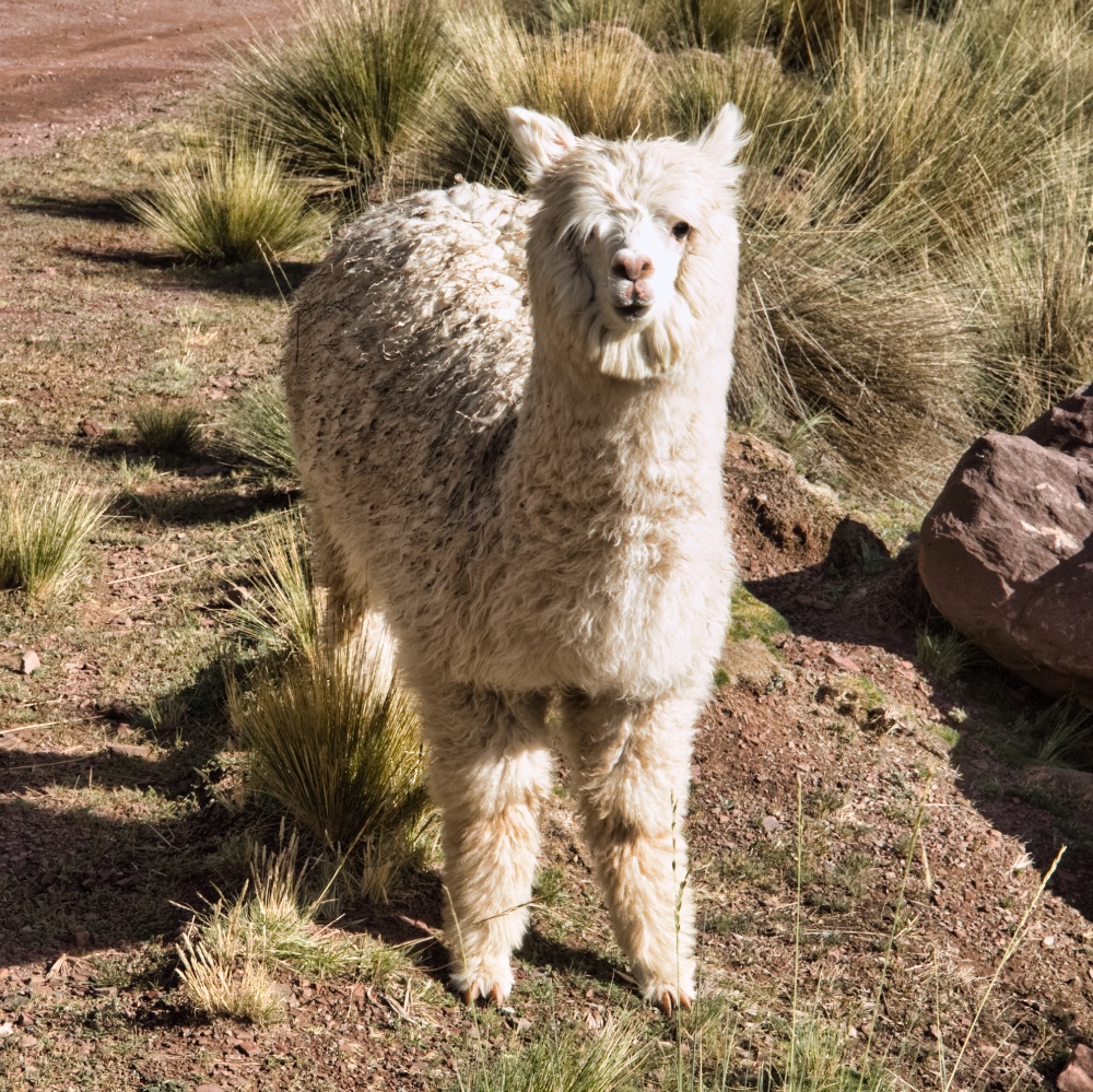
Apart from sheep, vicuñas, alpacas and llamas, there wasn't much to see. When I turned off onto the Ruta 34E, my Easter Sunday started to turn to shit. If the R 113 was a dirt road, the R34E was a disaster. Potholes every few centimeters for the next 25 km. At times I only made progress at walking pace. In between, the drizzle turned into snow and hail. And all this around 4'500 m altitude. My ass was on ice. If the route would become a muddy track, I would have been mad. --> watch the video to get an idea
The crowning glory of the day was a quarry, which the Peruvians call a road. It went down to 4'000 meters thru the quarry.
After that, the route became a decent track again with a bit of ripio and gravel. My highest pass that day was at 4'789 m.a.s.l. and had no name. Mt Wiswillani was the next mountain.
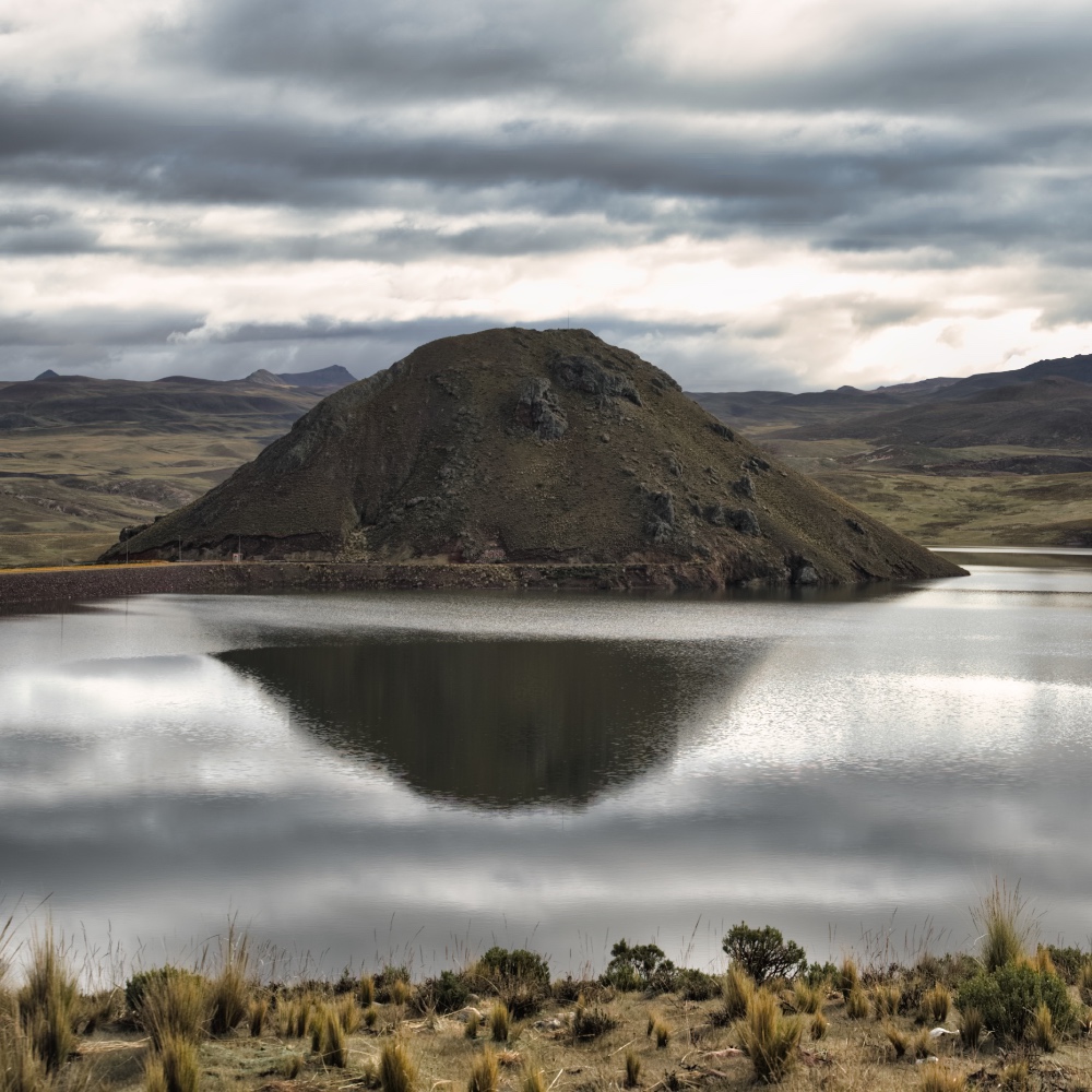
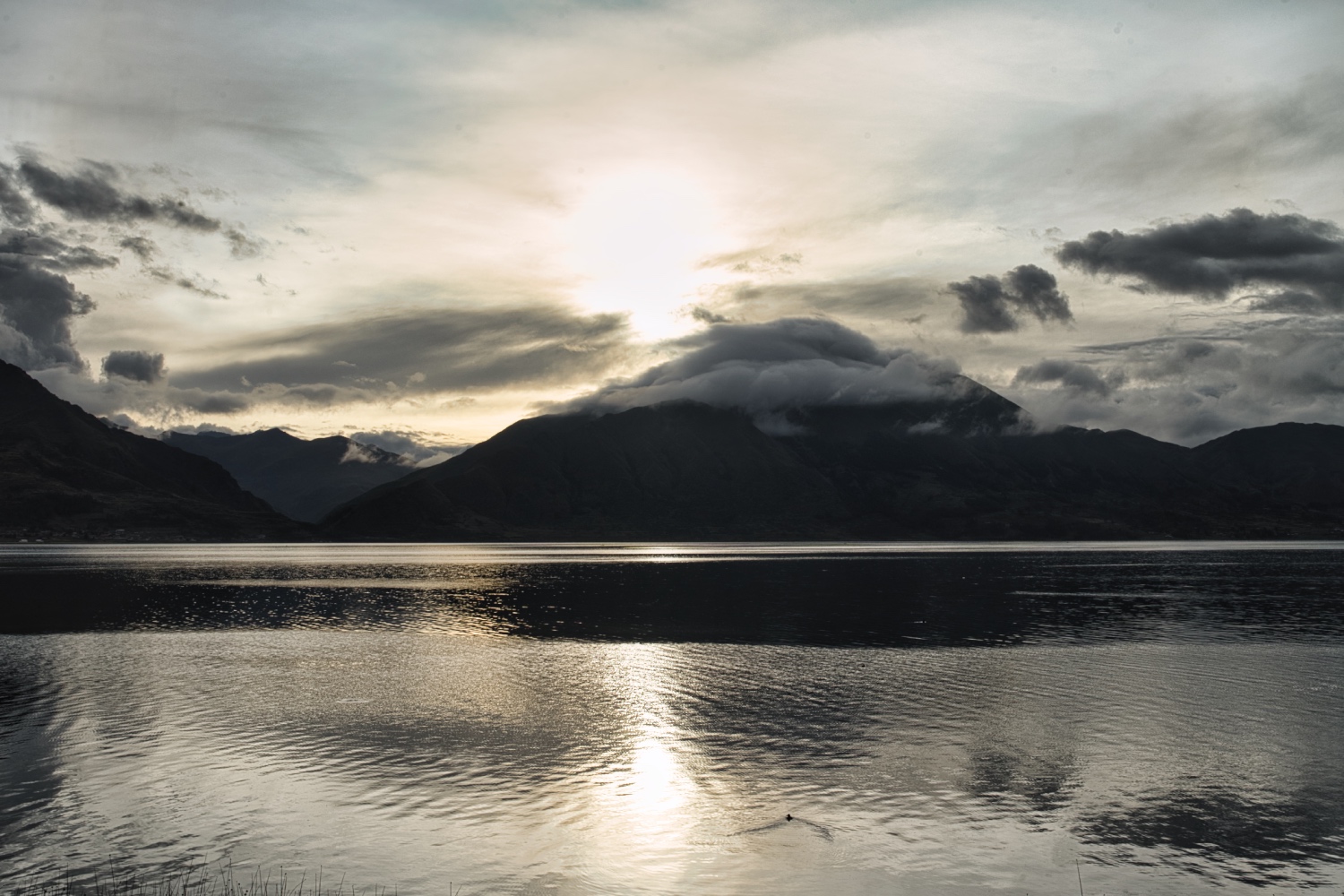
The rain had been with me all day and when I ended the day at Condorama Dam, it was storming and the temperature dropped to 3 Celsius around 18:00. I toyed with the idea of running the parking heater through the night, but didn't do it. I only gave in at 6:00 in the morning and switched it on. The Wallas 22Gb with the High Altitude Kit (HAK) worked perfectly as always! After a few months now in the high Andes, I stopped worrying about the altitude, the cold nights and bad weather conditions.
The next day I continued along the Ruta 34E. The track got better, but the landscape didn't change much. Green hills, alpacas, llamas and the occasional motorcycle. I realized that the R34E was constantly going uphill and started to measure the altitude. Near Condoroma, the apps showed 4'805 m.a.s.l. and this for the next few kilometers.
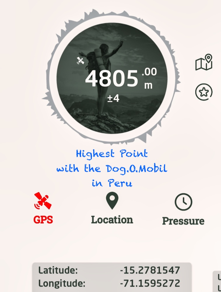
It felt strange that I had reached the highest point of my tour so far in the Peruvian Altiplano. No striking mountains, nothing special. If the Paso de Agua Negra was already not very impressive, an simple track with a sign, this area was even more unimpressive and almost disappointing.
The descend from 4'800 m to just under 4'000 m via the Ruta 34J did not at all come across as the high Andes, more a decent mid range mountain range. I had already noticed the many fuel trucks beforehand, but along the R34J I saw entire convoys.
Along the Río Salado, I tried to dispose of my garbage and do some shopping in villages. Both this proved to be more difficult than expected. In the previous countries, there had been garbage cans or baskets at the side of the road. In Peru, I only found twice garbage cans in a public square in Yauri / Espinar.
There were tiendas and alamcens in the towns, but the offer was basic. It was market day in Espinar, so I was able to buy bread, fruit and vegetables. I found a market woman selling a kind of salty corn pancake with jacket potatoes. It was definitely delicious and I would buy it again. White or black corn on the cob, boiled or grilled in the husk, was also available. Not really my favorite.
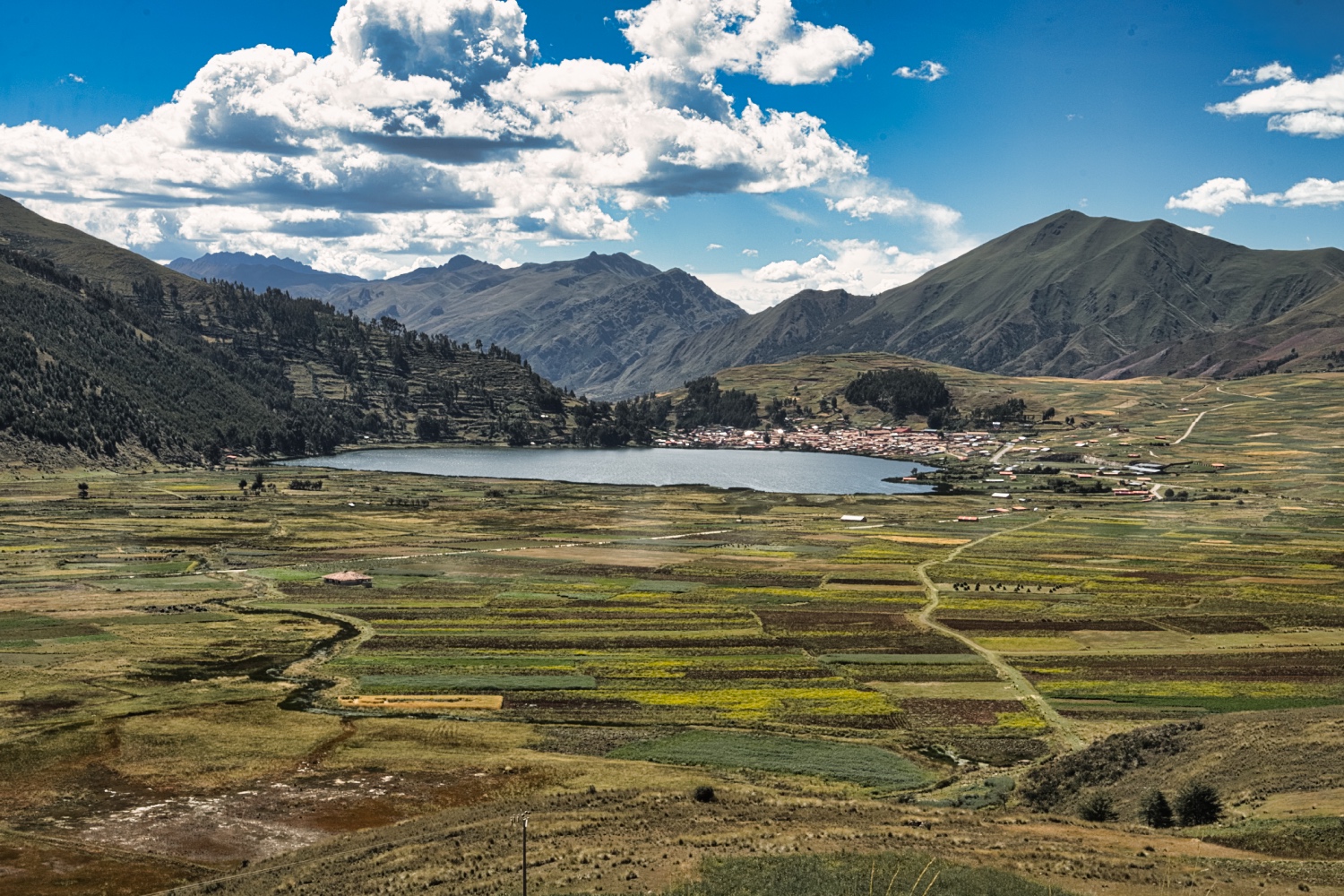
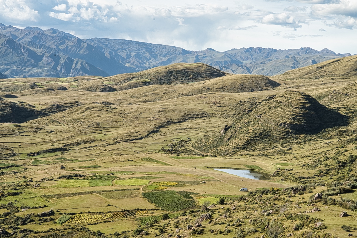
The hills along the road remained green and undulating, with the occasional barn or farm, and the closer I got to Laguna Langui near Layo, the more densely populated the region became. The Laguna itself can compete easily with any lake in the Alps.
Layo is a sleepy village with a few stores, but that's about it. The pitch at Coso Taurino de Layo was OK, but I was drawn to the mountains at Pallay Punchu. I knew that a landslide had made the road impassable, but it was only at 4'300 m that I learned from a local driver that I'd better stop here and walk the rest.
The small turning area on the road was OK and so I stayed. In the course of the afternoon I made the acquaintance of Jorge (I hope that's how he's spelled). Jorge owned 80 Alpacas and lived in a hut near where I was staying. I learned that he bred Alpacas for slaughter. Only a few of the Alpacas were shorn. He fed his family of 5 children with those 80 Alpacas. It was by far the longest conversation in Spanish I had ever had.
And the longer Jorge stayed, the closer the Alpacs came.
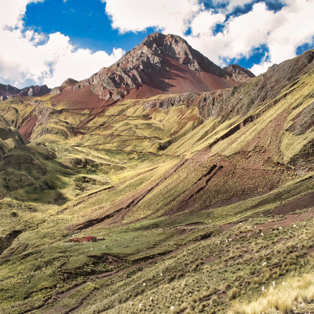
The next morning, a wheel loader and a grader came by and started to make the road passable again. The 3 km to Pallay Punch were passable again by the afternoon (by South American standards)
I climbed my first mountain that day at 4'730 m.a.s.l. The 400 meters in altitude over 4 km were more than enough for me. The landscape was breathtaking and watching the road builders once again showed me that things can be done differently. The two drivers worked alone on the steep slope. In places where the slope had been swept away by landslides, I thought that was brave. One wrong turn or misjudged the situation and that was it. But nothing like that happened.
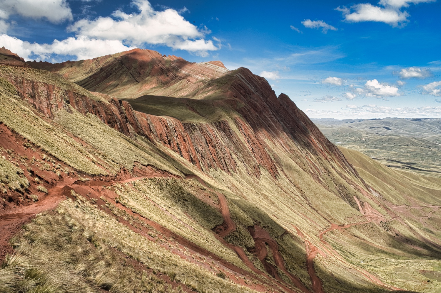
Although the Pallay Punchu didn't have 14 colors, it was beautifully embedded in the green of the surroundings. On the two days of my stay, not even 10 tourists passed by. I wondered whether I wanted to put up with the tourists in the Rainbow Mountains.
The repaired road was quite muddy in a few places and I lost my courage. Instead of driving over Pallay Punch and staying at the Aguas Calientes, I chose the road along Laguna Langui. But this road too was a roadworks site. I took the opportunity to take more pictures.
There was a cattle market in front of Langui. Sheep, Llamas and Alpacas were being sold. No auction with lots of action, but the sellers and buyers were talking to each other in a friendly manner and that was it.
In Langui, a campesino mistook me for a cab bus and I gave it a try. I wanted to see how far I could get with my Spanish. After the usual small talk, we started speaking about the Spanish language. He made a distinction between Castellan, Quechua and Aymara. It took me some time to realize that the Aymara are indigenous people in the Andes and Altiplano of South America. About 2.3 million Aymara live today in Argentina, Bolivia, Chile and Peru.
The ancestors of the Aymara lived in the region for many centuries before they were concurred by the Inca empire and later, in the 16th century, were made slaves by the Spanish. The conquest of the Altiplano by the Incas began around 1438 and was completed around 1500.
I had googled most of it afterwards, because he fell asleep during the ride to Chopin and then went for lunch in Sicuani.
I filled up with gas in town, bought some basic food and treated myself to lunch at the Combapata market. A soup, fried fish with rice and a warm fruit juice for just 9 sol (€2.25). It was delicious, but as often before, the fish had been fried to death.
At lunch in Combapata I made the decision! I left the Rainbow Mountains to the right and made my way to the Circuito de 4 Lagunas
The Circuito de 4 Lagunas (Pomacanchi <3'700 m.a.s.l>, Acopia <3'850 m.a.s.l>, Asnaqocha <3'950 m.a.s.l> and Pampamarca <4'050 m.a.s.l>) was a bit of a surprise for me.
The four Lagunas are embedded in pure nature, turquoise water, panoramic views of the Andes between 3'700 and 4'100 m.a.s.l and hardly any tourists. There were also plenty of pitches along the CU 1627.
I wanted to spend the night in front of a closed campsite at Laguna Pomacanchi when a car pulled up next to me at 23:00 <it had got dark by 18:00> and flooded my interior with light. I struggled out of bed and went to have a look. A police car parked next to me. I got dressed and went up to the three policemen. In my best Spanish 😇, I asked if it was OK to spend the night here. The chief said it would be OK, but he would like to take a picture of me with his colleagues. So I posed between 2 policemen in front of my Sprinter, which was illuminated by the police pickup. To say goodbye, the siren went off again briefly and then they were gone. It took me a while to get back to sleep, but it was the only visit of the night.
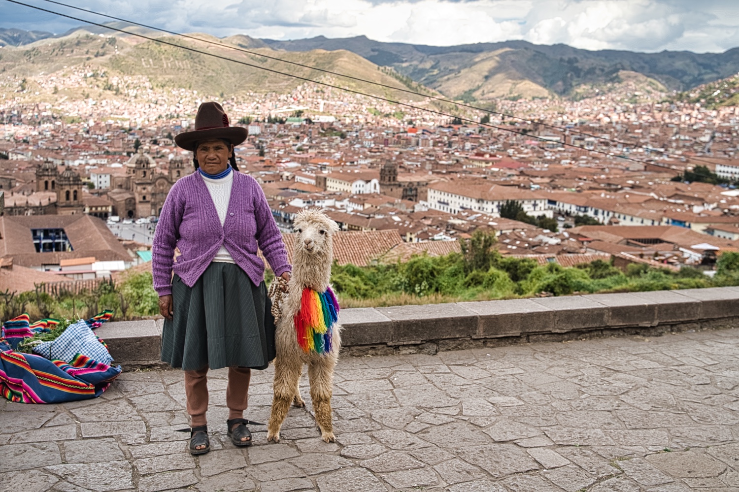
Peruvians seemed to love posing with me in front of my sprinter!
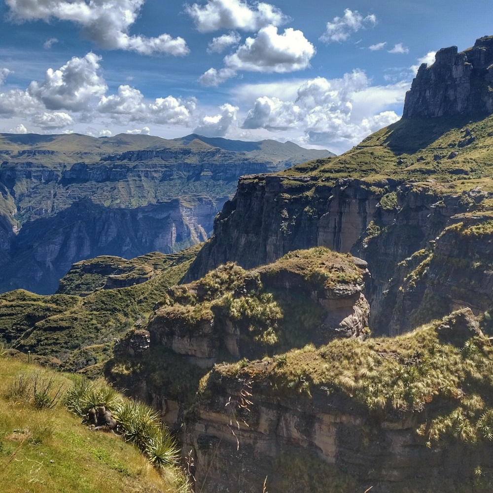
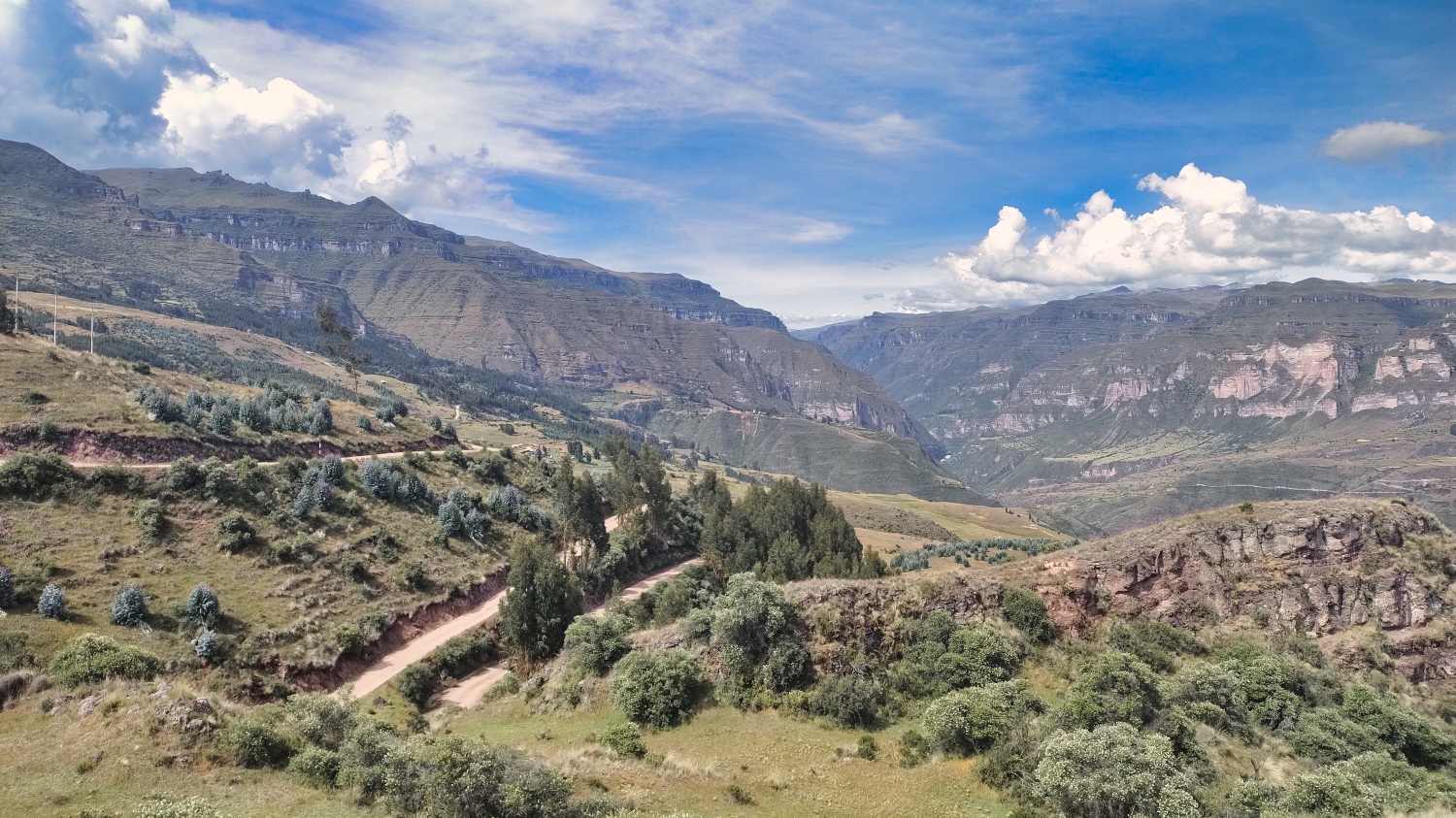
My destination was the Paisaje Arqueológico de Waqrapukara. The fortress or ceremonial center of Waqrapukara was built between 1500 BC and 1000 BC by the Qanchi and completed by the Incas. It sounded exciting, and it was. The journey alone along the Ruta 117 and later the dirt road to Campi offers a fantastic view of the Andes. The track meandered along the steep slope, but was easy to do, except for passing through the village of Campi.
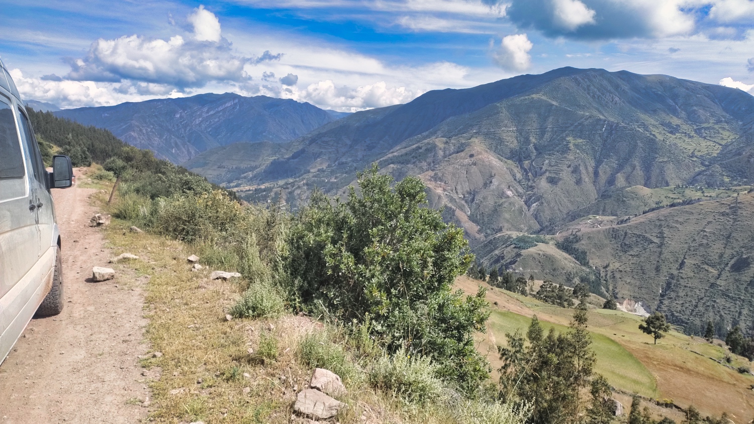
I parked the Sprinter at 3'900 m above sea level and set off on the 17 km to Waqrapukara. If the journey was good, the hike was phenomenal.
The first 4 km were along a path and the remaining 4.5 along a trail. Brilliant views, I can only say.
Unfortunately I had to stop 1.5 km before Waqrapukara because my legs had had enough and I still had the way back ahead of me. I hadn't underestimated the hike between 3'900 m and 4'250 m, but I was paying the price for the ups and downs. Sarah from the USA was the only other hiker I saw that day. She tried to motivate me, but unlike her, I had to walk the whole way back.
After 15 km in total, I arrived back at the Dog.O.Mobil, excited and exhausted. After a break, I set up my Evershower and treated myself to a well-earned shower before it got dark again at 18:00.
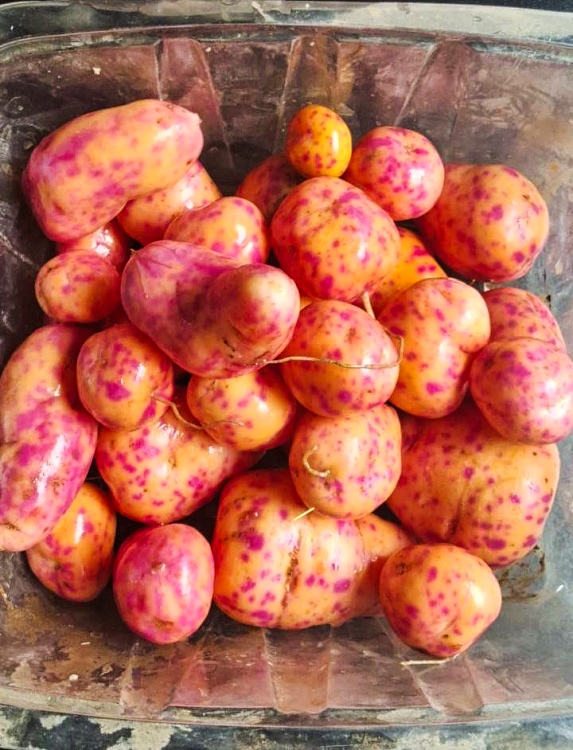
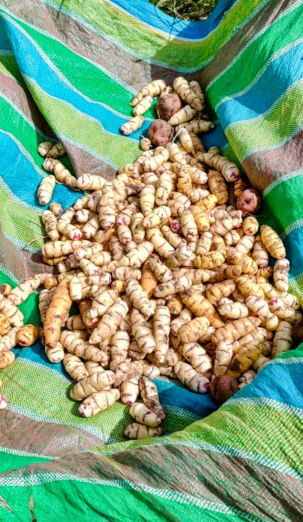
I spent the following day on the pitch in glorious sunshine, relaxing and looking after myself and the camper van. On the morning of the last day, Manuel, the son of a farmer, came by and started digging something up. I approached him and he made a real effort to explain that he had to harvest Oca and Olluco. I seized the opportunity and bought some Oca and Olluco and was going to try it in the next few days.
 |
 |
Already at my way back I saw a plastic bottle with juice. Manuel explained to me that it was a Chicha de Jora and that I was welcome to try it. I had already seen these bottles several times along the road. Women sell a brownish liquid in those plastic bottles. Chicha de Jora consists of fermented corn, yeast and water. At first I thought it was a juice because it tasted slightly sour, but the liquid also tasted like a naturally cloudy fermented apple juice, or something like that. Perhaps the lukewarm juice in Combapata had also been a Chicha de Jora and I had definitely enjoyed it.
![]()
Finally I headed to Acomayo via Campi. The narrow track led down the shoulder of the slope to around 3'200 meters. When the first minibus came towards me, I felt queasy, but I managed. I wondered why I should take one of the various Rutas del Muerte when I had something similar here.
It was market day in Acomayo, all the small stores were open and the streets were so narrow that I couldn't turn off onto the track that led to Quiquijana. When, after a short detour, I came to a halt behind a car parked on the road, the driver explained to me that the road to Quiquijana was not passable all the way through, let alone with my big Sprinter. So I changed my plans and took the Ruta 117 to Quiquijana and then Cusco.
Cusco later that day made a big impression on me, at least the traffic did. The closer you get to the center, the more confusing the roads became. Once again I drove the wrong way up a one-way street. The other drivers took it in their stride.
I was amazed that I was able to park my Sprinter in the parking lot in front of the entrance to a shopping mall, PlazaVea Cusco, for 2 Sol an hour. Had the opportunity to freshen up after Arica. Afterwards I struggled up the slope to my Quinta Lala campsite. This way I skipped the narrow roads thru the Centro.
I would rather call Quinta Lala a parking lot for Overlanders, that also has toilets and showers. But it's totally OK, because after weeks I had the chance to talk with others. Not just the usual 15 min at a super market. For a change, I wasn't the only Overlander, but shared the space with French, Dutch and Germans.
It was only by chance that I noticed a Ford 550 with the name “The Turtle Expedition Unlimited”. I had already read a few articles by Monika and Gary Wescott and in the evening, over a Pisco Sour and a bottle of rum, I learned something new. Gary and Monika have a few decades more experience in overlanding.
After a quiet night, I headed into Cuzco. It was a 20-minute walk downhill and I went in search of a Western Union and Movistar. The Western Union was so pleasant after the stress in Argentina. I went in, showed my passport and transaction number and had my Sol 10 minutes later.
Movistar was more of a disaster. I had topped up 50 Sol the day before at PlazaVea. The activation of my 30 sol tariff didn't work because the Movistar system didn't see the credit. The nice lady diligently searched the system, found my phone number and a credit of 18 Sol only. I spent the next 20 minutes trying to explain that I had topped up 50 Sol, which she acknowledged. But she couldn't tell me where the 32 Sol had gone. After a while the service manager joined in and the discussion continued. At some point I gave up, because the solution to my problem seemed to be to book another credit. Not in the Movistar store, but in any tienda in the city.
I wrote off the 51 Sol, crossed the street to Entel and after 15 minutes had an active Sim with 10 GB data volume & 30 days for 20 Sol. I've had the best experiences with Entel and Claro in all countries so far.
After this I finally started my tourist journey of discovery. Cuzco, or rather the greater Cuzco area, had around 480'000 inhabitants, lies at an altitude of around 3'400 - 3'800 m altitude and is the starting point for tours to Machu Pichu, Rainbow Mountains, etc.
A bit about the history (I listened to a guided tour in English at the Plaza de Armas and later researched it on the internet), because when you walk through the city you only see a small part of it. The oldest buildings in the Centro date back to around 1550.
Cuzco was founded by the Incas in the 11th or 12th century. Pizarro took Cuzco in 1533 and after that the decline began. There were various wars, sieges and a Spanish civil war over time. In 1572, the last Inca king Túpac Amaru was beheaded in front of an indigenous audience, and in 1781, after a failed uprising, the indigenous rebel leader was quartered.
During the War of Independence, Cuzco became the capital of the last Spanish viceroy in 1820. After independence, Cuzco degenerated into an insignificant provincial town, only to lose further in size after the Saltpetre War in the 1880s (at that time it still had around 20,000 inhabitants)
It was only when the hidden city of Machu Picchu was discovered in 1911 that Cuzco began to rise again to become Peru's largest tourist center.
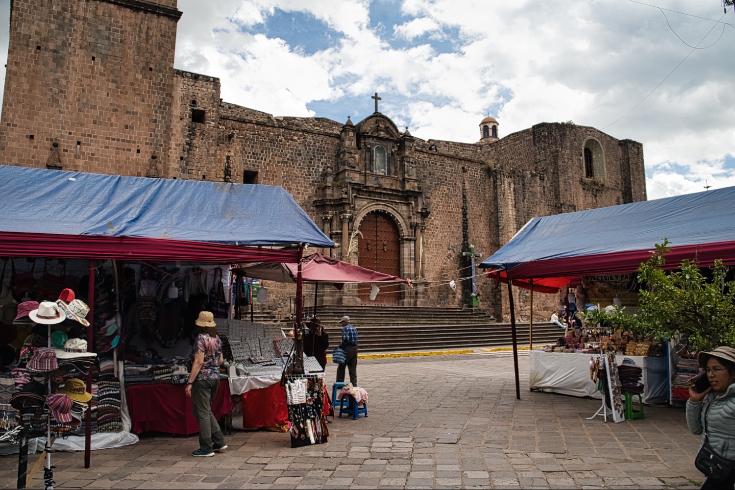
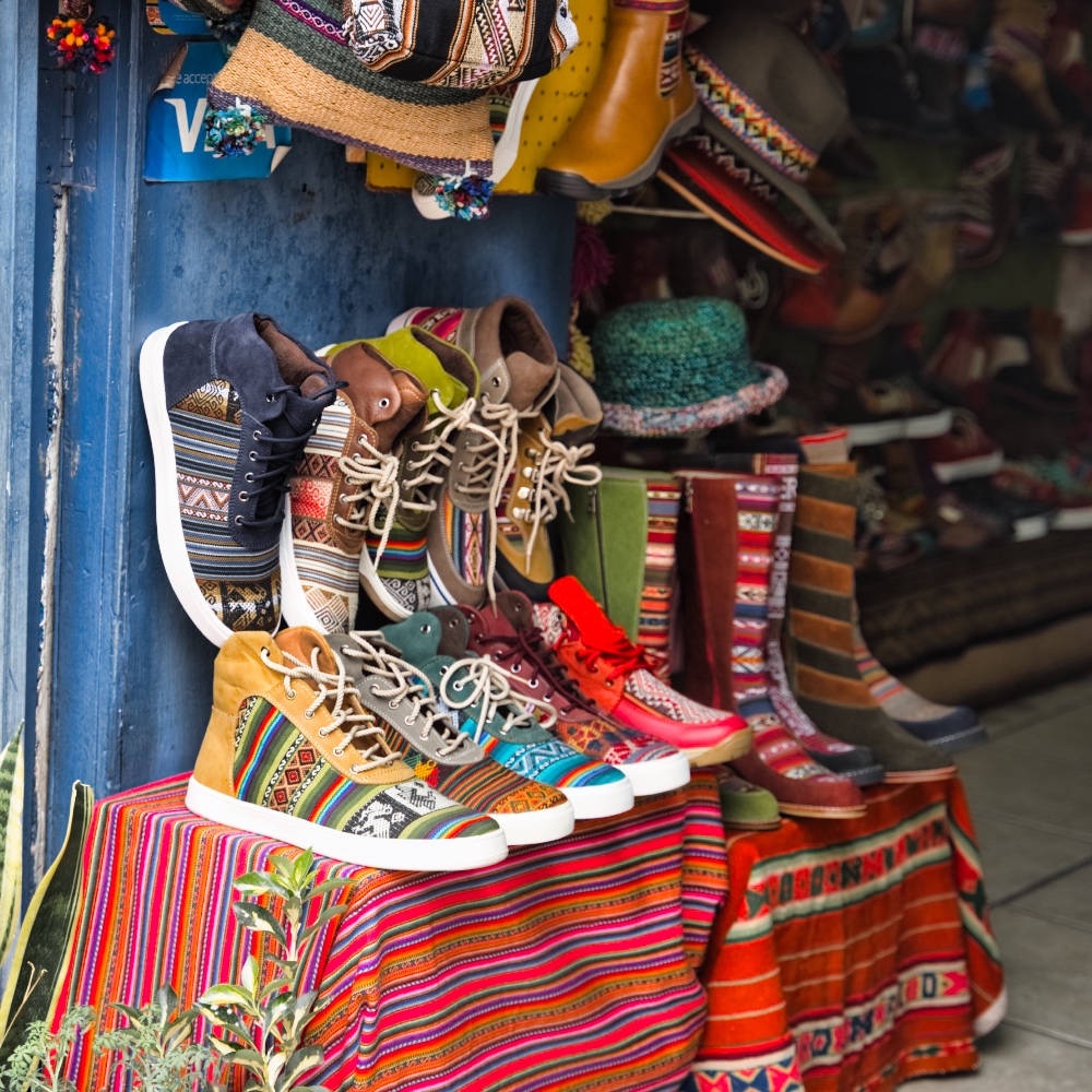
I had the feeling that more English, French and German were spoken in the Centro than Spanish. It felt like every second person was a tourist. The old town was beautiful, spruced up and offered everything your heart desires. Vegan restaurants, French bakeries, jewelry stores, bars, cheap and expensive stores, museums, churches and markets.
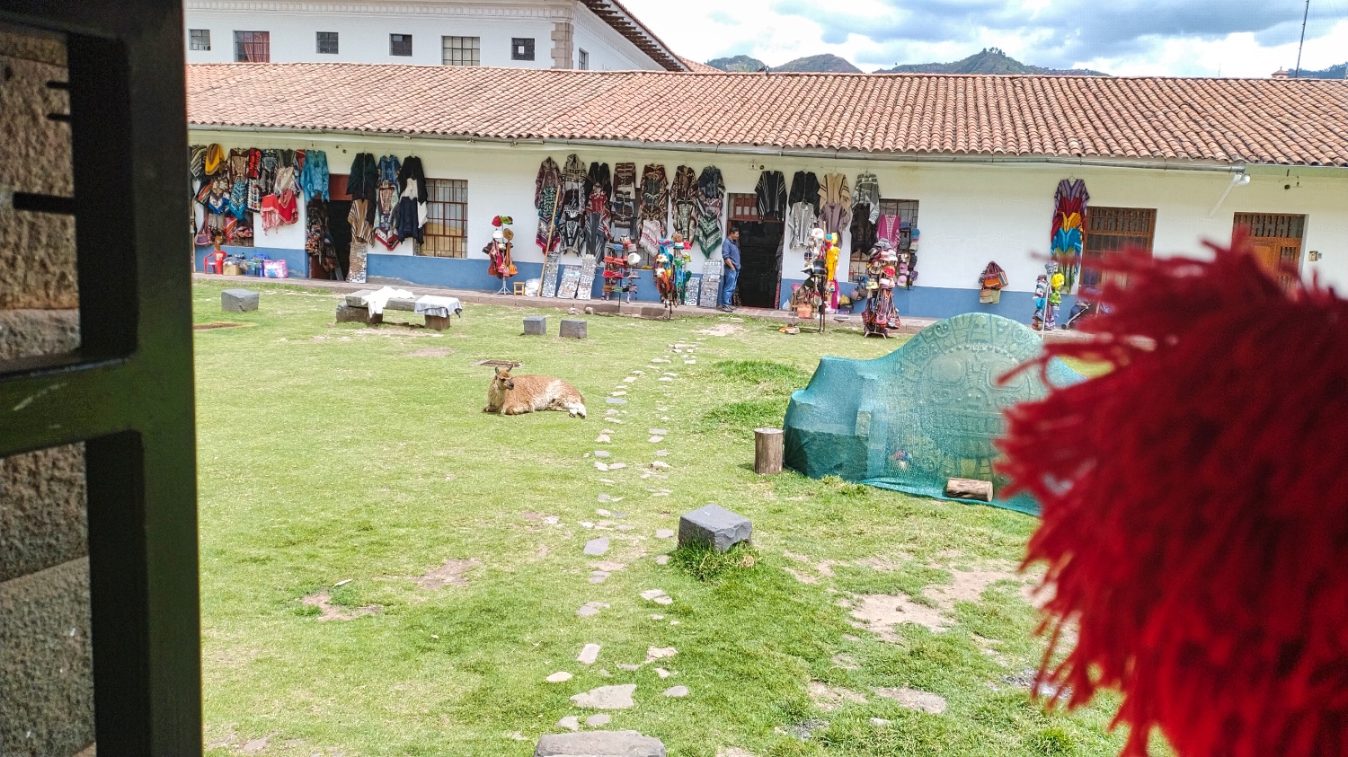
Visitors have the opportunity to pose with Alpacas, take a selfie in front of the Estatua de Pachacuti as they pass by, or get a Peruvian massage.
After 4 hours, however, I had run out of steam and sat down in a restaurant to take a breather. Cities have always stressed me out and even more so when they are flooded with tourists.
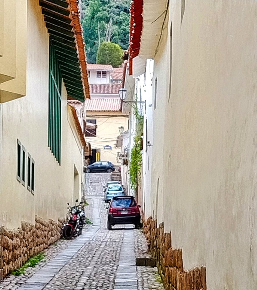
If the way to the center was downhill, I had to go all the way back up to the campsite. The cobbled streets were so narrow that I started to wonder how I was ever going to get to the other side of Cuzco in my Sprinter.
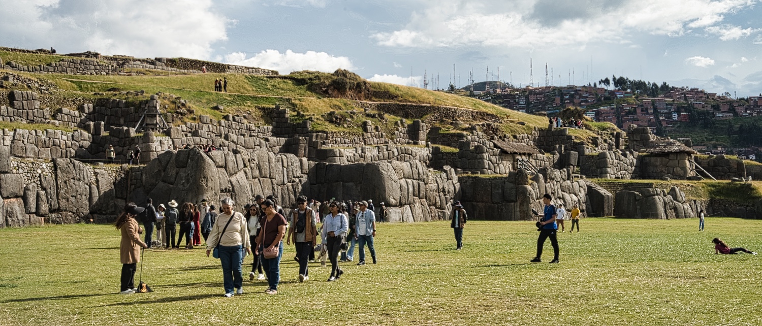
In the morning, only a few cars had passed me on the way up. In the afternoon, there were so many buses driving up the hill along Calle Don Bosco. While I took a longer break at the Mirador de Sán Cristobal, the buses continued on to Saqsaywaman after just a few minutes. The ruins of the Inca fortress of Saqsaywaman were first on my program for the next day.
I think it was at the Mirador de Sán Cristobal that I finally decided against visiting Machu Pichu. The feedback at the campsite was very mixed. I heard statements such as “If you haven't seen Machu Pichu, you've missed something”, through to “Got up at 3:00 in the morning, took the slow train there, waiedt 2-3 hours for a ticket, then go up and waited from 13:00 for the train, which didn't go back until 16:00”
Everyone agreed that Machu Pichu is beautiful and extraordinary, but also overcrowded and expensive!
That night I made out of the Oca home fries. Added broccoli and just some butter, salt and pepper. Delicious!
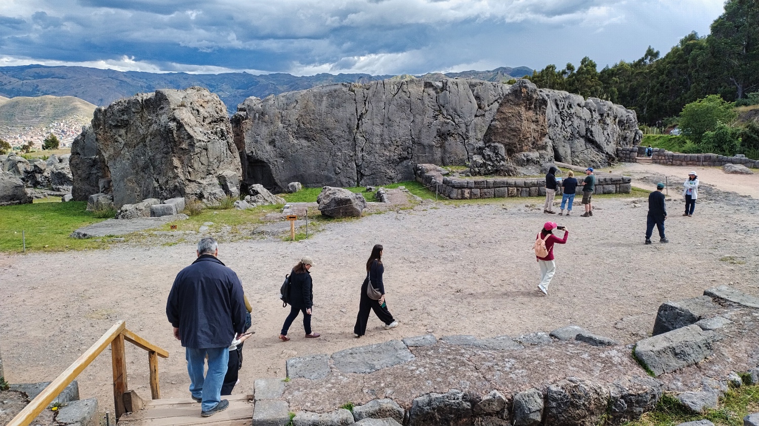
I chose a hike into the hills above Saqsaywaman for my 2nd day. I looked at the Balcon del Diablo and the Abra Qoricocha from a distance, stood on various miradors from which you can admire Cuzco from above, and finally visited the Complejo Arqueológico Q'enqo and Saqsaywaman
For me, Q'enqo was a collection of stones. Officially, i.e. on the 2 information boards, they are natural monoliths in a kind of amphitheater with niches and a terrace. If you know what you are looking for, you will also find the zigzagging stone channels. I liked the forest at the exit, Q'enqo Chico, much better.
But Saqsaywaman made up for all that. Even the guided groups couldn't dampen my enjoyment of the complex. I simply sat down on the lawn and marveled. Some of these carved stones were huge and blended seamlessly into the walls or houses. It wasn't just a wall either, there were the Ruinas de Qhalispuqyo, the Rodadero, the Trono del Inca and so on.
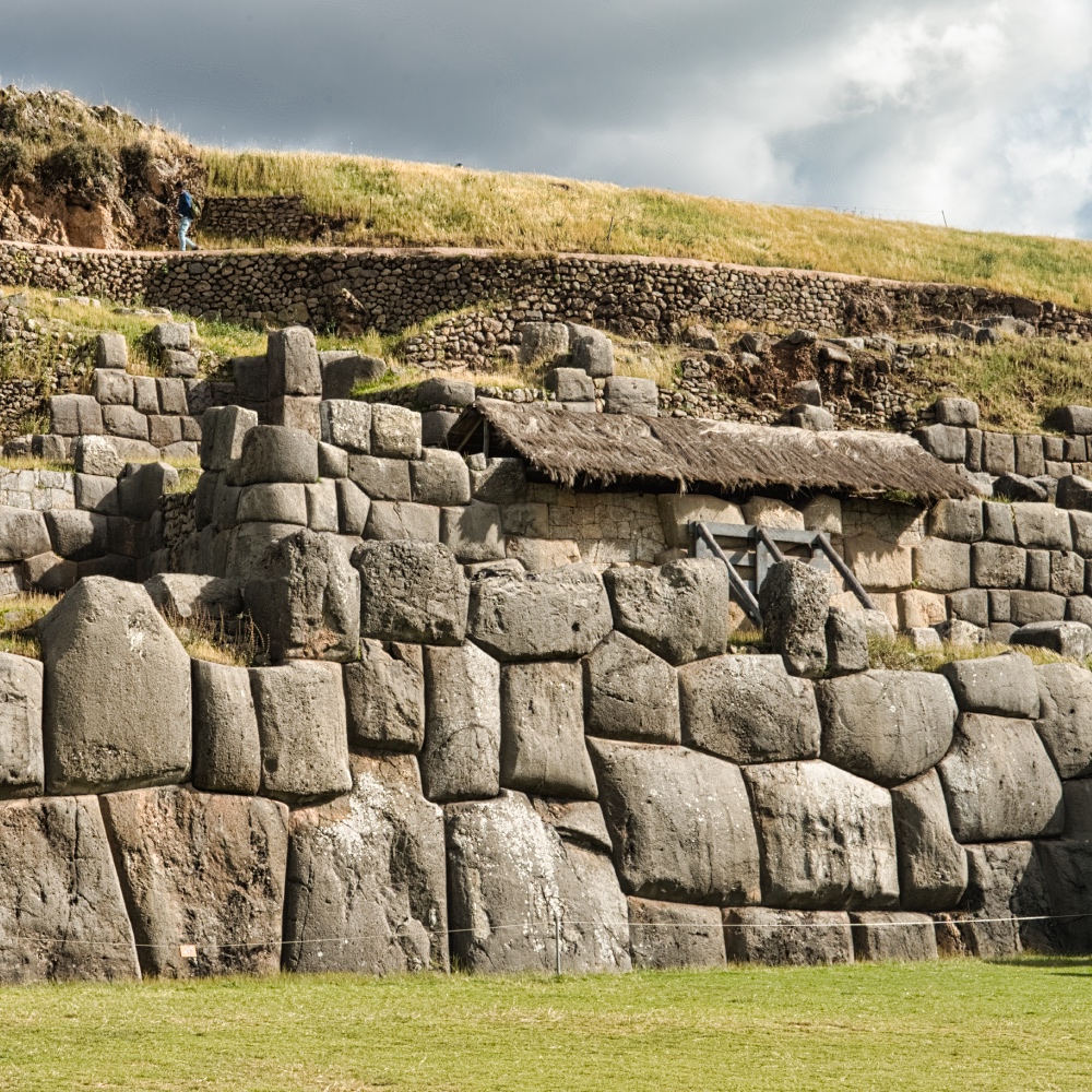
Once again, I was mooching and listening to an Asian group and their guide. Saqsaywaman was built in the 15th century by more than 20,000 people. It was intended to serve both as a fortress and for representational purposes.
After the Spanish conquest of Cuzco, the Spaniards began to use Saqsaywaman as a source of stone for the construction of the new Cuzco. Within a few years, a large part of Saqsaywaman had disappeared. What a shame!
I spent 2 days afterwards to relaxed in Cuzco and enjoyed the small talk with the other Overlanders at the campsite. On that night I prepared olluquito con carne. As close as I could get to the recipe of KAHLO'S EYES. The olluco tasted good and are on my shopping list as well.
The Stage

More Pictures
Videos
Latest Posts
-
 Closer to the end - South Colombia till Medellin
 -
 Ecuador - La Balsa to Tulcan
 -
 Lima to Ecuador
 -
 Lima from beginning to end
 -
 Cuzco to Lima
 -
 From Lake Titicaca to Cuzco
 -
 Bolivia, in search of diesel


Post Info
Date | April 2025 |
Status | Done / Visited |
Last updated | 03 October 2025 |
Page read | 580 |