Lima to Ecuador
The Dog.O.Mobil was only a little dusty when I picked it up near the airport. Jose Luiz, the owner, had even sent me a video that weekend. He took his job seriously.
I had found out that you could also leave Lima heading north along the airport on Ruta 100. After shopping at a Tottus, I left the city without any traffic jams nor nerve-wracking traffic.
After Ventanilla, I was on Ruta 1N and drove along the coast. This time the weather was better and you could see more than just the contours of the hills. From 2 p.m. onwards, the sun even came out. At El Paraiso, I found the perfect spot on the Pacific coast.
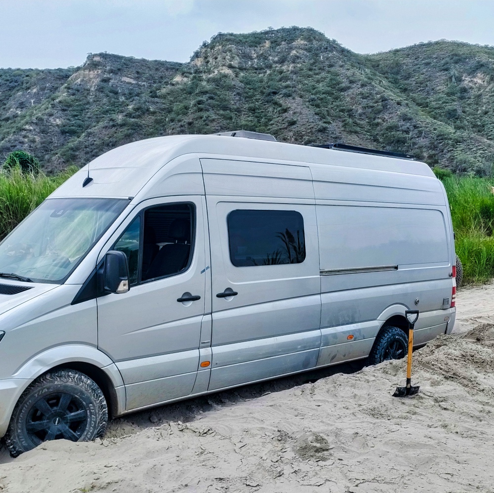
If you want, you can park on the beach in the sand, but I stayed further up the slope and wandered around a bit. It was even warm enough for surfers to try their hand at the waves.
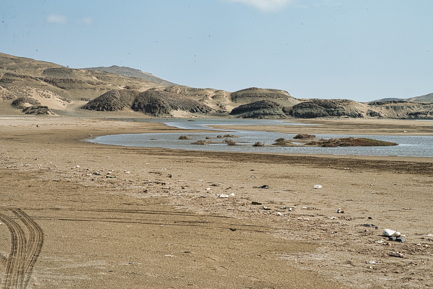
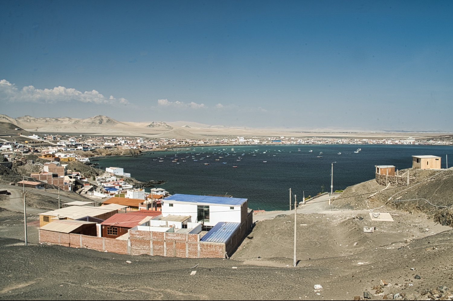
After a quiet night, I continued on towards Ecuador. I'm not much of a beach person, but a few sections were really beautiful. However, I wanted to cover some distance and ended the day at Tortuga. Tortuga was the first beach town that actually had some charm. At Playa Guaynuma, I was the only one hanging around besides the fishermen.
I couldn't take any really good pictures of Isla Tortuga or Isla La Viuda because the visibility wasn't that good. Isla La Viuda got its name “The Widow” after the ship Mercedes sank off the coast in 1852 with its entire crew of 1'200 people. I wondered what kind of ship could transport 1'200 people in 1852!
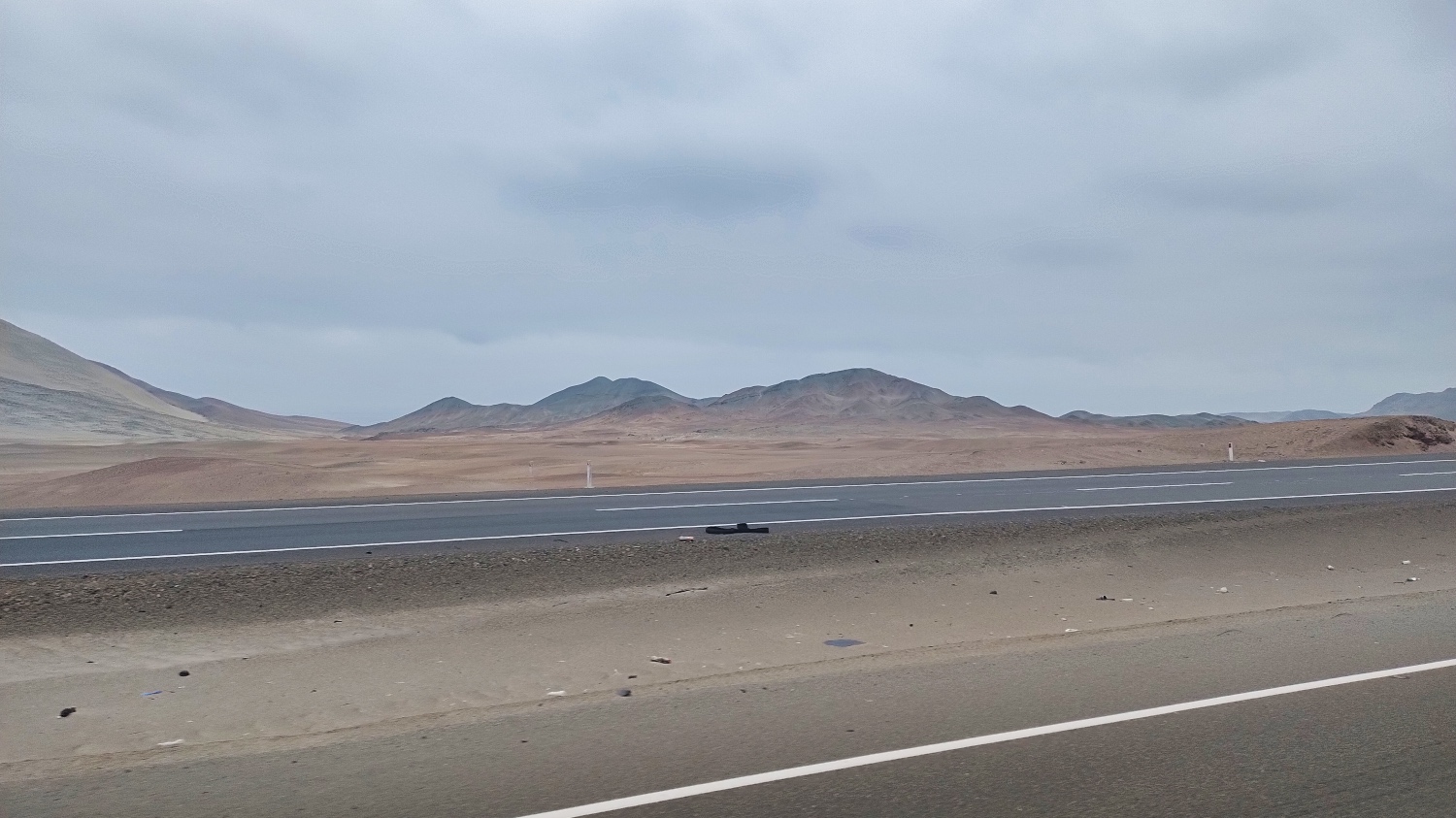
What can I say, since leaving Lima, I drove through a desert-like coastal landscape. With dunes and mountains that blended into each other in different colors. Every now and then a place, sometimes a small town, or a river or valley that stood out green from the rest.
After two days, I'd had enough, but I decided to do my laundry in Trujillo after four weeks.
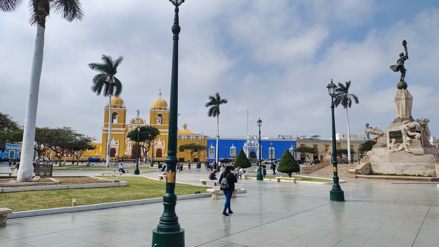
At first, I thought I'd chosen the wrong city with Trujillo, but it's enough for half a day of sightseeing and lunch.
The colonial center is home to a cathedral with a bright yellow facade and the blue Casa Urquiaga. The center looks very colorful, but outside it is just a functional city with a lot of traffic.
For the next day, I had planned to visit the adobe complex of Chan Chan, aka El Brujo, an abandoned city of the Chimu Kingdom.
Over coffee, I planned my last days in Peru. I didn't feel like driving 20 hours or more to Yurimaguas or Porvenir on the Amazon. Together with Pucallpa, these are the three easternmost cities that can be reached by car. After that, the only way to continue east is by boat.
But everything that interested me was in the mountains. It was 650 km to Catarata Gocta or Kuelap, which meant between 16 and 20 hours of driving time.
At my daily pace, 650 km would take somewhere between 4 - 6 days. And another 350 km to the Ecuadorian border at La Balza.
Along the way, I could visit the Bosque de Piedras de Cumbemayo, the Lagunas De Alto Peru, the stalactite caves of Iglesia Yanamachay, the Ventanillas de Otuzco near Cajamarca, the Fortaleza de Kuelap, the Mausoleum of Revash, and also the Mirador del Cañon de Huancas Sonche.
It sounded more exciting to me than driving along the coast. Chiclayo is worth seeing, and there is also the Museo de Sitio Huaca Rajada-Sipán, the Santuario Histórico Bosque de Pómac, and the Pirámides de Túcume nearby, but I was leaning toward the mountains, weather permitting.
At 6:30 p.m., I had my laundry back and drove out of Trujillo in the dark during rush hour. I don't like sleeping in a city or in a town, but what I found after about 60 minutes of close combat in traffic was borderline. A trash-strewn stretch of beach with walls. I realized too late that the sand was soft and damp. But after 15 cm of sand was solid ground. After some digging I found find what I thought was an acceptable spot, 100 m away from the surf. I drank another beer and felt asleep.
The next morning, after a quick bathroom break, what can I say, the waves were only 20-30 meters away.
Lucky me! But in daylight, the place was even worse. Littered, ugly, and only passable with caution.
Eight months into my trip in South America, on Calle Libertad, I encountered my first police officers who were determined to find a problem. The older of the two gave up and went to a scooter. The younger one became more direct, asking for cigarettes, liquor, and things like that. I said that at my age, I wouldn't consume such things any longer 🥳. After 10 minutes, he was satisfied with a bottle of water.
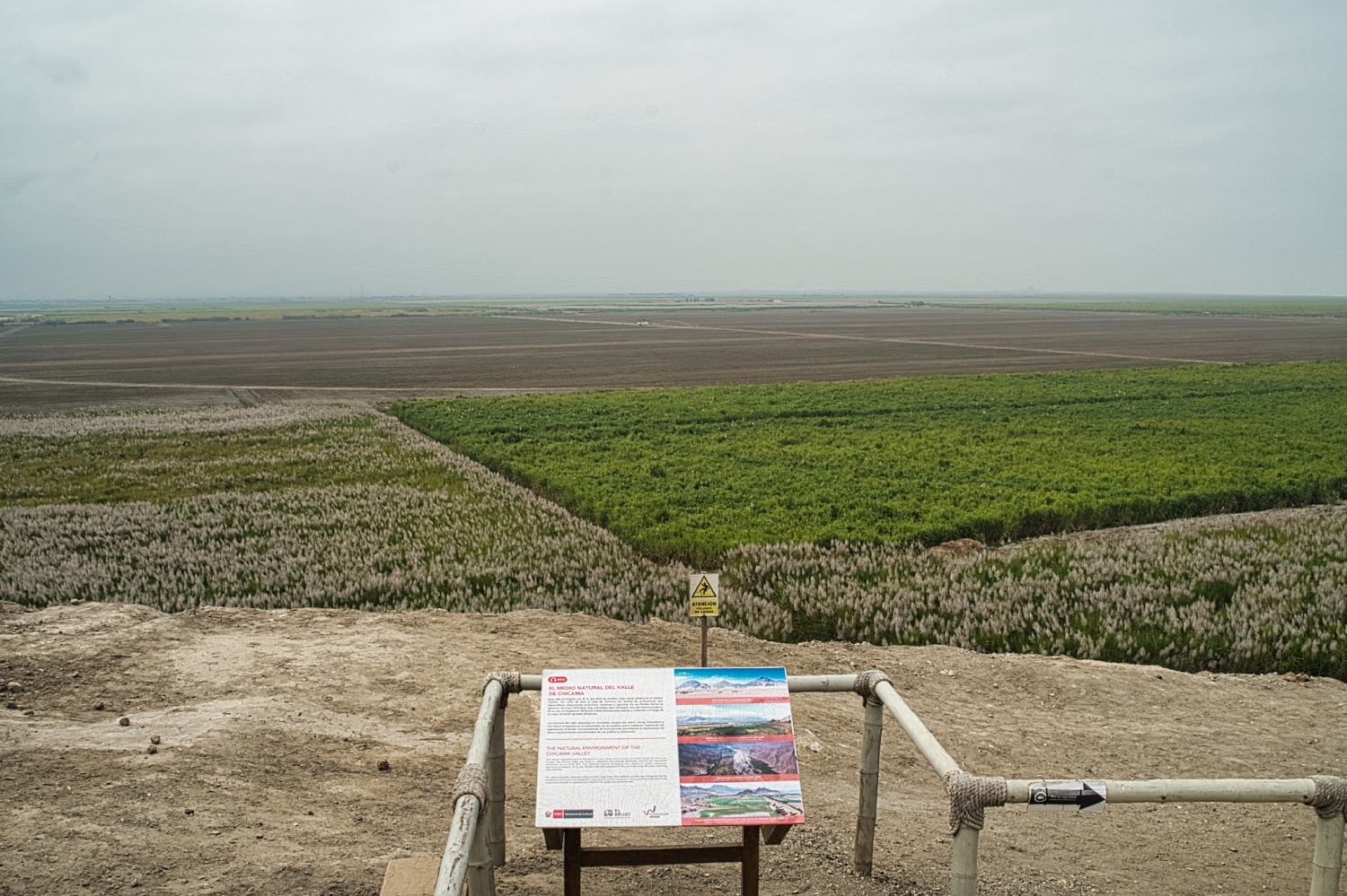
It took me 45 minutes to get to El Brujo. On the way there, I drove through endless sugar cane fields. The Rio Chicama brings water and sediment from the Andes to the fields.
My streak of bad luck continued, as a school was taking a field trip to the museum with seven buses full of children.
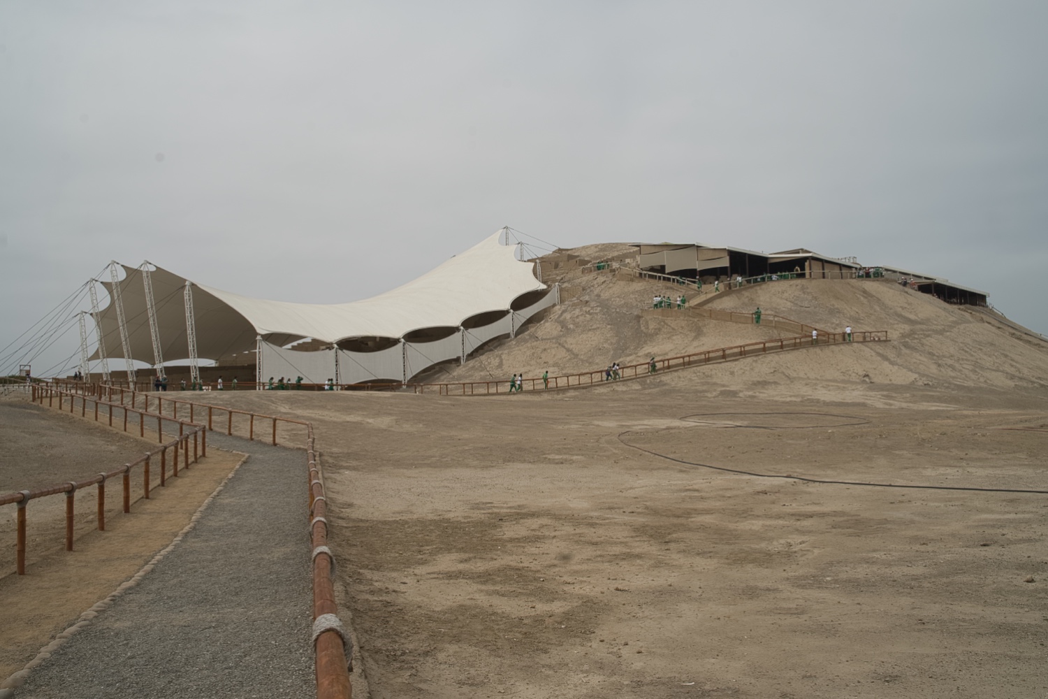
Nevertheless, I visited the Huaca Cao Viejo in the Complejo Arqueológico El Brujo. This time, it was not the Incas, but the Moche. The complex from the Moche period features ruins, wall designs on adobe, a mummy in the museum, and various artifacts. According to Wikipedia, the Moche (named after the Río Moche river) lived on the north coast of Peru from the 1st to the 8th century.
I found it interesting that the end of the Moche culture was linked to El Niño, as polar researchers at Ohio State University in Columbus discovered in 1990. With buildings made of mud bricks and fragile irrigation systems, the Moche were powerless against the storms. It's something to think about, but we don't have any problems with storms.
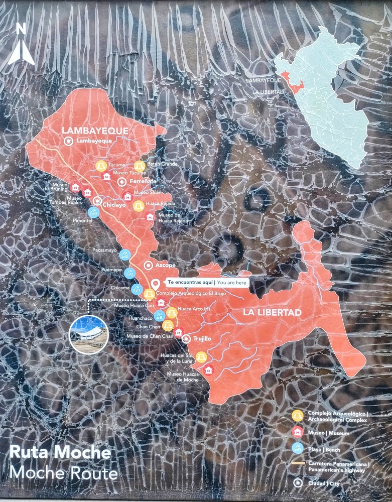
I found an information board entitled Ruta Moche. All Moche museums and complexes were listed on it. Tucume and Sitan were also included.
On the way to El Brujo, I had already noticed that the spray had literally stuck to the windows of the Sprinter. I had to refuel and load water, and I also wanted to have my Sprinter washed at the same time. In Germany, there is a list of penalties for washing your car on the street. In Peru, it's the norm! But either the shops were busy or there was no one there. I cleaned the windows and rear view mirror as best I could at a gas station.
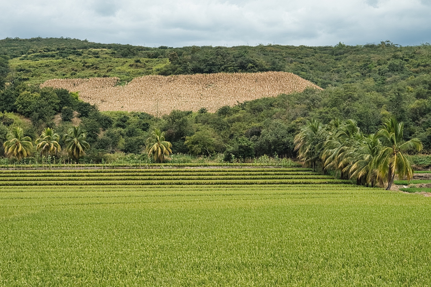
On the way to the parking spot, I passed through one of Peru's rice-growing regions, La Libertad. Over 25'000 tons of rice are produced here every year. The harvest was mostly over, as many fields had been burned and rice was already being grown again on others. Black sacks of rice were stacked everywhere along Ruta 8 and loaded onto trucks.
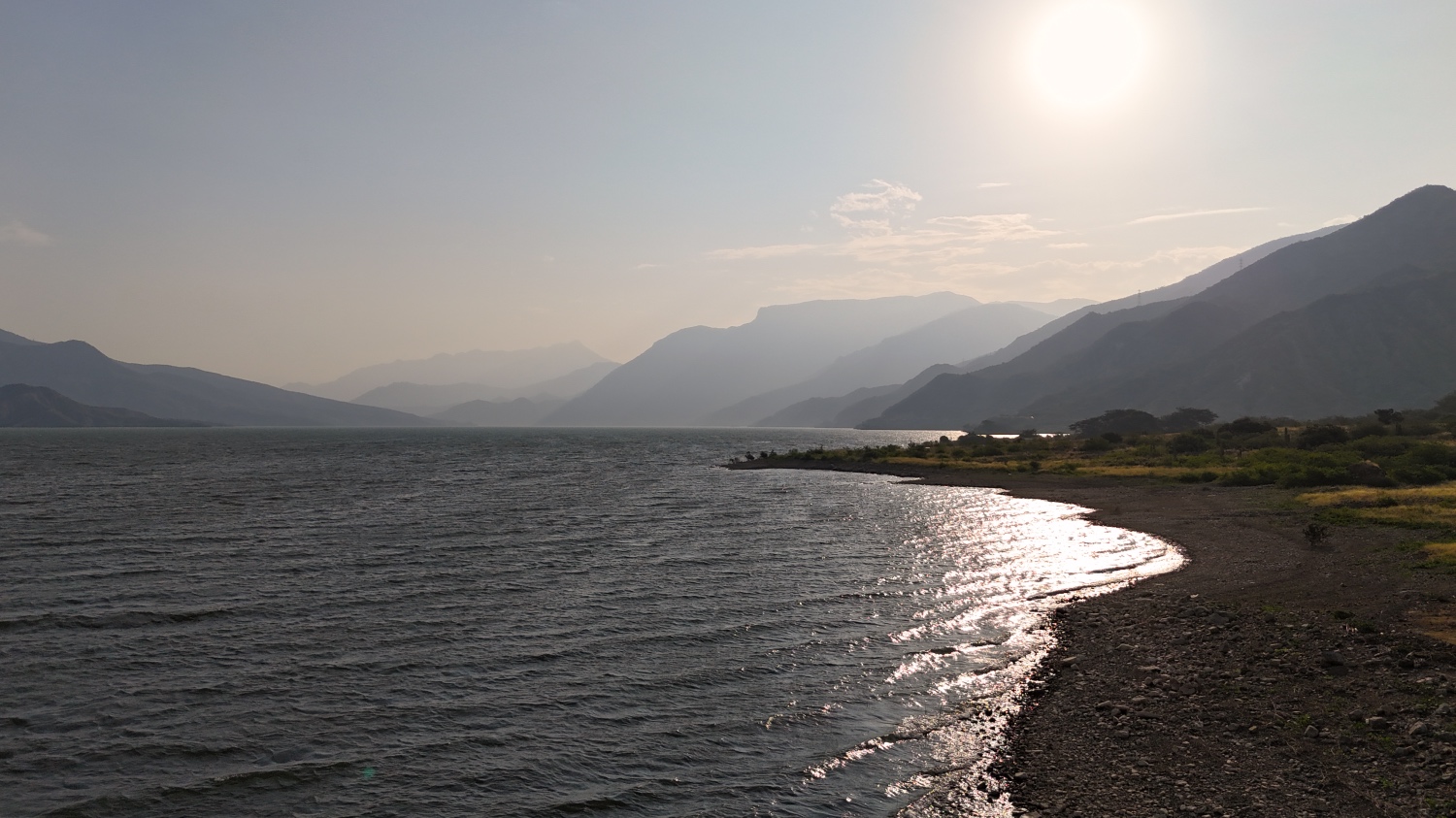
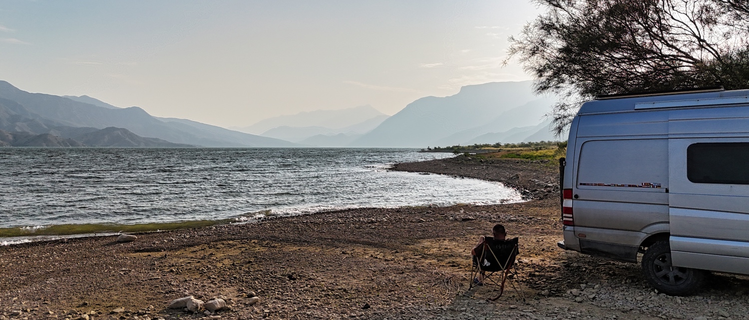
At the Represa de Gallito Ciego, a reservoir, I found the perfect parking spot right by the lake and took a day to wash the van. It took longer than I thought...
The next morning, it was warm and my neighbors, the fishermen, went swimming or bathing in the reservoir. Most of the time, you overlook the obvious! So after breakfast, I also bathed in the lake. The water was pleasantly warm.
Speaking of breakfast, the rolls and bread after Cuzco weren't really good. On the road, I could only get Lätschi-Dätschi white baked goods. It was time to bake bread again.
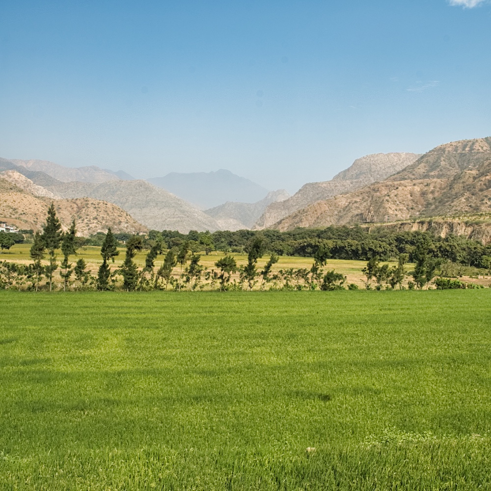
I drove along Ruta 8 towards Magdalena. Rice was still being grown on the Río Jequetepeque, but now not on large fields, but on terraces. The contrast to the cacti on the mountain slopes was impressive. By 11:00 a.m., it was already over 22 degrees Celsius, and the valley looked more like Malaysia or Bali. I hadn't expected anything like this in Peru. The river valley slowly wound its way up the western cordillera.
The villages were bustling with activity, and Chilete even had a respectable main square.
Before Cajamarca, I should be at 3'900 meters above sea level. I would climb to almost 4'000 meters over a distance of about 170 km.
Google Maps then told me in Magdalena that I had to turn left. Easier said than done. But 50 m later and higher up, I couldn't make the turn with the Dog.O.Mobil. Too narrow and too steep. I wouldn't be able to get to Bosque de Piedras de Cumbemayo via this road.
I had actually planned to drive to Cajamarca the next day, but instead I stayed on Ruta 8 and continued on. Today was not a Google Maps day, because although I was able to turn left in Cajamarca, 400 meters later I was faced with a staircase and the road came to an end. I should mention that it was steep and narrow. I did find a signpost to Cumbemayo, but the road was only suitable for small 4x4 cars. After 15 minutes, I gave up. Instead of Cumbemayo,
I treated myself to a trip to the nearest Tottus. Cajamarca feels like the city with the most tuk-tuks. I found a truck and followed it without hesitation. The Tottus had a huge parking lot with no height restrictions, so I took my time replenishing my supplies.
I decided to drive to Lagunas De Alto Peru. Although it is 4'000 meters above sea level, it can be reached via a good, straight road. However, I hadn't taken the weather into account in my planning.
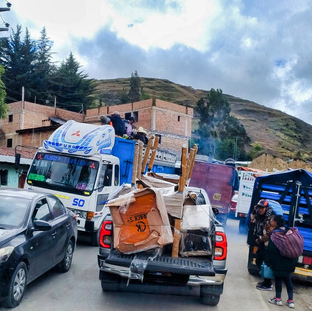
Cajamarca in heavy rain was similar to Trujillo at night during rush hour. Chaos, from a German's point of view! The tuk-tuks weren't really watertight, so people were busy improvising at the side of the road, naturally right where they had noticed the problem.
The motorcyclists were looking for a dry place and the schoolchildren were trying to get home quickly. In between were trucks, cars, and buses. Until then, I hadn't noticed that the gutters had no downspouts. The rain either splashed directly onto the road or leaving a drumming sound on the van's roof as I drove through.
But that too passed, and along Ruta 3N it stopped raining. And then I arrived at Lagunas De Alto Peru. I googled a little and found this:
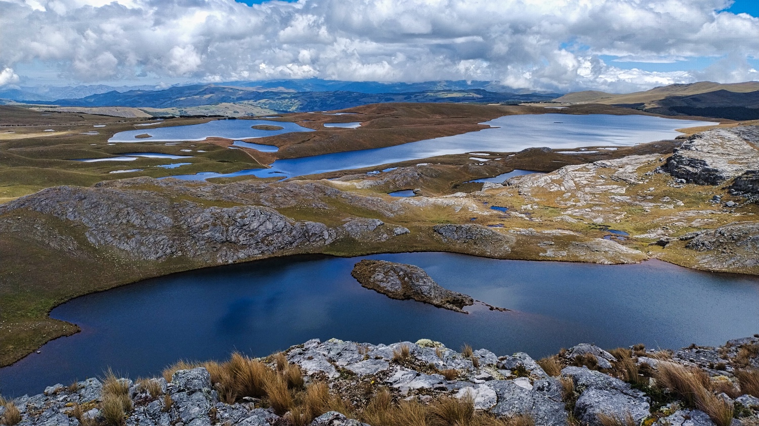
In the Cajamarca region is the Jalca de Cajamarca (area: 2'960 hectares). The Jalca is located at over 3'900 meters above sea level and consists of 284 lagoons of various sizes.
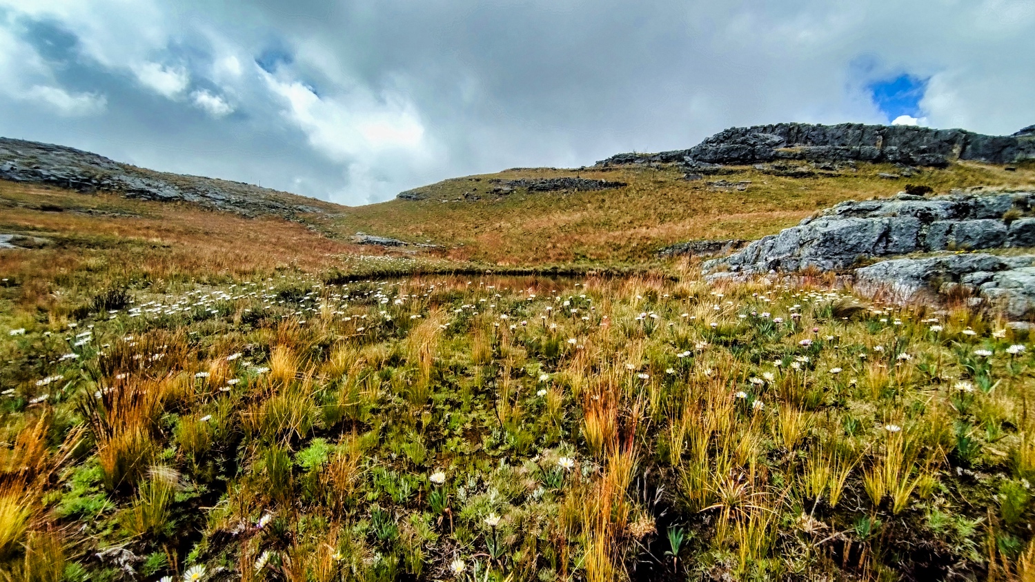
This is where it rains, fogs, and hails the most in northern Peru. The Jalca collects rainwater, which is then stored in the lagoons and the ground. Most of the rivers that irrigate the valleys of the coastal region originate in the Jalca. Whether Quecha, coastal Yunga, Pacific desert, or high jungle, they all get their water from here.
The region is considered a transition zone between the Páramos (the area with high-altitude tropical vegetation above the tree line in the northern Andes) and the Puna (grasslands or mountainous terrain with diverse vegetation including shrubs, grasses, and specialized plants). The Puna lies at an altitude of about 3'000 to 4'800 meters, with conditions in the different regions of the Andes varying greatly from humid to dry).
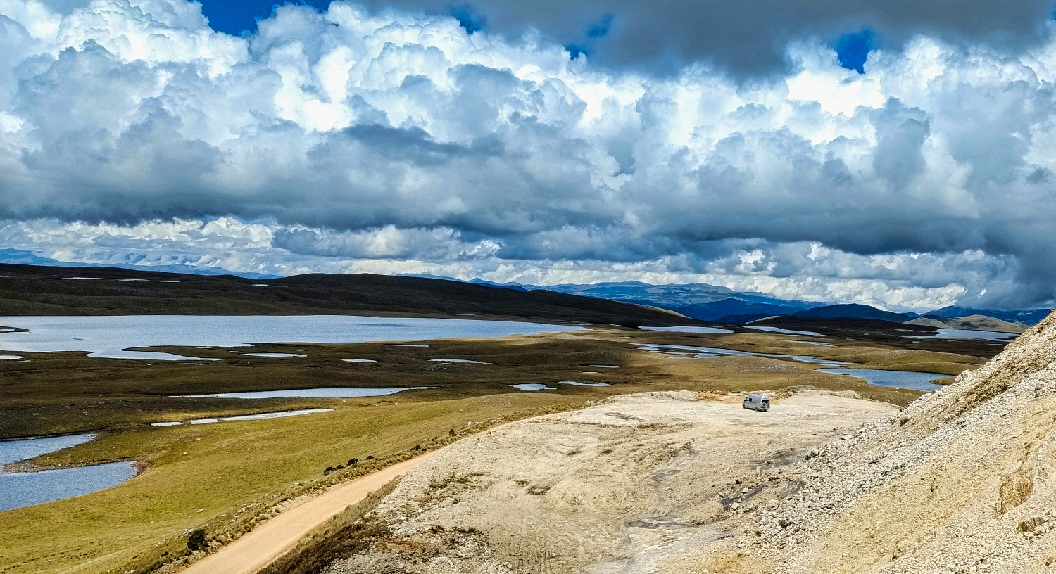
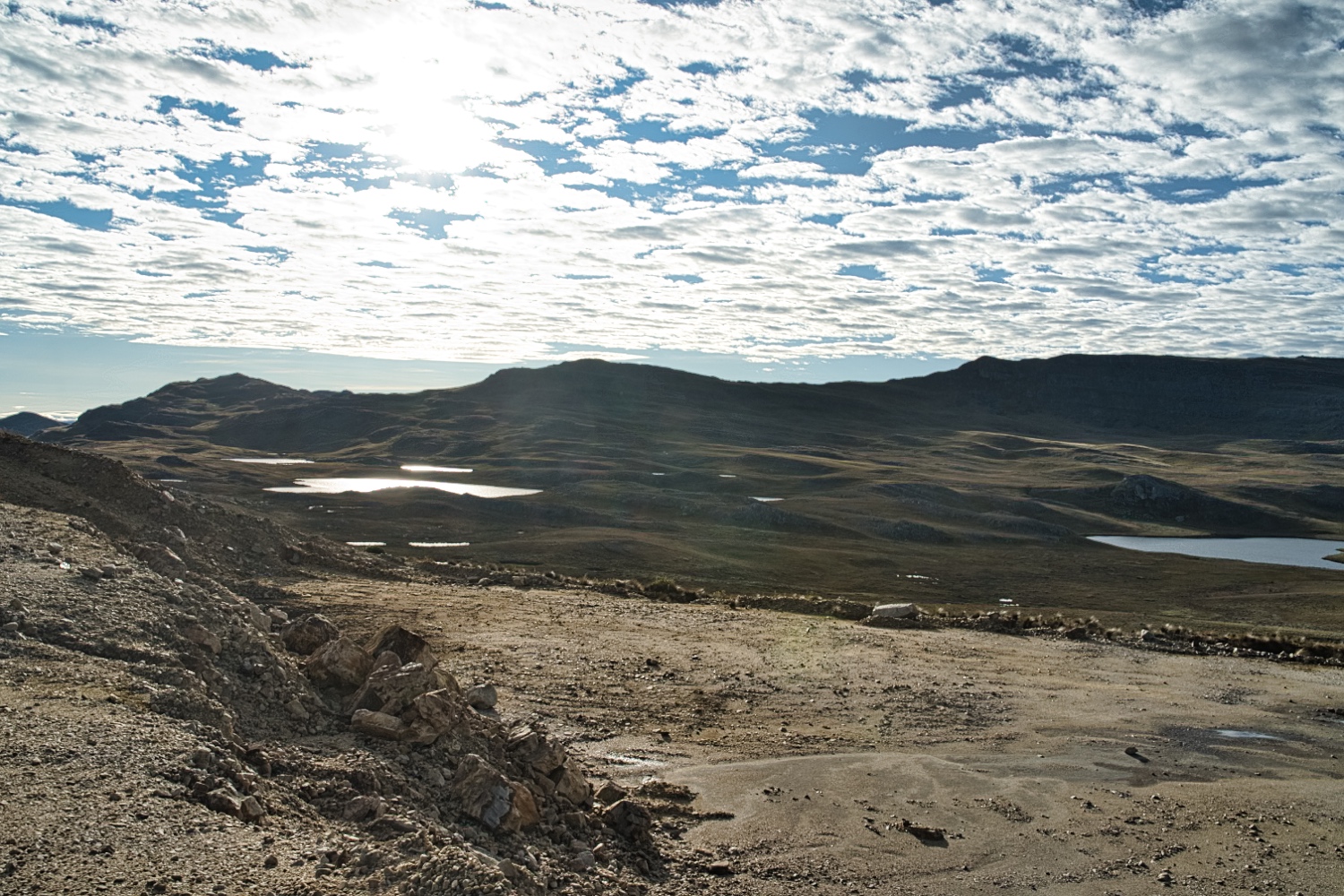
Once I reached the top, I noticed the slightly undulating plateau and the drop in temperature from 25 degrees at Represa de Gallito Ciego to a mere 12 degrees.
After I found a parking spot, it started to rain. At 7:00 p.m., I turned on the auxiliary heating. It was getting chilly.
After a quiet night, I had sunshine, clouds, and temperatures around 8 degrees the next morning. It was supposed to rain at 2:00 p.m., so I set off at 10:00 a.m. There wasn't really much going on up here. I had seen 12 hikers throughout the day.
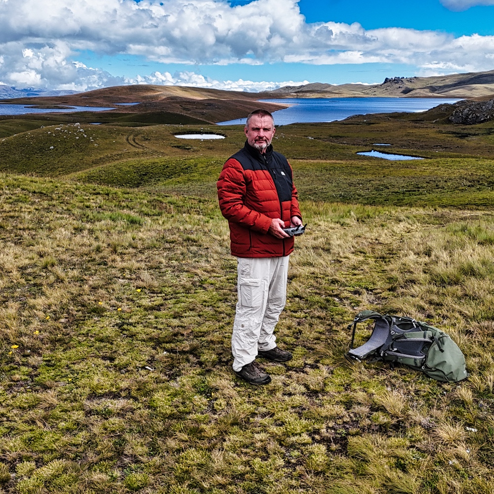
The weather held and I hiked up to about 4'100 m. Unfortunately, hiking is restricted by llama breeders. A 1.5 m high fence stretched across the landscape. But even without that area, it's worth a hike. It was the first time I put on my quilted jacket and a hat, because when the sun hid behind the clouds, it was cold and windy.
I spent the rest of the afternoon trying out OpenStreetMap apps on my tablet. Google Maps had already become an entertaining asset to my trips over the months 😎. Not always the best route, nor the fastest. In Cajamarca, I was supposed to take a staircase to Cumbemayo. Not for the first time!
I already use LocusMap and OsmAnd. It takes quite a long time to get started with LocusMap, and to navigate offline, you have to download maps and profiles for each country. OsmAnd was much easier to use.
I also tried MAPS.ME and Magic Earth that day. Maps.Me was easy to understand and worked without registering. The Magic Earth user interface wasn't my thing, so I uninstalled it after 15 minutes.
My first test was a plan from my parking spot at Mirador Cerro San Cirilo to Yanacancha Baja (Ventanillas Yanacancha Baja and Centro Turístico Iglesia Yanamachay were just around the corner). I tried it offline first and then online. The outcome was
- Google Maps said it was about 32 km and would take 62 minutes.
- Maps.Me offered me the Google Maps option and a 27 km route that each would take more than 180 minutes.
- Locus Map took a completely different route that would be 31 km long and take 125 minutes.
I took the Maps.Me 27 km option that afternoon because I thought there would be no road at all after about 10 km. And that was the case. It was more of a dirt track, unsuitable for my van.
I drove back to my parking spot and found out about admission to Kuelap. Machu Picchu and Kuelap use the same system.
The next day, I wanted to continue on to Celendín, or more precisely to the Mirador de Celendin. I liked the Maps.Me route through the mountains, but after only 10 km, the junction was no longer there. This was because Minera Yanacocha had fenced off the area. It was now private property!
So I drove along Ruta 8B to Celendín. In every larger town, there were markets and corn and vegetables were sold on the streets. It was very busy! Encañada was bustling with activity, and just driving through took 30 minutes.
After 4.5 hours, Google Maps navigated me to a staircase in Celendín once again. After three attempts, I gave up and drove on, as there weren't many suitable parking spaces along Ruta 8B. Maps.Me didn't give me any other route to the Mirador either.
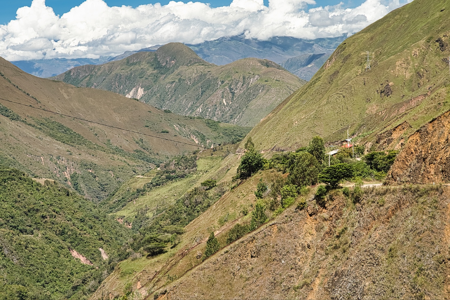
On that day, I drove along Ruta 8B again, climbing to almost 3'000 m (near El Lanche). Narrow, winding, with fantastic views – that's how I would describe the route. While it had been 27 degrees in Cajamarca, up here it was only around 12 degrees. The descent to El Limon and my parking spot made me nervous.
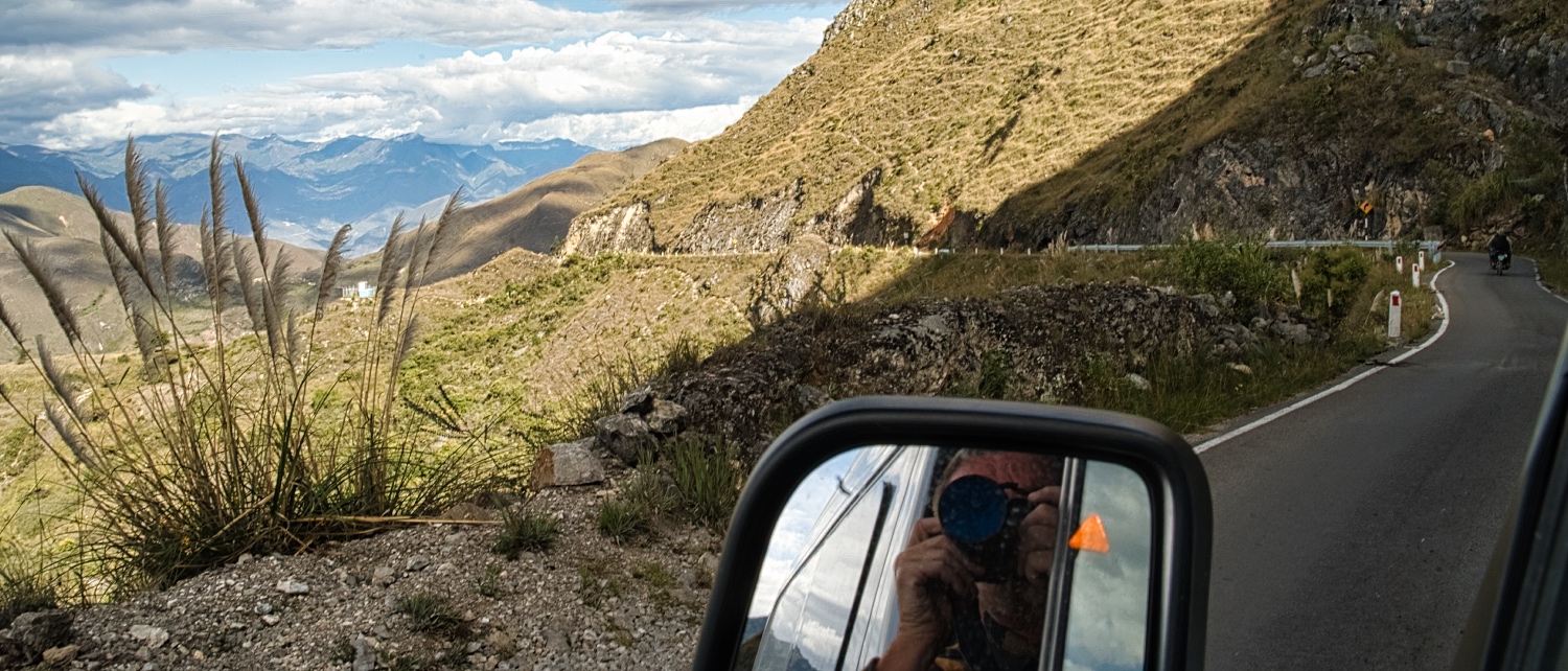
Next to me was a steep slope and on the other side was a precipice, all on a road that was no wider than a dirt track. Oncoming traffic was not welcome. There were very few places to pull over!
The next day we continued, this time in sunshine. Downhill to Puente de Chacanto (approx. 870 m above sea level). I was very impressed by the truck drivers on the route. They had been on the road until late at night. Not for me, because even during the day you have to drive with full attention here. I couldn't even listen to an audiobook!
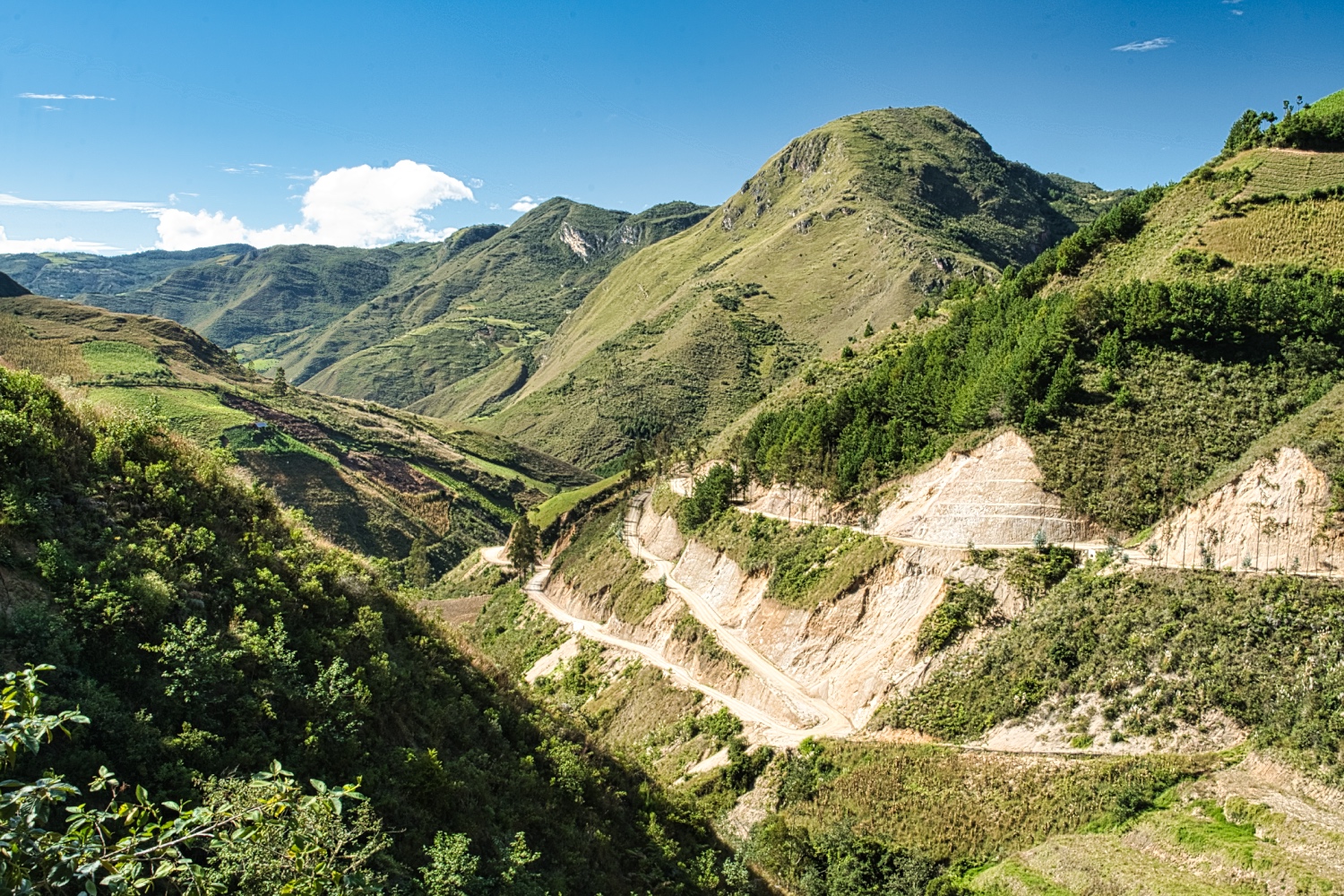
From Cajamarca, it was up and down, and by the time I reached Leimebamba (approx. 2'200 m above sea level) in the Rio Utcubamba valley, I had to climb back up to 3'600 m. No wonder the estimated travel time from Cajamarca to Kuelap was 9 hours.
I seriously considered whether I wanted to take on this ordeal! It ended up taking 12 hours until I arrived at the top in Kuelap.

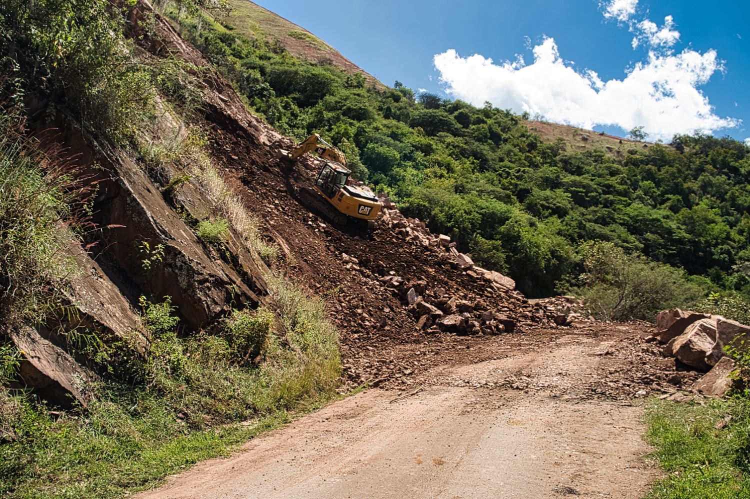
On the drive uphill from Puente de Chacanto, there were once again landslides and excavator operators showing me what you can do with an excavator.
However, there weren't many cars, buses, or trucks to be seen until Leimebamba. Maybe five, if that. I couldn't enjoy the view during the drive either, because the higher I climbed, the more it became a slalom around the potholes.
In any case, after two days I was so exhausted that I had to take a long break at the Rio Utcubamba.
Oh yes, I should mention that I met a Swiss touring cyclist. Respect!
And somewhere between Celendín and Leimebamba, I arrived in the province of Amazonas.
After two peaceful and sunny days at the Rio Utcubamba, I continued on to Kuelap. It was only 1.5 hours away and the new road is in excellent condition.
Fortaleza de Kuelap is run like Machu Picchu, except that I hoped to find a fraction of the tourists here. When booking the ticket online, it looked good. There were six slots per day and 100 people per slot were guided in groups of five. On June 4, 2025, most of the slots were only minimally occupied.
When I arrived at 11:30 a.m., there were many vendors, employees, and guides standing around. Tourists were few and far between. Nevertheless, the system was quite inflexible. My slot was at 1:00 p.m., and I asked if I could go at 12:00 p.m. The answer was a clear NO!
At 12:55 p.m., there were about 15 people at entrance 1, and the crowd was already overwhelming the two people at check-in. I was lucky; at some point, there was a need for a single person, and I seized the opportunity. After my ticket and passport were checked, we set off in a group of 15 people. There was no option for a tour in English; only Spanish was offered.
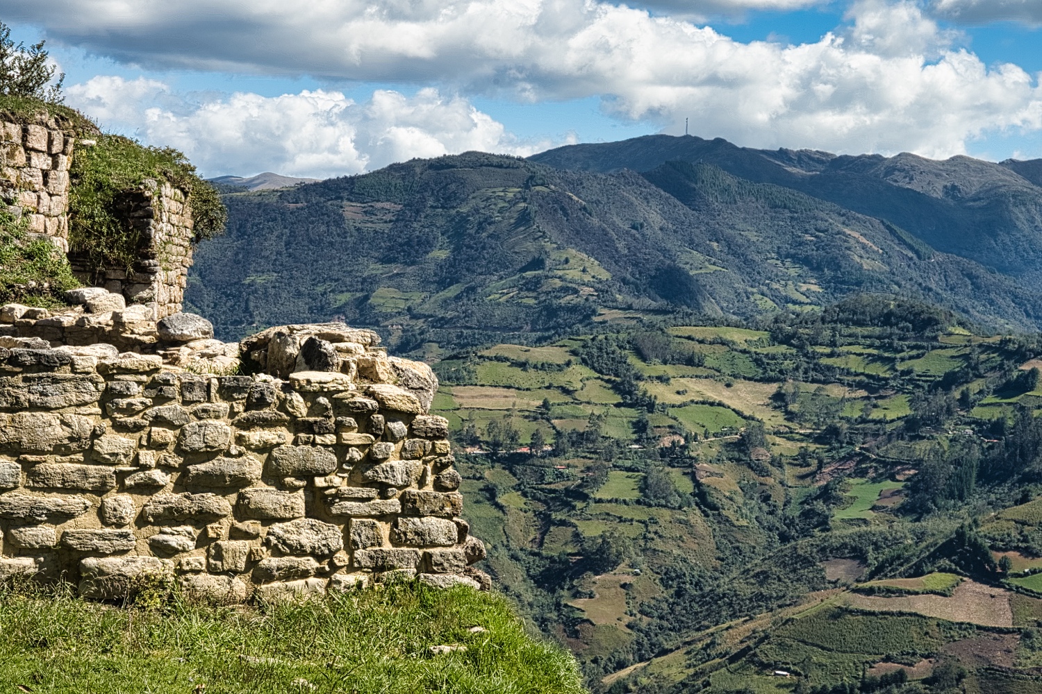
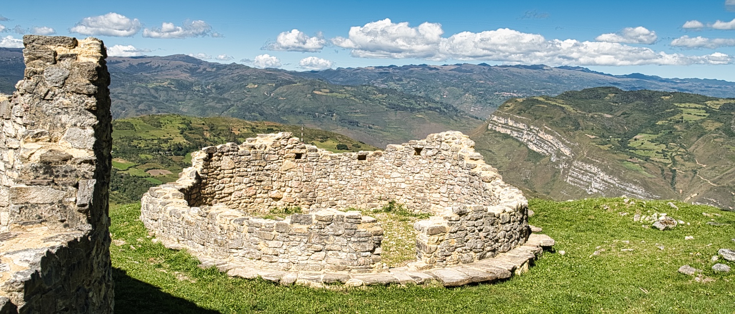
Some background on Kuelap. It is a former fortress of the Chachapoya, perched 1,000 meters above the Río Utcubamba river valley. Most of the fortress was built between 900 and 1100 AD.
Part of the surrounding wall collapsed in April 2022, and another part collapsed a little later. Kuelap was closed to the public for a long time.
The Chachapoyas inhabited the site until the Inca Empire conquered the area around 1470 AD. The Spanish conquered the area from the Incas 100 years later. The fortress was then abandoned for hundreds of years until it was rediscovered in 1843 by local judge Juan Nieto.
Kuelap is currently only a candidate for inclusion in the UNESCO World Heritage List. For this reason, and because of its remoteness (it usually takes two full days to get there and back by plane), there are probably so few tourists here.
Visitors per year:
- Kuelap has about 200,000, or about 650 per day. On June 4, 2025, there were less than 100, I would say.
- Machu Picchu has about 1.5 million, or over 4,000 per day.
Kuélap is a large walled complex covering 6 hectares (584 m north-south and 110 m at its widest point). What remains of the walls is between 10 and 20 m high and consists of limestone blocks.
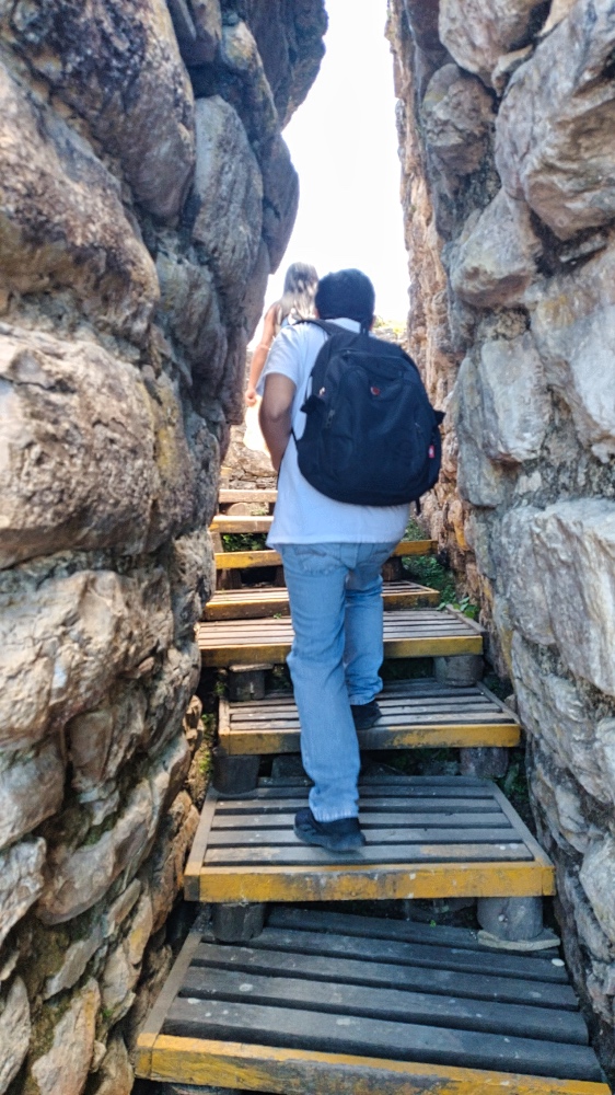
There are only three entrances, all of which must have been narrow, steep, and easy to defend.
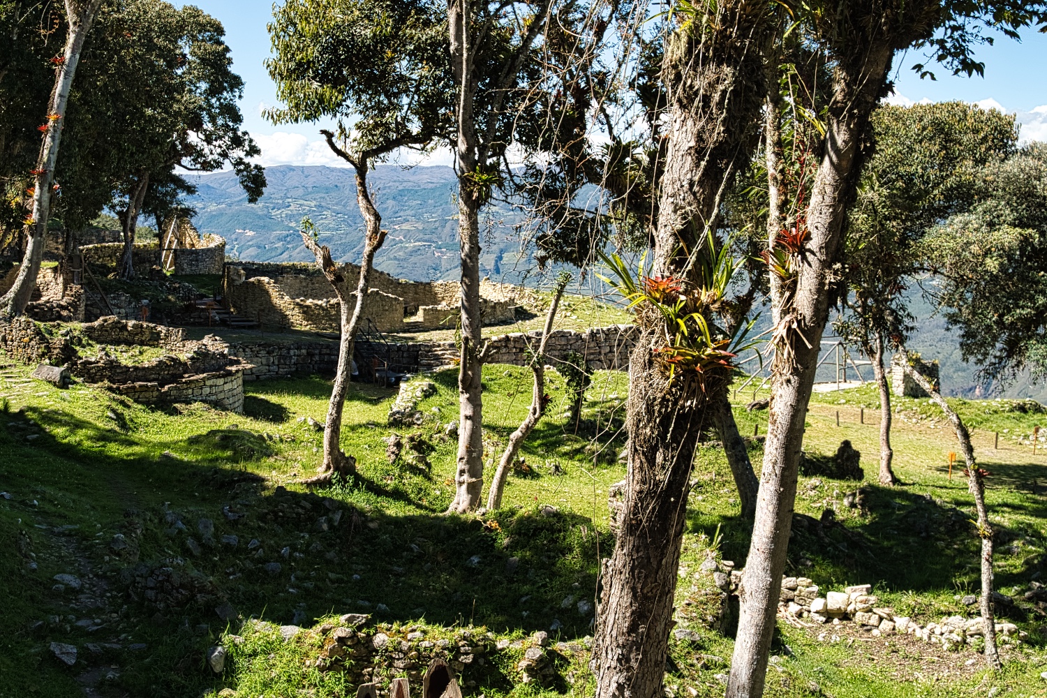
Work was still going on diligently in Kuelap. On the one hand, archaeologists are digging, and on the other hand, walls and houses are being maintained or restored.
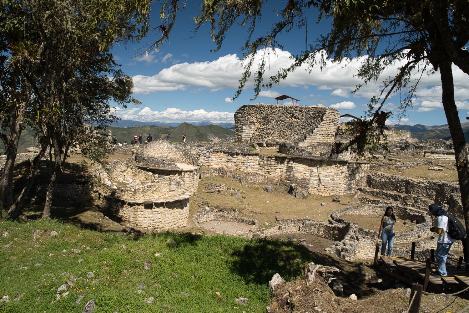
In addition to various round “houses,” there is a 5.5 m high structure in the center, the Templo Mayor, which has the shape of an inverted cone. In addition to its ceremonial purpose, the building may also have been used as a solar observatory.
The approximately 400 roundhouses had steep, cone-shaped thatched roofs, but nothing remained of them.
Our guide explained that archaeological and human remains had been found throughout the complex. I found it bizarre that there was a hole in the floor of each round house where the dead were buried. This seems to have been typical of the Chachapoyas.
He also showed us the walls with diamond-shaped or zigzag patterns, another trademark of the Chachapoya.
After almost 2 hours and 5 km, I was done. Fortaleza de Kuelap costs only 30 Soles, or €7.50, and the wait was less than 30 minutes. The fortress was impressive and the tour was informative, as far as I could understand. I would give it 4 out of 5 points.
After a quiet night at Floriz's campsite, I headed to Gocta the next day. The new track from Pumachaca to the fortress had been a pleasant route. Ruta 8B to Chachapoyas, on the other hand, was more difficult to drive in the morning. On the one hand, the road was full of potholes and, on the other hand, you couldn't see it in the play of light and shadow. I even saw a marathon in Tingo because the police closed the 8B.
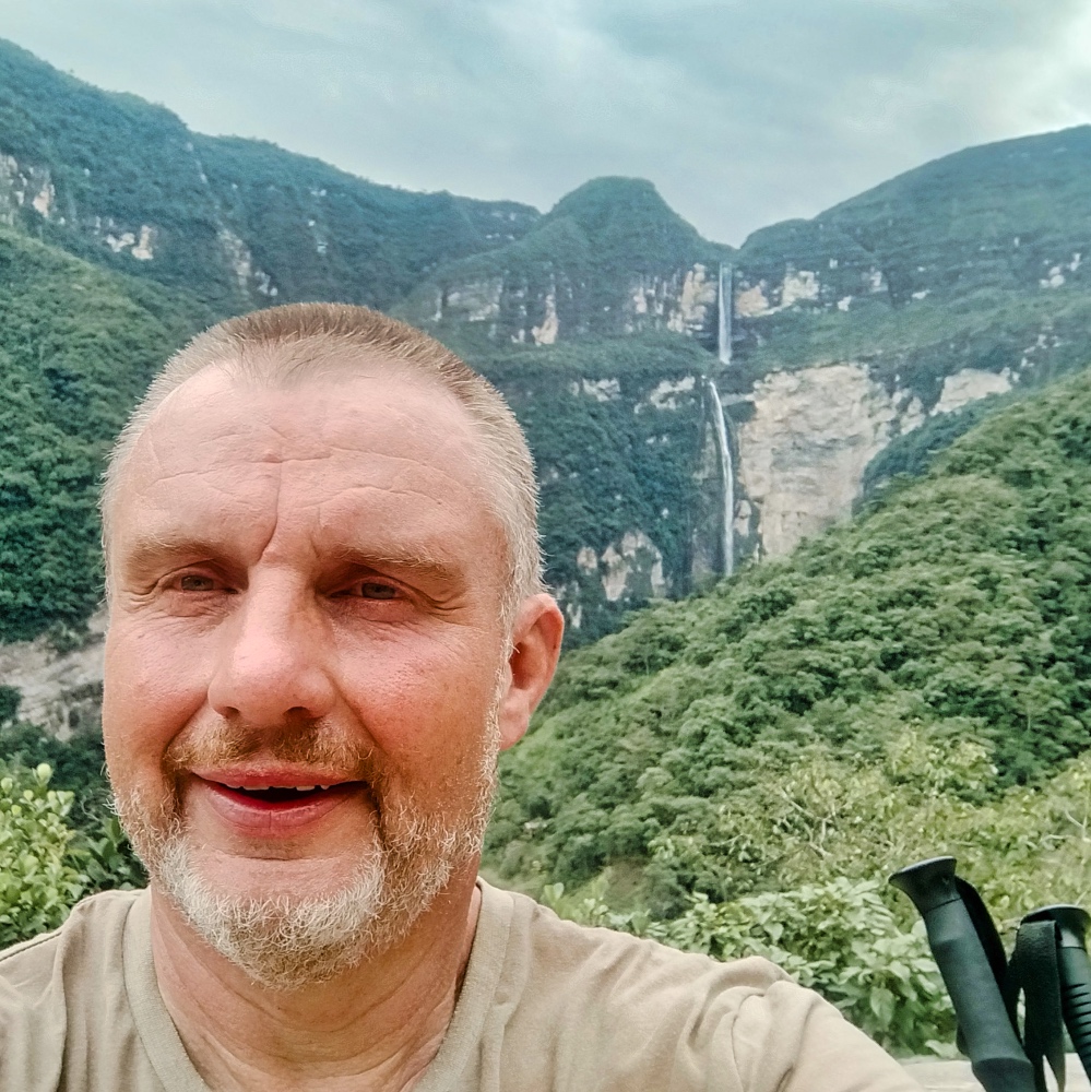
Around 12:00, I arrived at the construction site called Cocachimba (1,796 meters above sea level). The village is currently undergoing a complete renovation. I bought a ticket for 10 soles and made my way to the waterfall.
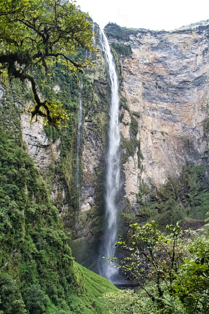
In 2002, German Stefan Ziemendorff and his team measured the total height at 771 meters. Gocta is the third highest free-falling waterfall in the world after Angel Falls (Venezuela) and Tugela Falls (South Africa).
I skipped the last 500 meters to the lake, because even so, I could only see the lower 521 meters of the waterfall. The light was mediocre, so the pictures turned out average.
The 11 km to the waterfall involved quite a lot of ups and downs (400 m difference in altitude) and the temperature was between 20 and 25 degrees. I had definitely arrived in the tropics. I was drenched in sweat when I got back to the van.
Too exhausted to eat much, but I still treated myself to 2 liters of water.
And the penultimate day in Peru was also going to be my last. After Limoncillo on Ruta 5N, I was stuck in a complete traffic jam for over 2 hours.
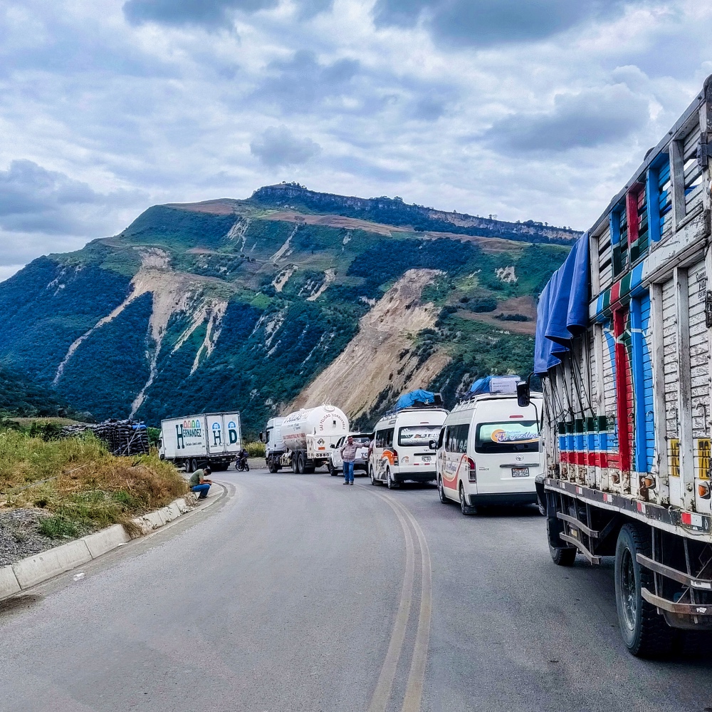
In Bagua Grande, a funeral procession was taking place on the main road, and it took me almost 45 minutes to cover the 2 km.
But the crowning glory was my pitch on the Rio Maranon, near Balanza. There are two sandbanks in the river before the Curva de la Esperanza. The first was easy to reach, but you could hear the Ruta.
The second, which is marked on IOverlander, led to a campesino's landing stage. I managed to get the 500 meters to the shore, but the sand there was so soft that I sank when I turned around. While I was trying to get out, the campesino came by with his wife and child. It was the first time in South America that someone didn't offer to help me, but just complained. After about 45 minutes, I was free again and drove back.
Stupidity knows no bounds! Being a good German, I tried to put on my seat belt while driving and sank the Dog.O.Mobil a second time. But this time for real. Without help, the campesino just came by to make a few stupid comments in Spanish, and this time it took me over two hours.
It was almost 6:00 p.m., and I was dirty, sweaty, and exhausted, so I just drove to the first spot, set up the Evershower, and took a shower. That day, an ice-cold beer was my dinner.
At 6:00 the next morning, a diesel generator started up somewhere near me. I was too exhausted to check and stayed in bed until 7:00. Then I saw a fruit farmer watering his fields with river water. At 8:15 a.m., I thought he was done. Shortly after, a truck came by and picked up some large, medium-sized river stones. At 9:00 a.m., it was gone again, but the fruit farmer was back with new diesel fuel. The generator was rattling again and another truck arrived. Overlanding is always so great!!!!
I had actually wanted to spend Saturday here, but annoyed, I drove to Jaén to go shopping. Jaén is not that great, and afterwards I made my way to the Ecuadorian border. As described on IOverlander, there are almost no usable parking spaces for motorhomes.
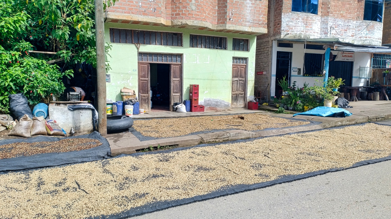
What really impressed me how they dry the coffee beans along the road to the border.
I finally found one in Namballe, but La Balza, the border town, was only 10 minutes away. I spent Saturday on the banks of the Rio Canchis, exhausted and a little frustrated.
However, my last encounters with Peruvians were a ray of hope. A woman gave me popcorn and a man gave me oranges. The Peruvian customs officers spoke excellent English, and the next morning I was in Ecuador after 10 minutes.
As I looked back on my weeks in Peru, I noticed that some Peruvians had behaved very differently from the average Argentinean or Chilean.
If or should I say when I had problems, I couldn't count on Peruvians to help me out. In Peru, I was ripped off several times. Small things, like entering 15% instead of 10% as a tip in the apps, or increasing the price for camping from 20 soles to 50 soles. Always hoping that I wouldn't notice and that it would go unnoticed.
That doesn't mean that all Peruvians are like that, but I hadn't noticed anything like that in Chile or Argentina.
The Stage

More Pictures
Videos
Latest Posts
-
 Closer to the end - South Colombia till Medellin
 -
 Ecuador - La Balsa to Tulcan
 -
 Lima to Ecuador
 -
 Lima from beginning to end
 -
 Cuzco to Lima
 -
 From Lake Titicaca to Cuzco
 -
 Bolivia, in search of diesel


Post Info
Date | May 2025 |
Status | Done / Visited |
Last updated | 03 October 2025 |
Page read | 518 |