Ecuador - La Balsa to Tulcan
I crossed the border to Ecudor at La Balsa. Customs in Peru took 10 minutes, as did immigration in Ecuador. Adounas Ecuador then took almost 1.5 hours.
It wasn't that busy, I was the only one there, but the TIP is checked and created somewhere else. Everything via WhatsApp! Then, after 45 minutes, I received an email with a code. Printing it out took another 15 minutes.
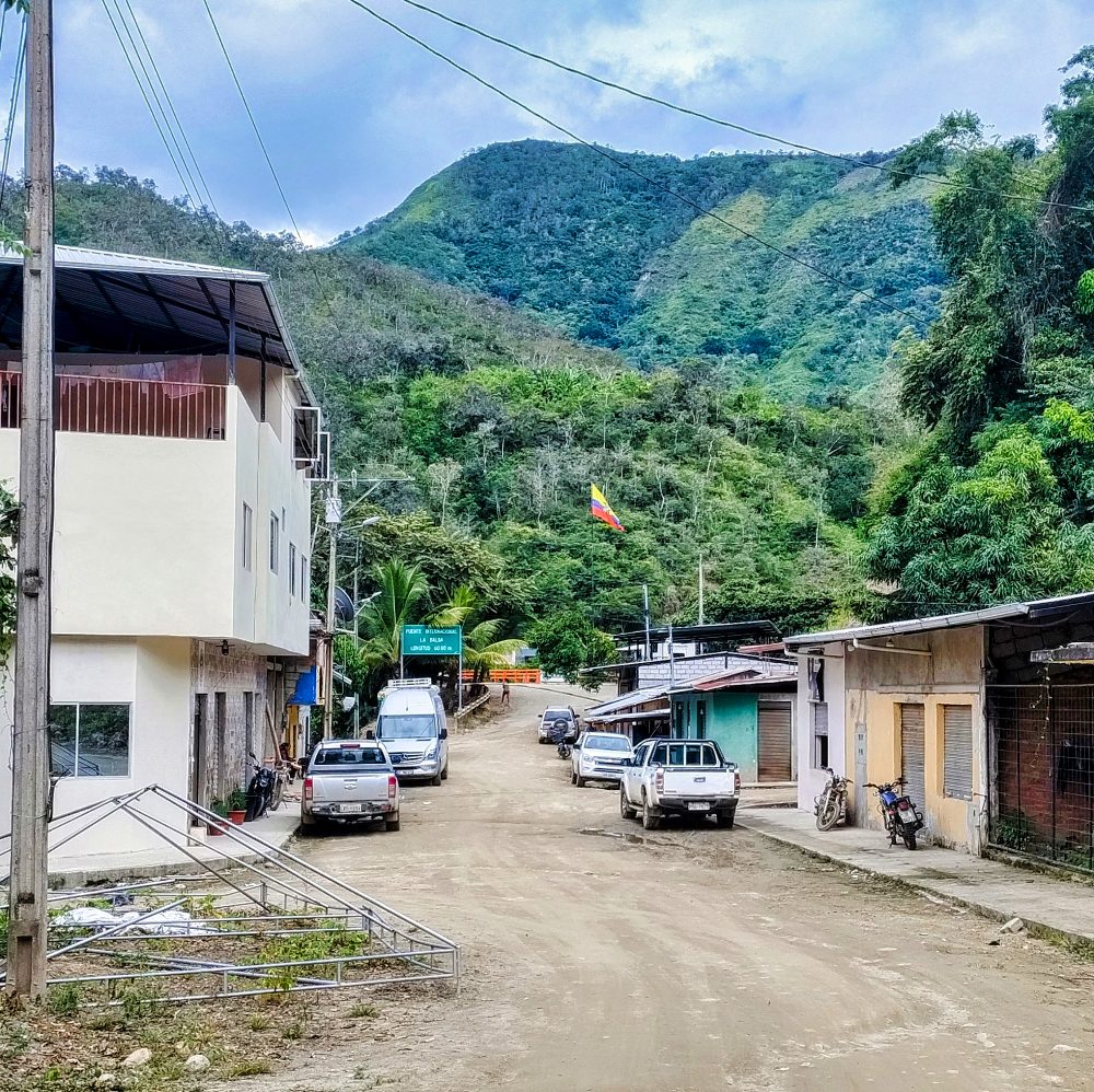
There was nowhere to get a drink either. There were only about five houses and a small shop.
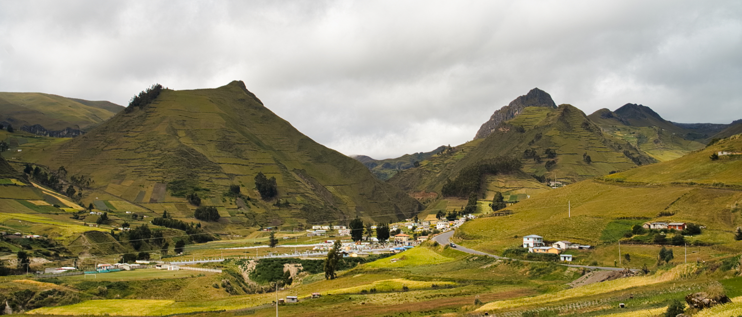
The E682 to Loja was a dirt road until about Puente Palanumá (62 km). Not bad, but not a high-speed route either. I was checked by the military and the police. But it was just routine for them. They wanted to see my passport and the TIP.
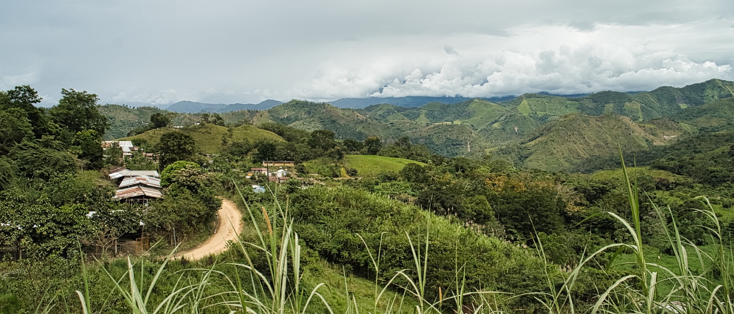
The 200 km to Loja took me a total of 5 hours. Not that I necessarily wanted to drive that long, but there was rainforest along the route and you could only stay overnight in the villages. Not my thing!
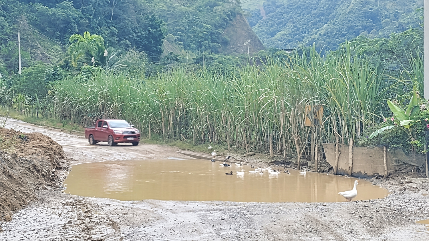
In Peru, I had mud instead of ripio or sand from time to time. In Ecuador, it had rained a lot, and when the road wasn't paved, it was mud or a small lake. But it was okay. There was no traffic until Vilcabamba.
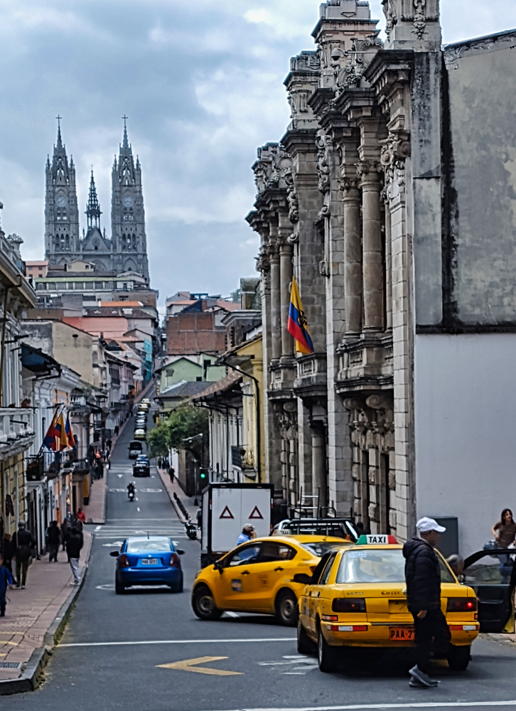
Loja is located on the Pan-American Highway, the E 35. I tried to drive to the only parking space that caught my eye. Option 1 was a locked gate, option 2 was a dirt road with lots of mud and oncoming traffic. Just what I needed after a 5-hour drive.
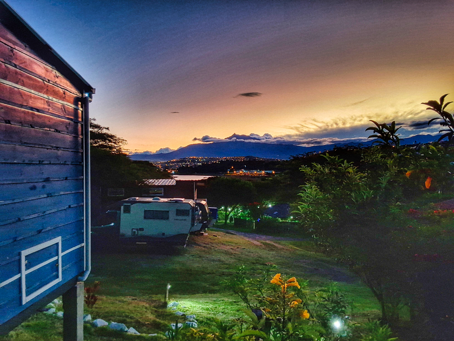
But I made it to Parque Colinar Carigán Villonaco despite another police check. The park is something like a local recreation area with children's entertainment and food stalls. At 6:30 p.m., with drizzle falling, it was easy to find a parking space and buy a good burger with fries. By 8:00 p.m., the park had emptied out, and by 9:00 p.m., there were only two motorhomes left.
After a quiet night, I drove along the E35 to Ona and Camping Lotus Wasi.
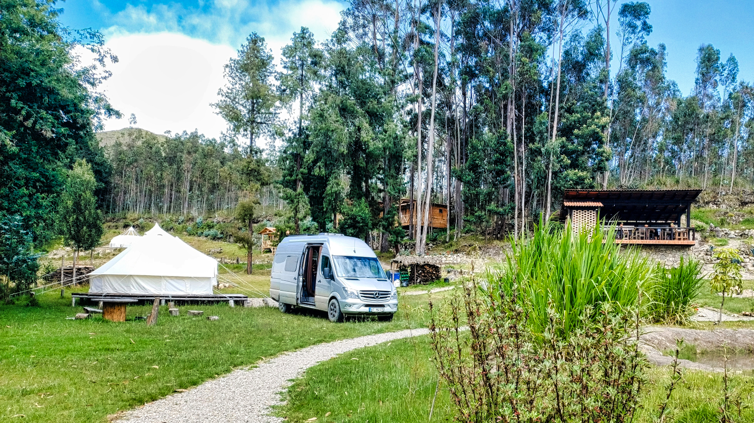
I needed a break, and I was the only camper at Emillio and Chris's place for the next few days. In my opinion, Lotus Wasi is the best campground I've had in South America so far. Clean, quiet, and nice hosts. The best part was that Emillio also cooked. I had local cuisine for breakfast and dinner. Really delicious!
His mashed green plantains “Majado de verde” with fried eggs for breakfast were great. Here's the recipe.
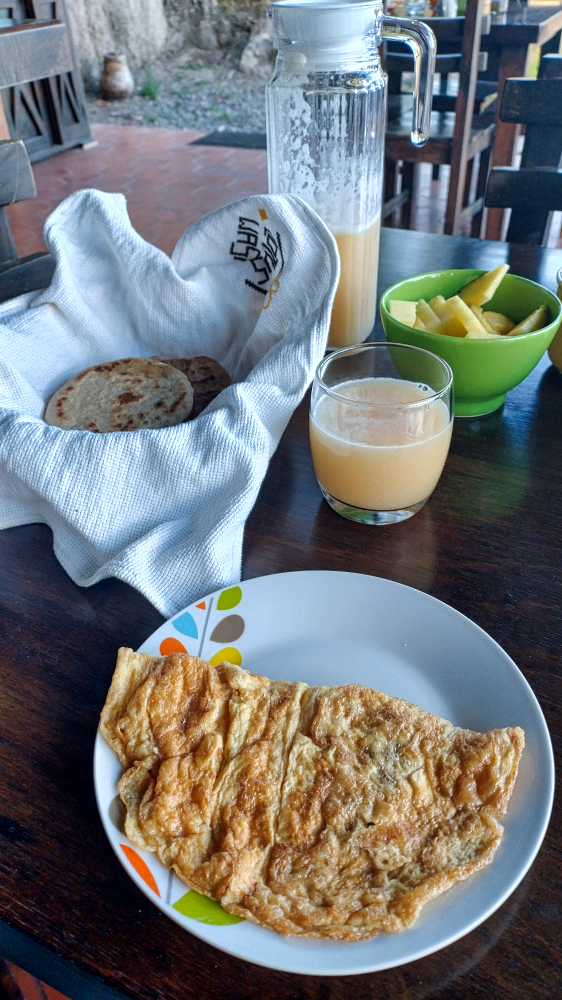
The tortillas de trigo with a piece of cheese were also great. Here's how to make them.
Ingredients:
- 2 cups wheat flour
- 1 teaspoon salt
- 2 tablespoons olive oil
- 1 cup warm water
Preparation steps
- Mix the wheat flour and salt in a large bowl.
- Add olive oil and warm water. Knead until a smooth dough is formed.
- Divide the dough into small portions and shape into golf ball-sized balls.
- Roll out each dough ball with a rolling pin into thin tortillas.
- Fry each tortilla in a hot cast-iron pan for 1 minute on each side until lightly browned.
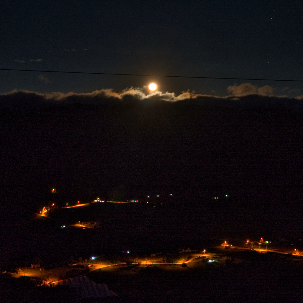
Emillio and Chris also took me to a full moon photo shoot. I felt right at home here! Emillio's tips for Ecuador were good and I adjusted my stops in Ecuador accordingly.
While the route to Ona was more like a rainforest, the area towards Cuenca was more like southern France. The houses in the villages were much better maintained and the many trash cans caught my eye.
A gallon of diesel also cost only USD 1.79. The dollar is the national currency of Ecuador, which definitely makes the country a little more expensive than the countries I had visited before.
The campsite in Cuenca was a green backyard. But it's enough to explore the city. It's a 30-minute walk to the center and 10 minutes by metro.
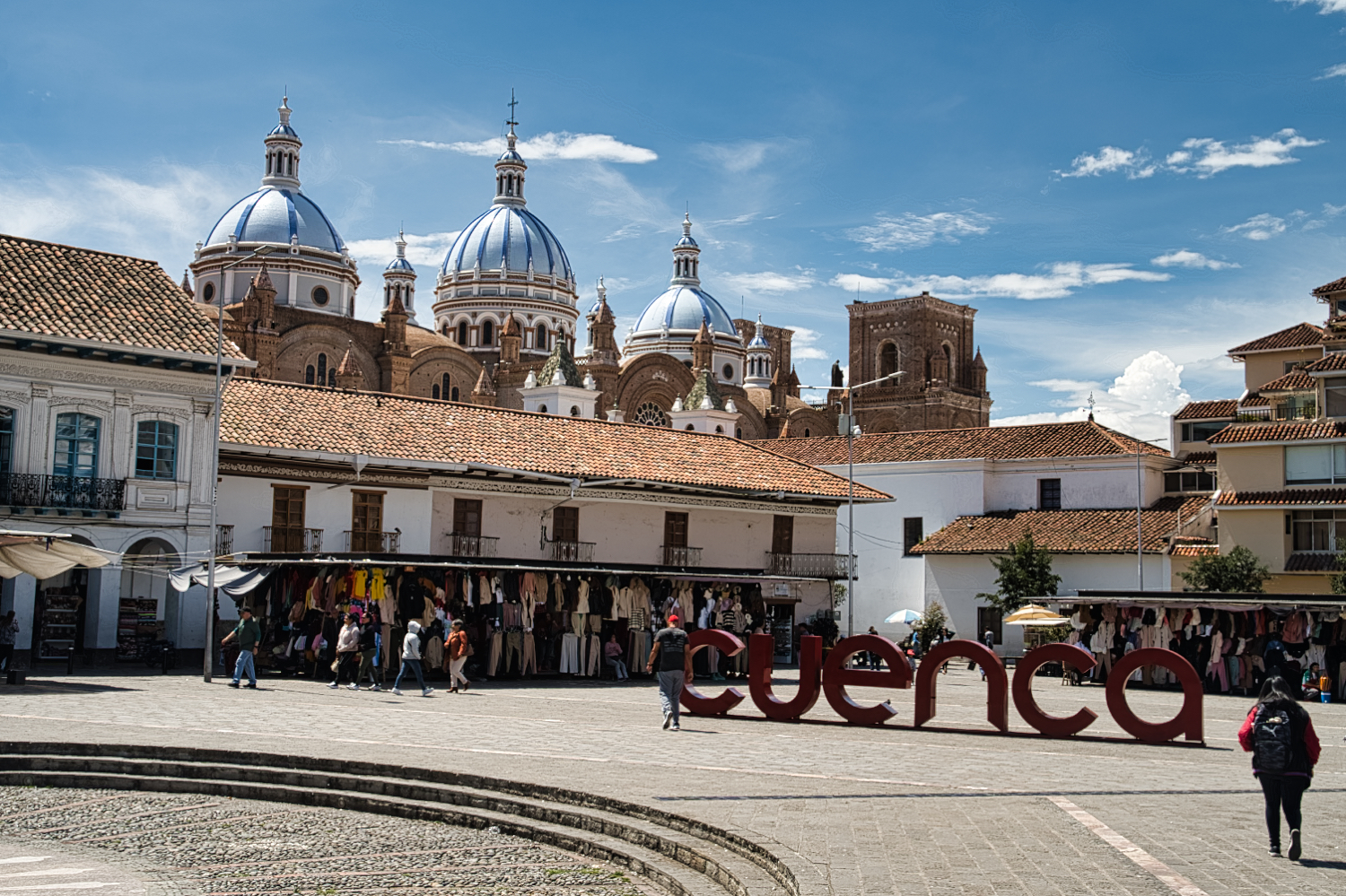
Cuenca impressed me. The center of Ecuador's third-largest city (approx. 330'000 inhabitants) is Plaza Calderón. The square is surrounded by the old cathedral, La Catedral Vieja, and the new cathedral, La Nueva Catedral. There are various other sights in the immediate vicinity, such as the Mercado 10 de Agosto, Plaza San Francisco, Plaza de las Flores, and a variety of shops, restaurants, and cafes. I would say that, except for the Ruinas de Pumapungo, everything else is within 1 km of Plaza Calderón.
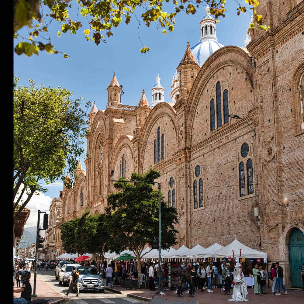
I was struck by the many well-preserved buildings with courtyards. Although the old town was added to the UNESCO World Heritage List in 1999, I didn't see many tourists. I didn't really understand why Cuenca is called the “Athens of Ecuador.”
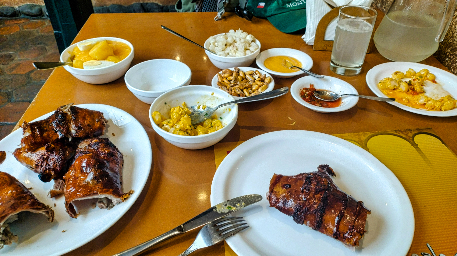
But the city is well worth a visit. I had two recommendations for cuy to eat. One was at Guajibamba and the other at Salón Tres Estrellas. At Salón Tres Estrellas, I had to wait an hour for the cuy, which was too long for me. At Guajibamba, I didn't have to wait long for the cuy. I would call Cuy the South American version of Peking duck, because apart from crispy skin, there was only a little meat on the guinea pig.
I continued along the E 582 to Parque Nacional Cajas. While Cuenca is located at 2'500 meters above sea level, the park is between 3'100 and 4'450 meters above sea level.
It had been raining a little every day before. Not much, but enough to sit in a café. That was also the case on the way to Parque Nacional Cajas. I had thought that on the way to Mirador Tres Cruces I would find other spots where I could take pictures. But that wasn't the case. Either the miradors were blocked by boulders or guardrails. The access road to Laguna Toreadora and the visitor center was blocked. You could only get there on foot. But there was no parking for vehicles. Actually, you could only park at restaurants or hosterias. I have no idea how you could hike here if you can't get into the park.
The road had been very rainy, and from San Felipe de Molleturo onwards there was fog, thick fog. And that continued all the way down to the lowlands. The whole thing becomes challenging when a motorcyclist overtakes you, the road becomes single-lane due to a landslide, or a truck breaks an axle in a pothole. I only managed to stop the Dog.O.Mobil a few meters before that in the fog.
I didn't see much, but from Puerto Inca on the E 25, I was able to admire the straight two-lane road. I didn't take a single picture until Guayaquil. In Guayaquil, I was busy managing the traffic and detours. On a Saturday afternoon, it seems like the whole city goes shopping in the various malls. I had chosen a TUTI supermarket on the way to the Pacific.
After five hours, I actually wanted to drive to a campsite in Montanita. But as great as the place was, the hotel was closed, as were the other campsites in town. It was off-season on the Pacific coast.
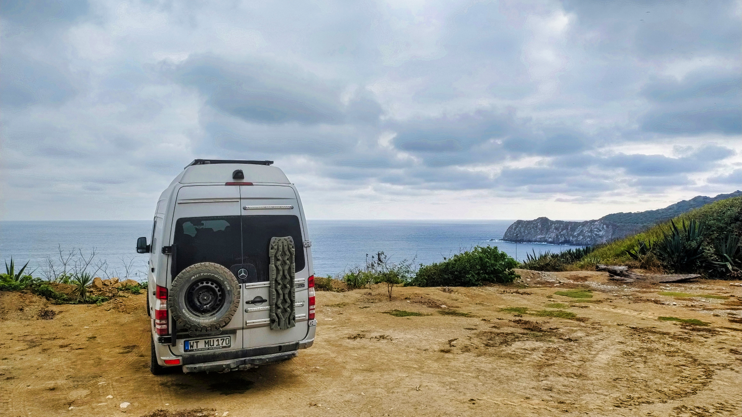
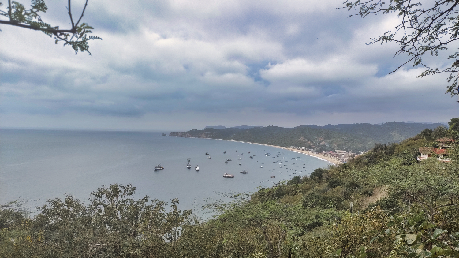
Around 5:30 pm, I found a place to stay for the night at Bungalows & RV Camping Islamar. The view of Isla Salango was the perfect end to an exhausting day. The campground was run by Jan, a man from Regensburg. Later in the evening, an Ecuadorian family arrived, but otherwise I enjoyed the view alone.
Jan had explained to me that the Pacific Ocean here is known for its whales and Isla de la Plata, also called the little Galapagos.
It wasn't stormy, but it was cloudy and windy. I considered taking the 3-hour boat trip from Puerto Lopez in the coming days if the weather improved. I would decide in Quito whether I would visit the Galapagos. So far, a 5-day trip including flights started at around USD 2'500 per person... plus extras. But you can easily find offers for USD 8'000 and more.
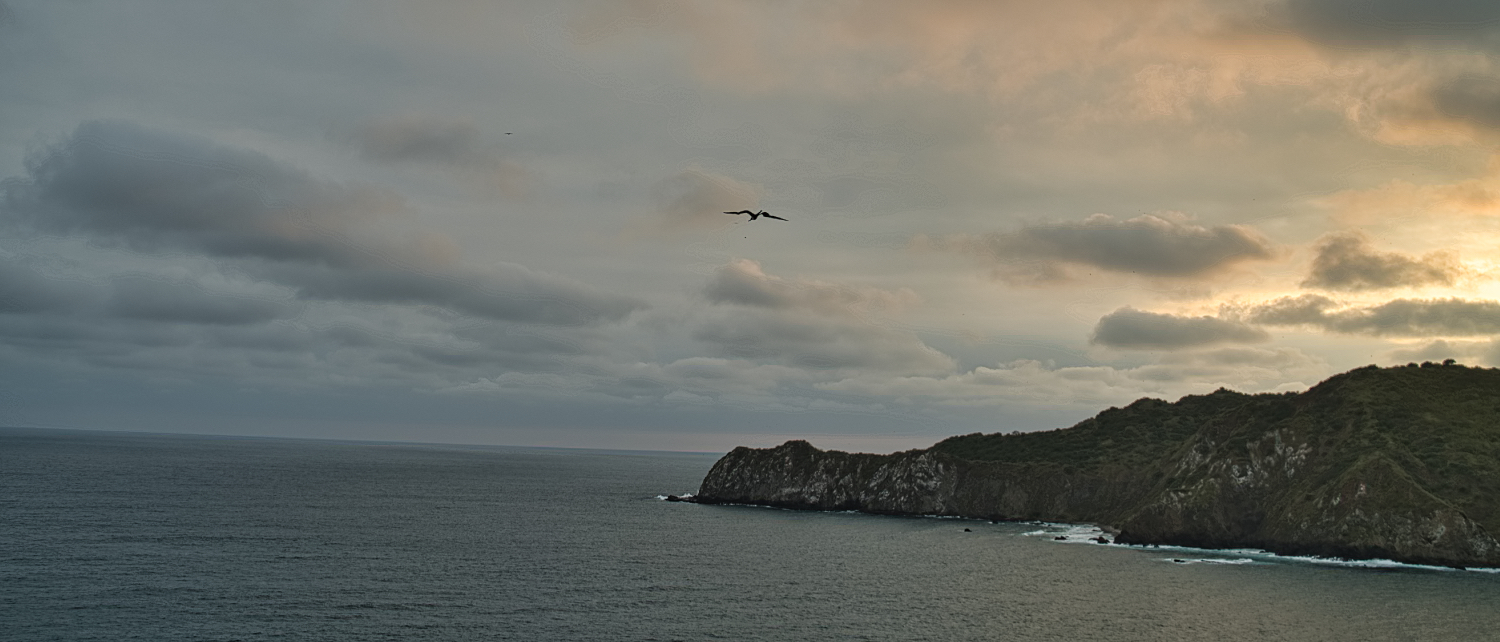
The view of the sea, waiting for the whales and watching the birds fly filled my day.
In Ecuador, Father's Day was celebrated that Sunday, and I was invited to a barbecue by Anna, Gerhardt, Deise, and Jan. There were salads, Regensburg potato salad, lots of meat, and fish. That's the life!
I spent the next few days watching the sea, but apart from sea lions, pelicans, frigate birds, seagulls, and the condor's little brother, the Gallinazo Cabecirrojo, I didn't see anything else.
And then the weather changed, it started to rain, and the forecast for the next few days was similar. Inland, from Velasco Ibarra onwards, it was supposed to be warm, up to 30 degrees. So I canceled the trip to Isla de la Plata and set off for Laguna Quilotoa. There was nothing that really interested me along the 375 km between the two places, and the parking spaces and campsites didn't appeal to me.
The 375 km took me over 8 hours. Each town took at least 30 minutes to drive through, and somewhere around San Sebastian, on the E30, the road turned into a dirt track, which was really challenging.
What struck me was that there seemed to be themes along the route. Sometimes you would find delicious tortillas for the next few kilometers, and then nothing else of that kind. Then aluminum pots and pans were sold, or a few kilometers further on, wooden bowls and children's toys. Quevedo in the afternoon was impressive. The larger cities somehow reminded me of clones of US cities. On the one hand, there were huge malls and, on the other, local shops.
From Quevedo, the road climbed steadily to 3'900 m. Down in the valley, it had been humid, around 30 degrees, and the sky was cloudy. After La Mana, the road wound its way up, but the Ecuadorians loved to build power lines along the road, ruining every view. Then at some point I was above the clouds and it looked magnificent. There was only one mirador until the highest point in Pilalo. That was then back in the fog.
In the evening around 6:00 pm, I parked in Quilotoa at the Hostel Runa Wasi. Camping was free and you paid for breakfast and a shower. The owner really tried to please the few guests in the off-season.
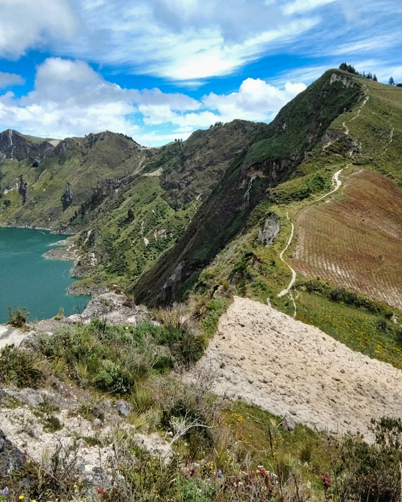
I had greatly underestimated the hike around the Quilotoa crater. The wind was gusting at over 20 km/h at 8 degrees Celsius, the 500 meters of elevation gain over 11 km were tough, and the climbs were challenging for me.
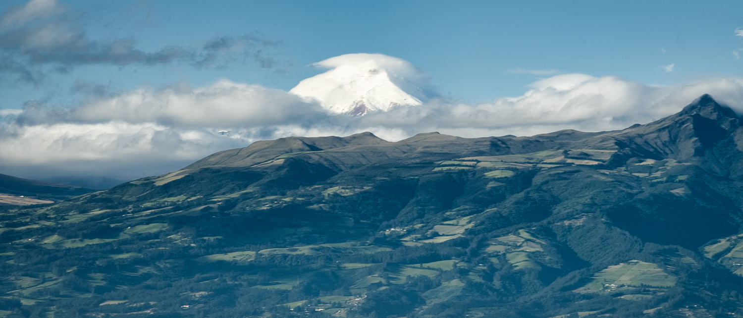
The view of the lagoon was impressive, the canyons in the area are rugged, but I couldn't see Cotopaxi or Chimborazo because of the low-hanging clouds.
After finishing the hike, I wanted to have a nice lunch in town, but the ladies only sold traditional clothing, toys, and other things for tourists during the day.
Over a beer, I studied the weather forecast for Cotopaxi. It was supposed to be between -8 and -14 degrees Celsius with snowfall at the top.
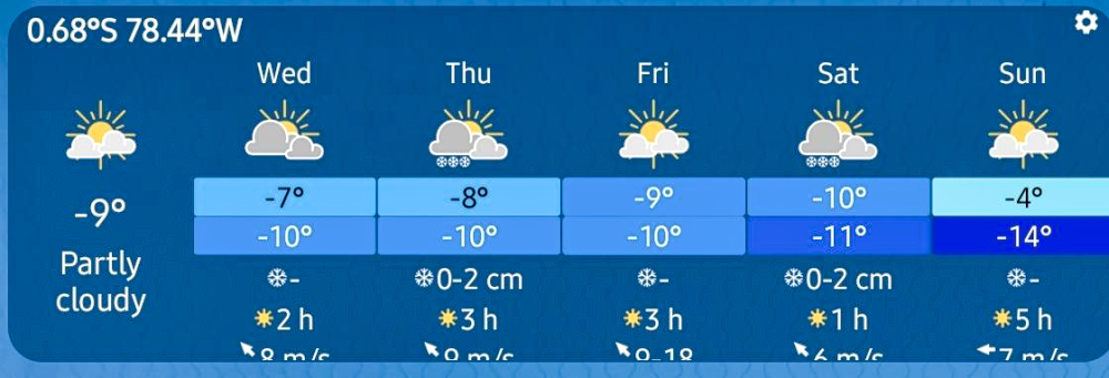
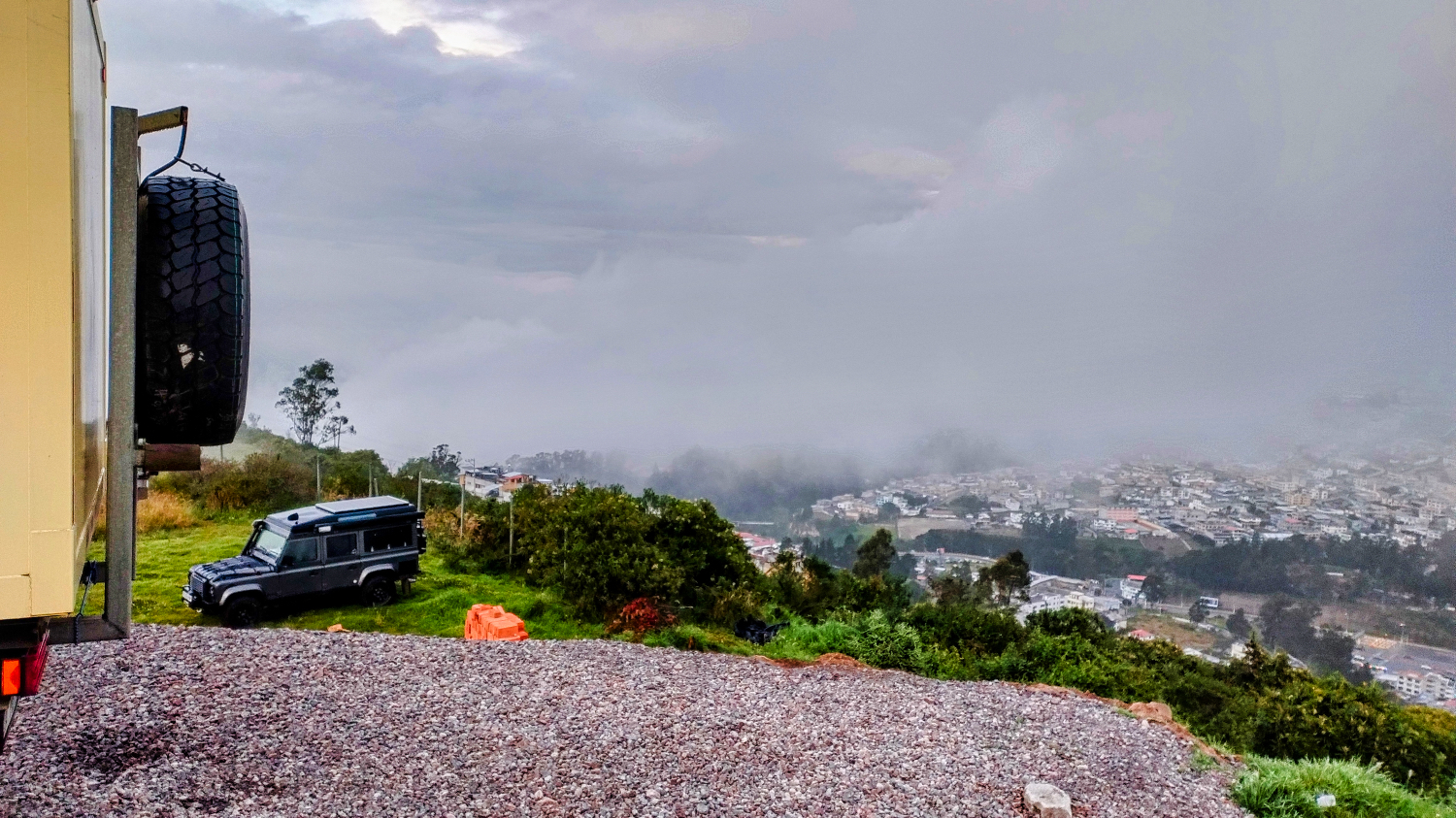
So I probably wouldn't go up there, but I should be able to see Ruminahui (4'721 meters above sea level), Sincholahua (4'887 m above sea level), and Cotopaxi (5'897 m above sea level) with a grog or hot chocolate in my hand. I had already found a campsite at 3'820 m between the volcanoes.
The next morning, I drove to Cotopaxi. The E30 wound its way through the Cordillera to Latacunga. I couldn't see much; Cerro Amina wasn't yet swallowed up by the clouds, but shortly afterwards I drove down through thick clouds and fog to Latacunga and then on the E35, which is partly a four-lane road, towards Quito. The turnoff to Parque Nacional Cotopaxi is impossible to miss, and I just had to register at the Centro de Interpretacion Parque Nacional Cotopaxi. There was no entrance fee for the national park.
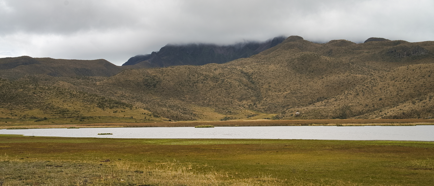
When I made my first stop at Laguna De Limpiopungo, it was raining and the volcanoes were not visible.
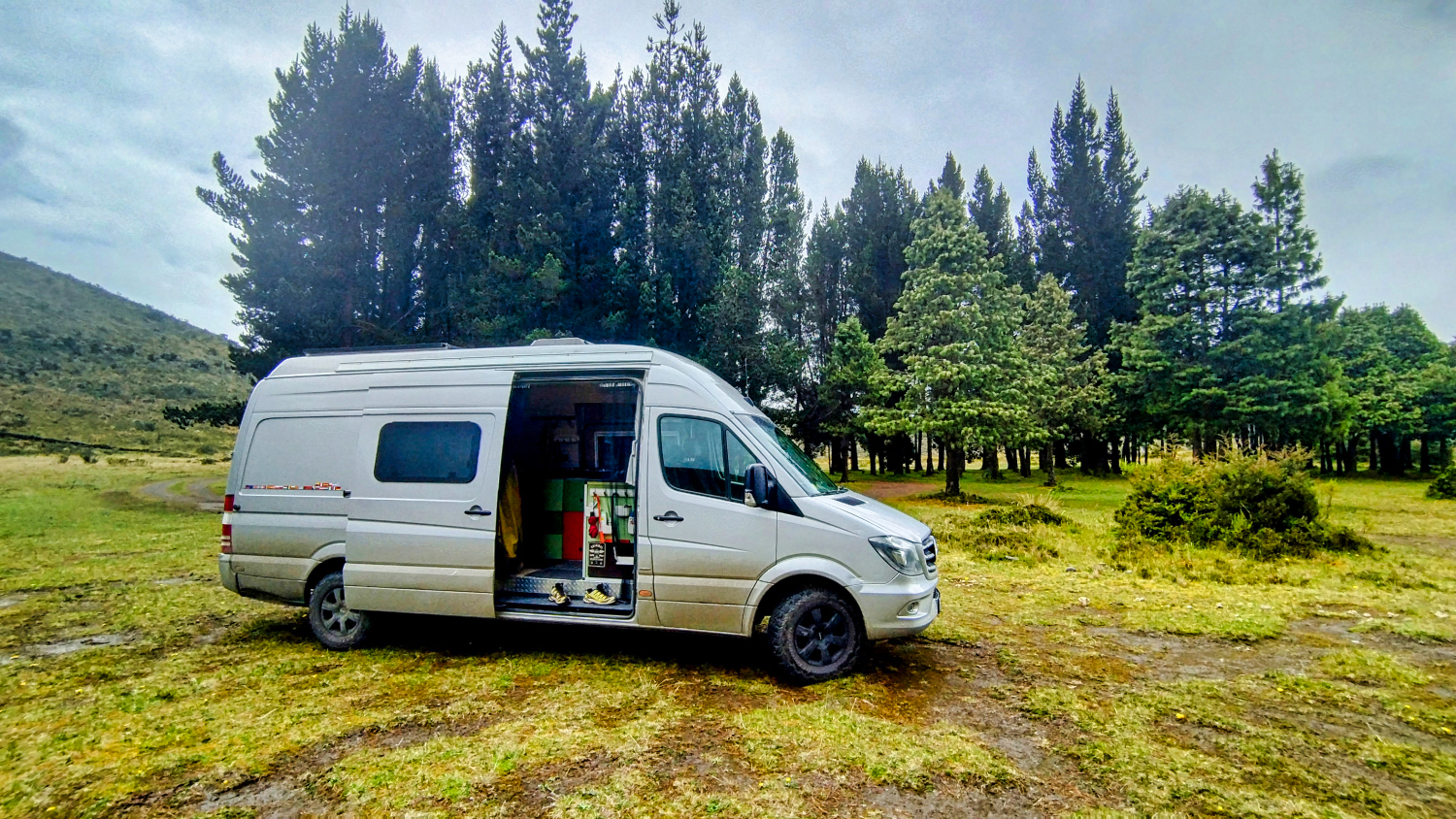
I looked for a place to stay at La Rinconada Camping. It was no problem, because apart from me, there was only one French overlander there.
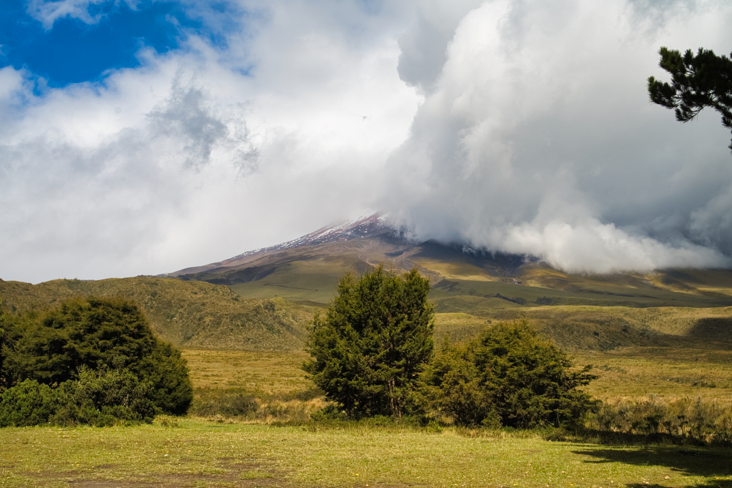
I made myself comfortable, because I was waiting for the moment when the cloud cover would break and I could photograph Cotopaxi. It turned out to be a long afternoon. When the sun came out, I sat in front of the Sprinter, otherwise on the passenger seat.
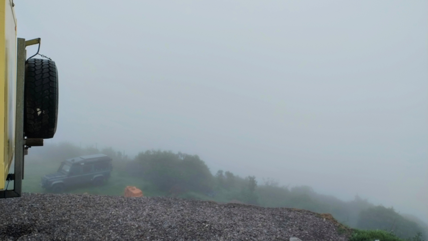
The cloud cover hung somewhere between 4'500 and 5'000 meters. I could see into the valley, but the volcanoes didn't come out.
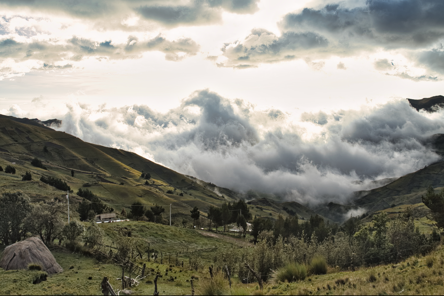
After a cool night, the mountains and volcanoes were still hidden in fog the next morning. I decided to drive to Quito along the RUTA DE LOS VOLCANES. The 1.5-hour drive took me through beautiful countryside with lots of greenery and bumpy roads.
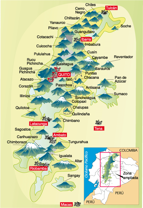
Here is an overview of all the volcanoes in Ecuador that I didn't see.
I had to pay 12 cents for my Claro SIM card in Quito. I couldn't use the MiClaro app because it is only available in the Google Store for Ecuadorians or South Americans. My attempt to do it online also failed.
I found a Claro Customer Store in the San Luis Shopping Mall and paid the 12 cents. Otherwise, they would have deactivated my SIM card on June 21. To my surprise, I also found decent shoes in size 12. In Cuenca, the stores only had shoes up to size 11!
The mall is very large, but not cheap. I didn't find any bargains here. But at least parking was free and there was also space for large motorhomes.
I spent the next few days at the CODA VISTA campsite. The view of Quito was great and I also met a few overlanders again. Andy, the manager, is Canadian and helps you with pretty much everything. He gets bread from a Swiss baker in Quito, organizes taxis, etc.
I took my first tour of Quito on the same day that Inti Raymi was celebrated. The winter solstice festival takes place on June 21 in Ecuador. There was music, dancing, and other performances in all the major squares. In any case, the city was packed.
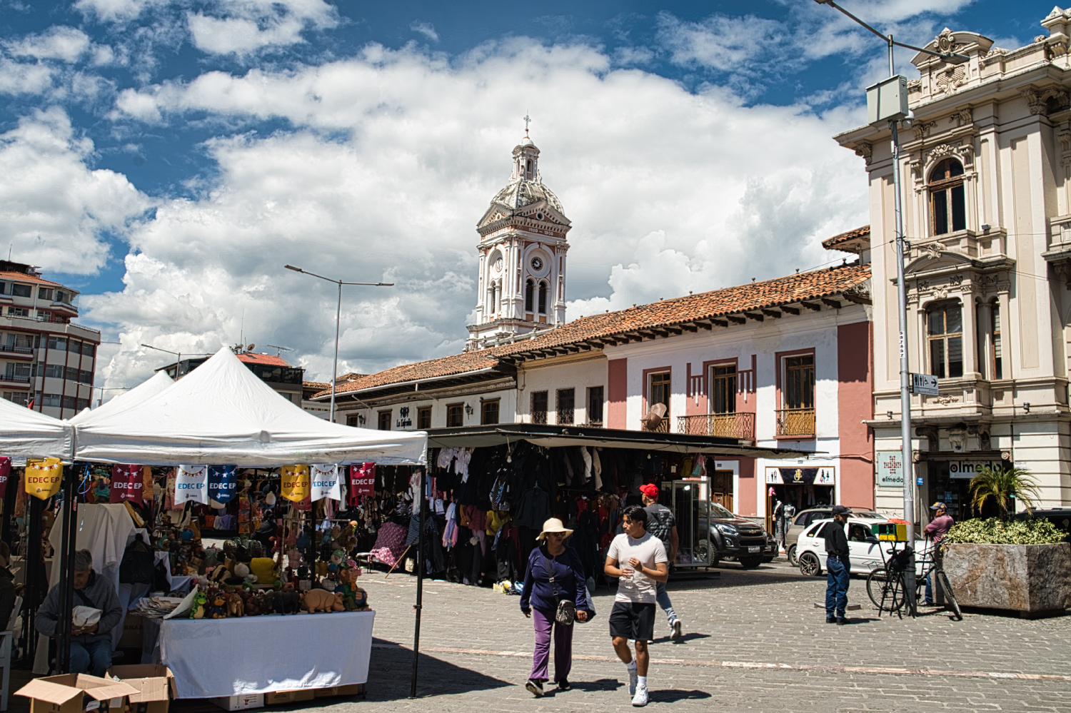
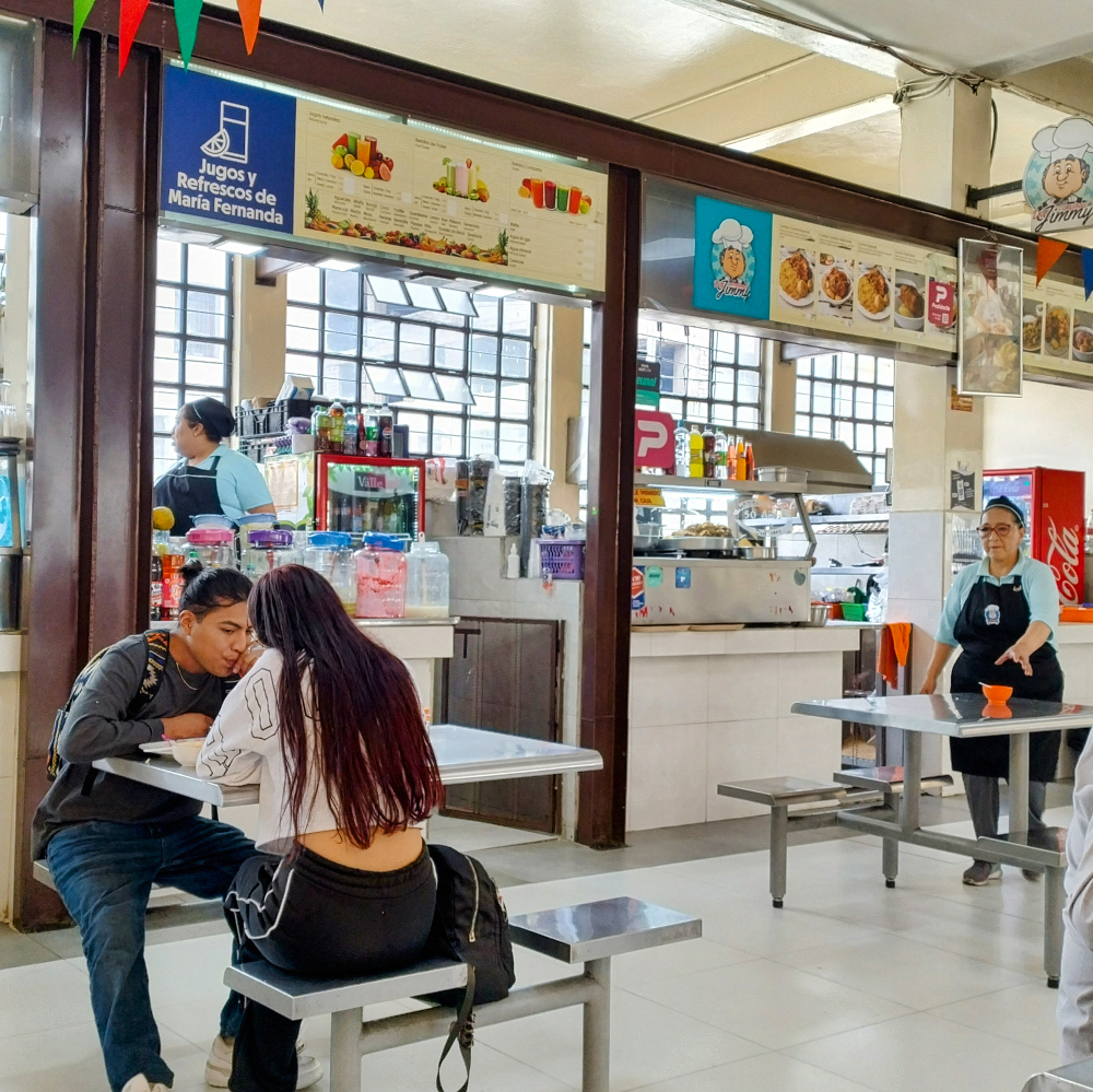
I started my tour at the Mercado Central. It was OK, but it didn't blow me away. It wasn't really a market hall, but rather a collection of various food stalls with seating in a sober atmosphere. There are more stalls around the market hall. What annoyed me most were the recommendations for two options that I couldn't find. When will people learn to date their blog posts? Then you don't have to read articles that are no longer relevant.
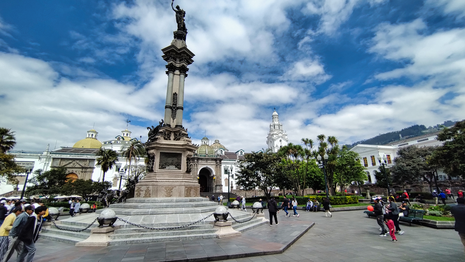
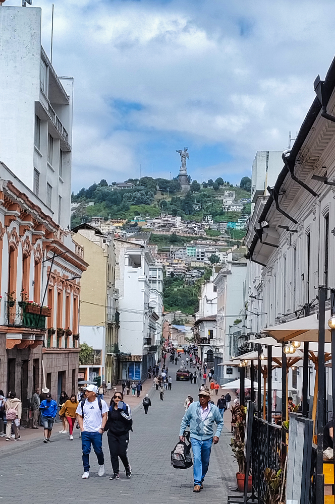
A few words about Quito. The city (the greater Quito area has 2.7 million inhabitants) was founded by the Spanish in 1534 and has a well-preserved historic center. The architecture of the old town is called Escuela Quiteña, which combines indigenous and European elements. Compared to Santiago, the city has its own unique flair.
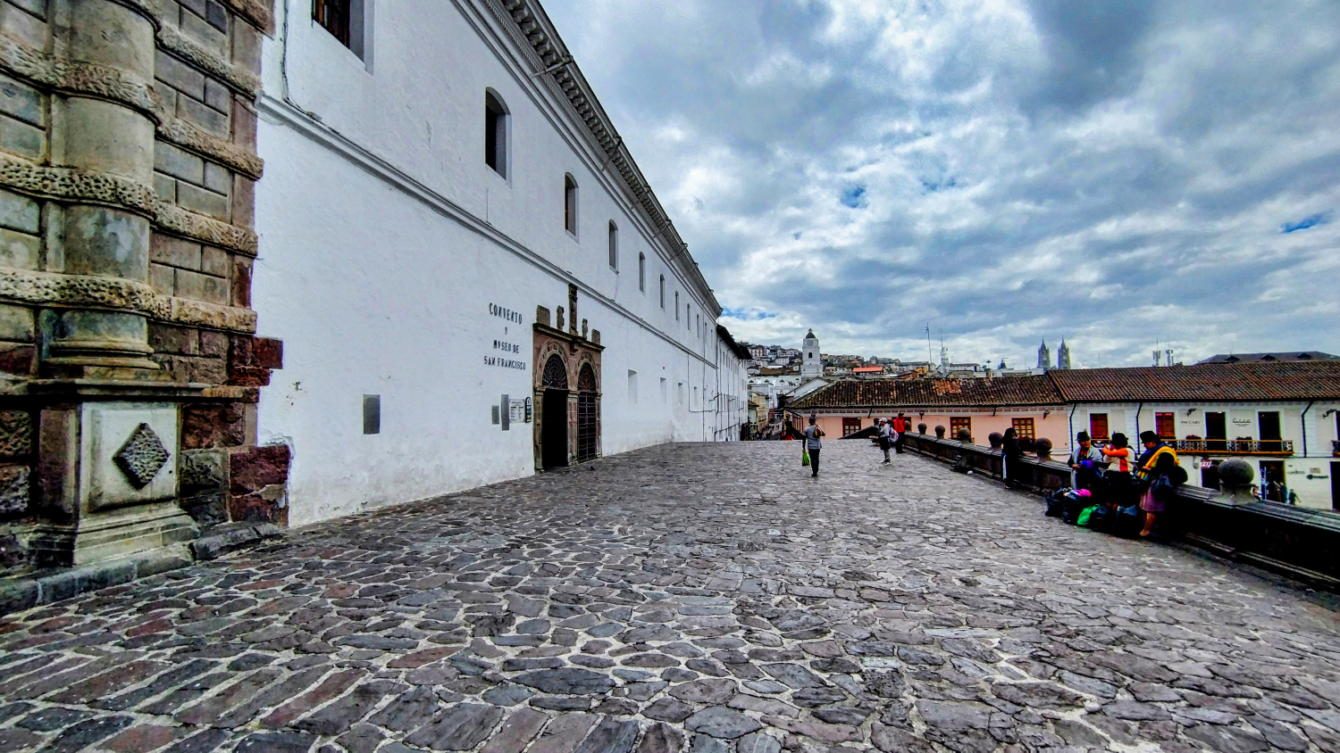
The highlight of this artistic era are the churches. And Quito has quite a few to offer. Whether it's the Catedral Metropolitana de Quito, the Santo Domingo monastery, La Recoleta De San Diego, or the Iglesia de la Compañía de Jesús. Some of the churches are located outside the center on the many hills.
From the Mercado, I went to the Basílica del Voto Nacional and then to the actual Centro Historico.
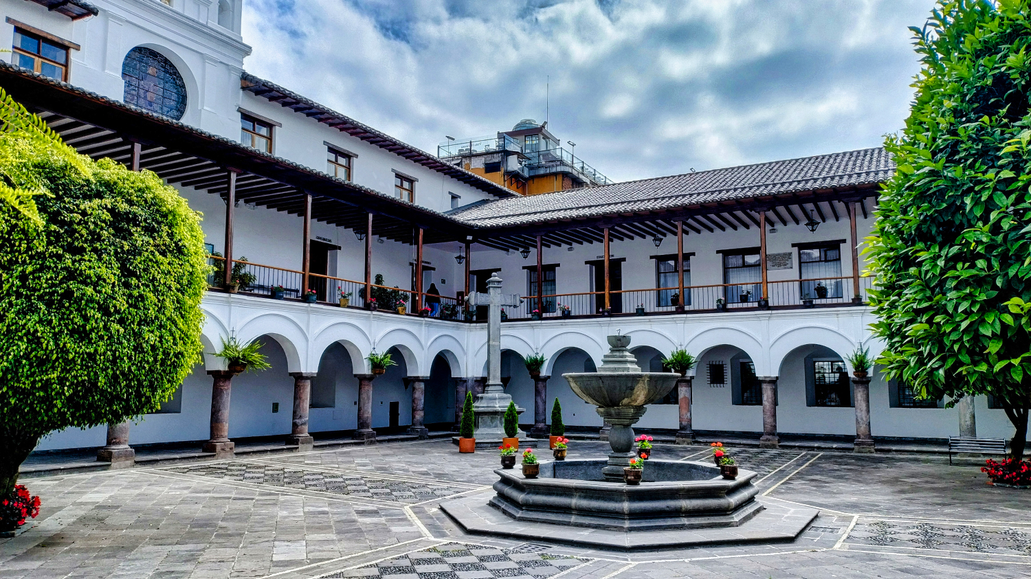
Between churches, museums, and squares, I discovered small shops and shopping centers. If you wanted to shop, there were plenty of options here. Large supermarkets are not really found in the old town. If you keep your eyes open, you will find entrances and passageways that end in courtyards.
The Palacio Arzobispal, on the Plaza Grande, was a nice place to watch people while having a coffee. Whether restaurants, cafés, or studios, there is a lot to discover. Drinks and food were sold on the streets, and you could buy ice cream every few meters. Some of the fruit ice cream was made fresh on the street.
I was struck by the many museums, such as the Museo de la Moneda, the Museo Alberto Mena Caamaño, and the Museo de la Ciudad. None of them charged admission on June 21.
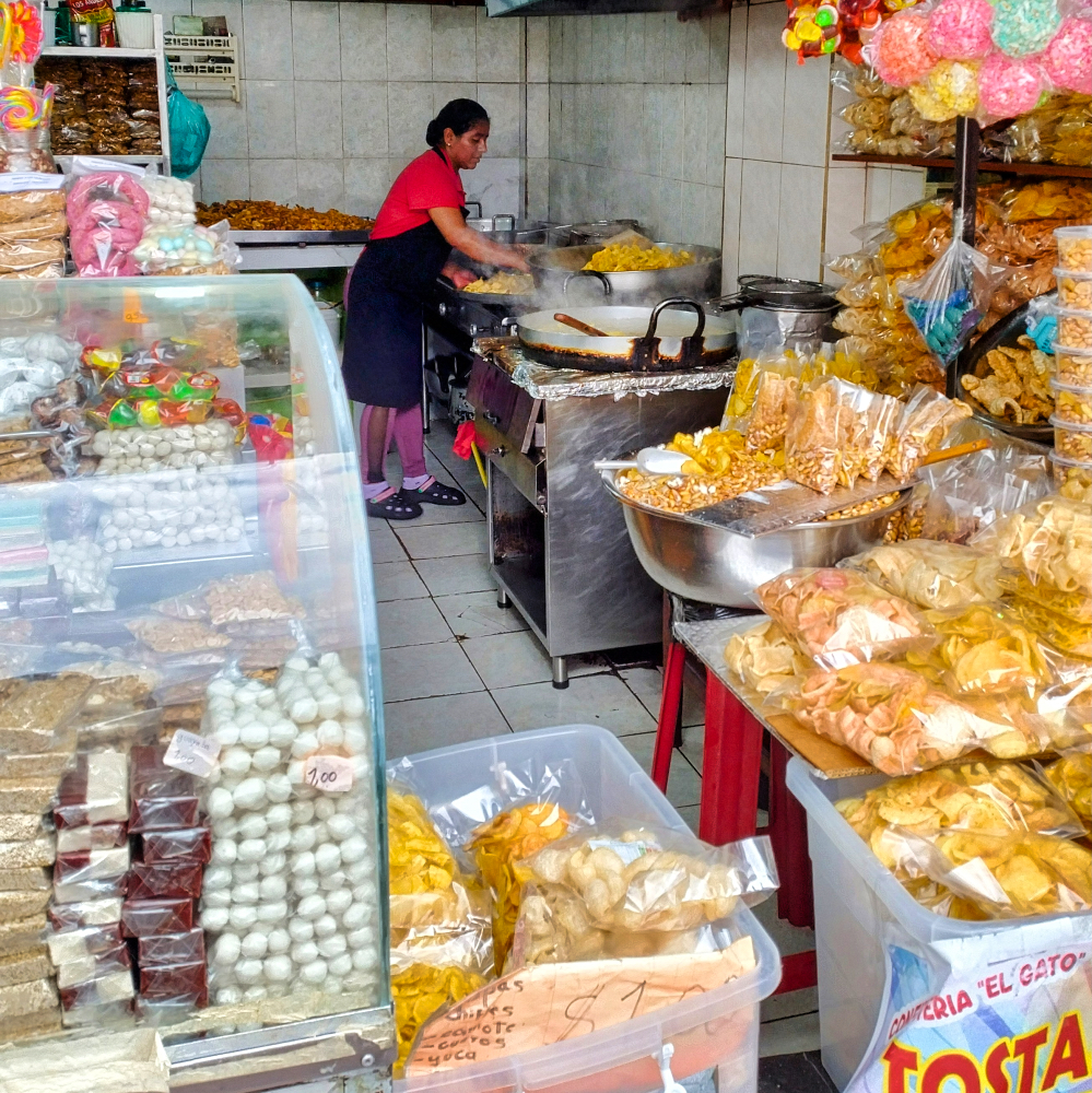
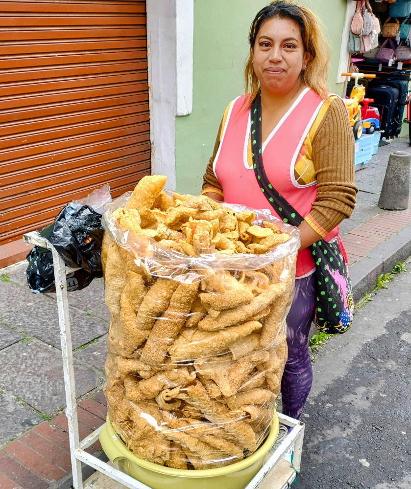
I passed the time until lunch with empanadas, chochos (roasted lupins), chifles (thin plantain chips), and tostado (roasted corn). For USD 1, you could get a good portion. I skipped the chicharrones (crispy fried pork rinds) this time.
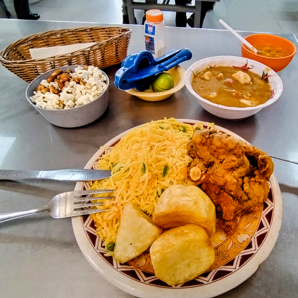
Looking for something new, I tried fritada de chancho with llapingacho for lunch.
Fritada de chancho is a dish in which pieces of pork are cooked in large pans with water until the water has boiled away and the pork is cooked in its own fat. The result is pieces of pork that should be crispy on the outside and juicy on the inside.
Llapingacho is similar to a tortilla, made by mixing mashed potatoes with fried onions, garlic, and cheese and frying it in a pan.
After that, I was full and skipped the hike to the Virgen del Panecillo. The Panecillo is a hill about 200 meters high in the middle of the city, on top of which stands a 41-meter-high statue, the Virgen del Panecillo.
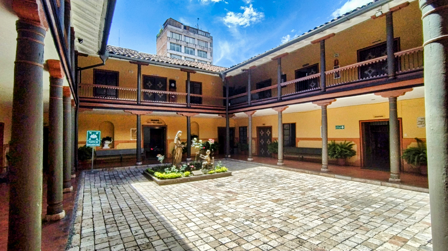
On my second visit to the city center at 10:00 am, it was much less busy and I really enjoyed exploring the Centro. I even enjoyed visiting the Museo del Carmen Alto. I also found more courtyards and browsed in small shops above Plaza San Francisco.
I was looking for two things: a cap with an Ecuador or Quito motif and a pair of thin pants for Colombia. There were many sports shops and hat shops, but they mainly sold caps with sports motifs. I had already noticed the various Chinese junk shops, and in one of them I found the pants I was looking for.
Quito wasn't really good for my figure, because while strolling around I snacked on chicharrones, bolon de verde, Ecuadorian ceviche, and corviche.
I had received further recommendations over the weekend, and one of them was again in the Mercado Central. Second attempt, and I had a Corvina Especial for lunch with a jug of freshly made Annans orange juice.
I got my Corvina at Don Jimmy's. Corvina is a fish similar to red snapper. I have no idea if Don Jimmy's is that much better than the other stalls, but the fish was fresh and very tasty. The juice and food cost a total of $14. You can't complain about that.
I can't say whether it was because of the Ecuadorians or because their cuisine was really better, but I went out to eat more often in Ecuador than in the countries before. I definitely found the cuisine more varied! None of the dishes disappointed me, and I often ate at reasonable prices.
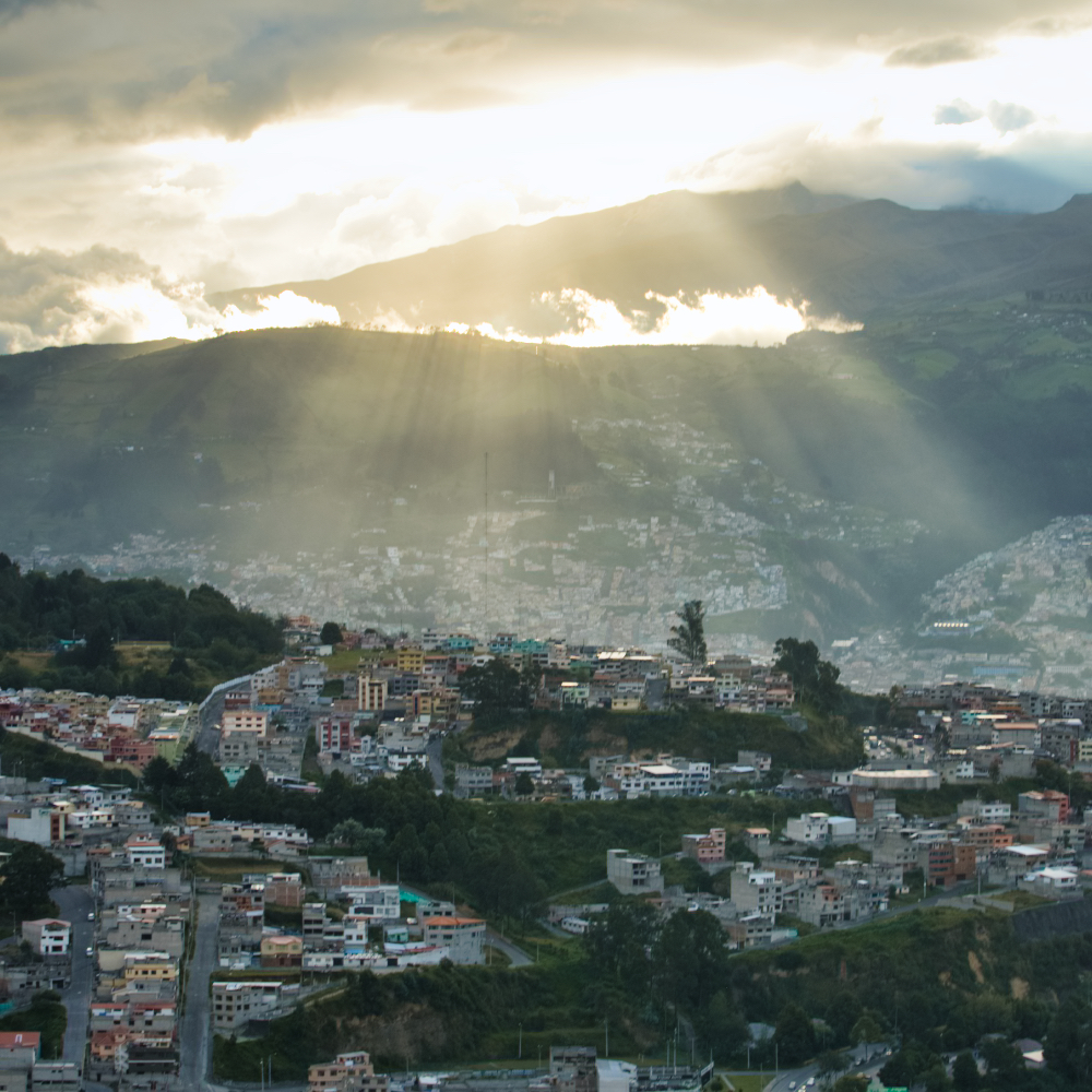
A few words about the weather in Quito. I hadn't had much fog until now, so the fog that rolled in in the evening and drifted through the valley was something new for me.
On the first day, I had a good view of Cotopaxi in the morning, but that wasn't the case on the following days.
With temperatures around 68°F, you could walk around without a jacket during the day, but it quickly became quite chilly after 6:00 pm Only a few people sat in front of their motorhomes in the evening.
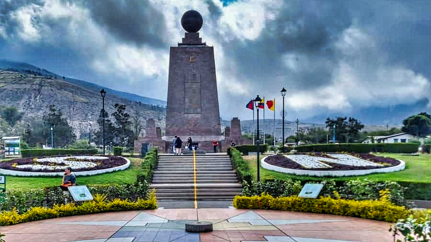
On the way north, I drove to Mitad del Mundo, where the equator was supposed to run. The information center was very busy, but I learned that the equator ran 240 m south, at Mt. Catequilla. Shit happens!
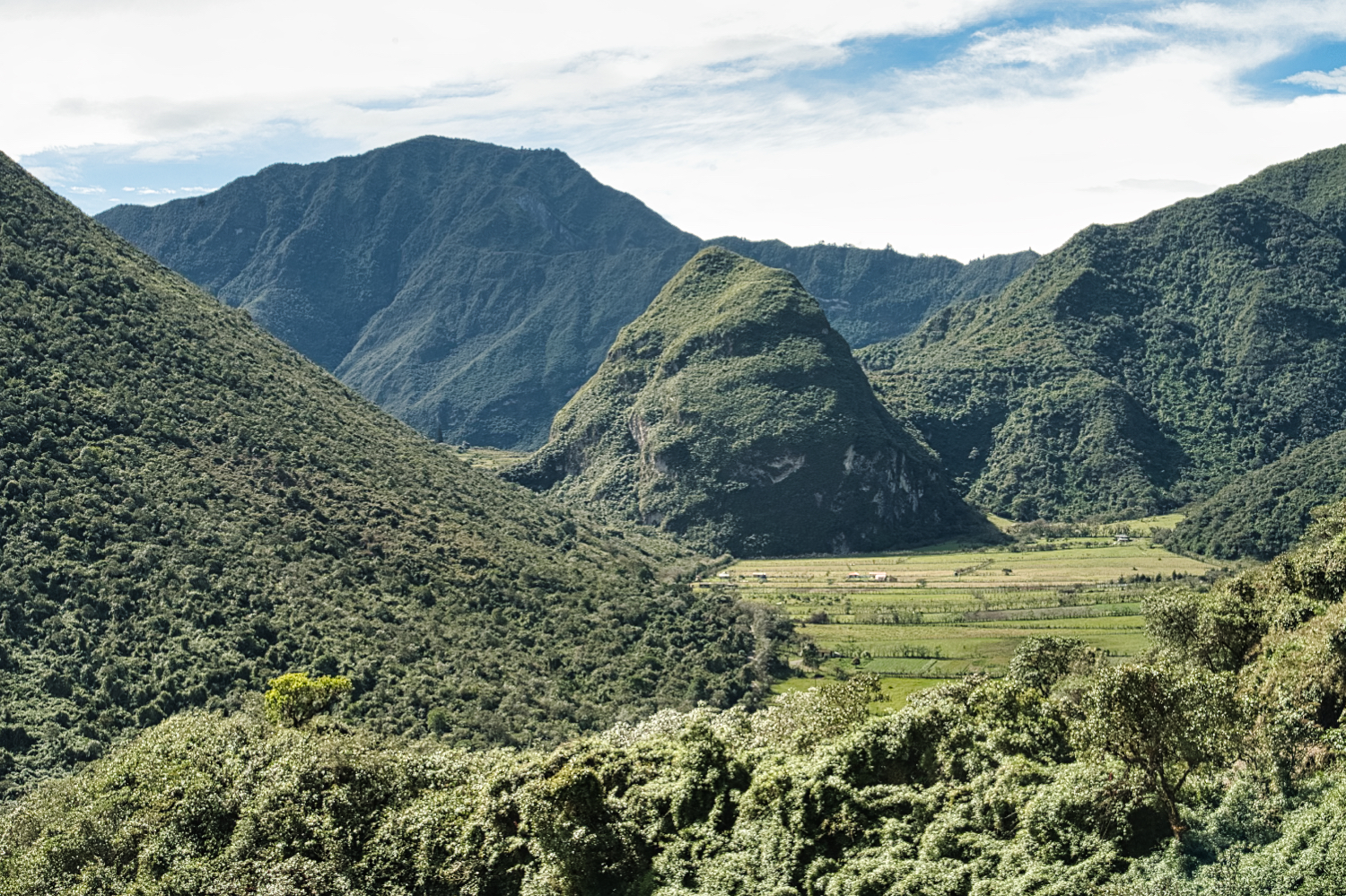
I drove on and an hour later I was standing in the Pululahua crater. For a change, it wasn't a lagoon, but a green oasis. The descent into the crater was my third dirt road, but it was also well maintained. Once again, I was the only guest at Pululahua Camping Tres Colinas and enjoyed the short climb to Cerro del Chivo. What I really liked was the peace and quiet compared to Quito.
As my time in Ecuador was coming to an end, I decided to stop at Laguna Cuicocha on my way to Finca Sommerwind. Maps.Me had suggested a 3-hour route of just under 90 km, and up to El Boliche it was a beautiful route, but then Maps.Me to a nursery and onto a path that wasn't really passable for my Sprinter. I had to reverse 50 m down a track at a snail's pace. After a quick chat with two employees, I found a passable track that led me into the mountains.
It went up and then steeply down again. I decided to follow the well-travelled track and not Maps.Me. On a track with no name, I arrived in Saavi or Cubi. There were two problems for me that day. The track was a big construction site and closed, and the participants of a funeral were gathering and 15 minutes later drove to Saint Louis de la Chonta in pickups and a cattle truck, carrying the coffin. I joined the procession, because if a coffin could get through, my Sprinter should be able to as well. The track was in terrible condition, even though a grader was in the process of improving it. I would say it would take him a few more days to finish the job.
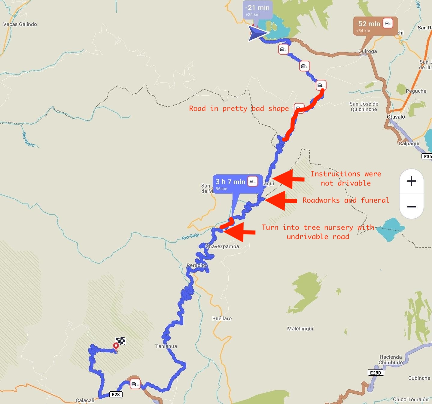
In Saint Louis de la Chonta, Maps.Me sent me on a shortcut. For the second time that day, I drove down a steep section covered with deep ruts in reverse. For about 10 km, the road climbed up the mountains towards Otavalo. After the 10 km, it was back to a track through the rainforest and a Bosque Protector. Unfortunately, I didn't take a picture of the sign, so I don't know exactly what this park is called.
At some point, it became a paved road again until Laguna Cuicocha. Instead of 3 hours, it had taken almost 5 hours and I was pretty exhausted.
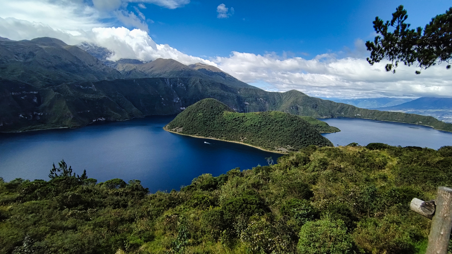
I wasn't really impressed by Laguna Cuicocha. It looks nice in the pictures, but the hiking trail runs at the same height between bushes and trees, so you can't see much. The miradors are OK, but nothing more. To be honest, this was the first recommendation that flopped.
I had my first negative surprise the next day when I arrived at Finca Sommerwind. Someone had torn off my front license plate, leaving only the screws stuck in the bumper. It was just a dummy plate, so no real problem.
Finca Sommerwind was an institution in South America for overlanders. Hans, the owner, has been running the finca for 15 years now, and he also gave me the latest information on the changes for entering Colombia.
The latest news for me was (June 28, 2025)
- You can now only get SOAT if you have the TIP. This is now done online
- The online form for the Colombian TIP didn't really work for me. You need an entry permit from the Colombian immigration authorities, and you can only get that once you've been through Migraciones. His tip was that there are small shops at customs in Ipiales, after Migraciones, that offer this service. So before you go to Adouanes. Alternatively, you can start your Starlink and do it yourself
- Don't buy a SIM card from street vendors at the border, but from a CLARO service center.
- Don't exchange dollars for pesos at the border, but get money from Western Union, Bancamia, or an ATM.
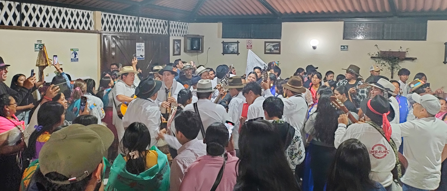
On Friday, Inti Raymi was also celebrated in the next village. Together with other campers, we set off at 7:00 p.m. and accompanied the residents on their parade. It's quite different to celebrate Inti Raymi in a small village. We moved along with the procession and “danced” to the music for about two hours on the road along the Laguna de Yahuarcocha. There was schnapps to drink and skewers were sold along the way. A local even tried to teach me the right dance steps.
Instead of driving straight to Colombia, I made a detour to the El Ángel Ecological Reserve. Hans had suggested the Bosque Mágico de Polylepis, and afterwards I wanted to visit the Cementerio Municipal de Tulcán - José María Azael Franco in Tulcán. The road there was paved, and only the last 5 km to Laguna Yanacacha were unpaved.
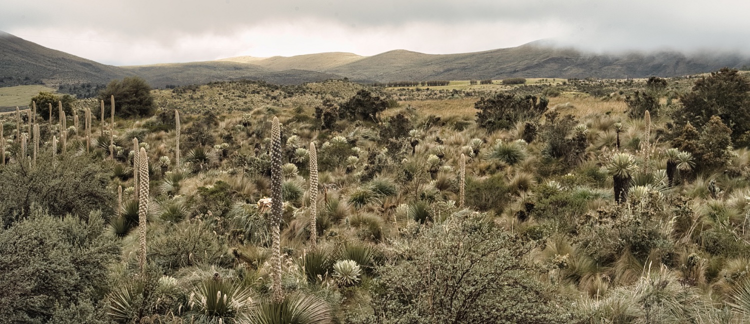
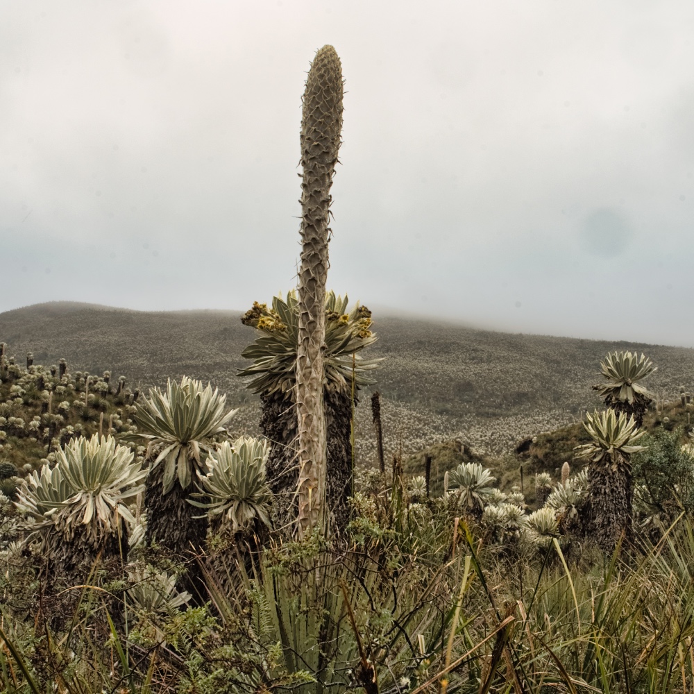
The Reserva Ecológica El Ángel is located in the Cordillera Occidental and reaches an altitude of 4'000 m.a.s.l. I wasn't very lucky with the weather that day. It was windy, foggy, and raining. I could see the Polylepis trees and how they disappeared into the fog.
But apart from a short walk, I couldn't bring myself to do anything else. Around 2:00 p.m., I set off for Tulcan. Maps.Me showed me two options. Both took two hours, and the first went via the east entrance and the Mirador Corazones Sanos. I hoped I would be able to see a little more and set off. But at around 3'500 meters, it was foggy again and visibility was poor.
After the turnoff to the east entrance, the road became narrower and bumpier. But it was only 35 km to Tulcan. 10 km further on, after a few nasty sections, I found myself facing a muddy landslide. Without a 4x4, I wouldn't be able to get through here. It took me 30 minutes to turn around on the narrow road, and 10 minutes later I was stuck in a muddy hole. Nothing was working, and at 5:00 p.m., there was no one else around for 15 km.
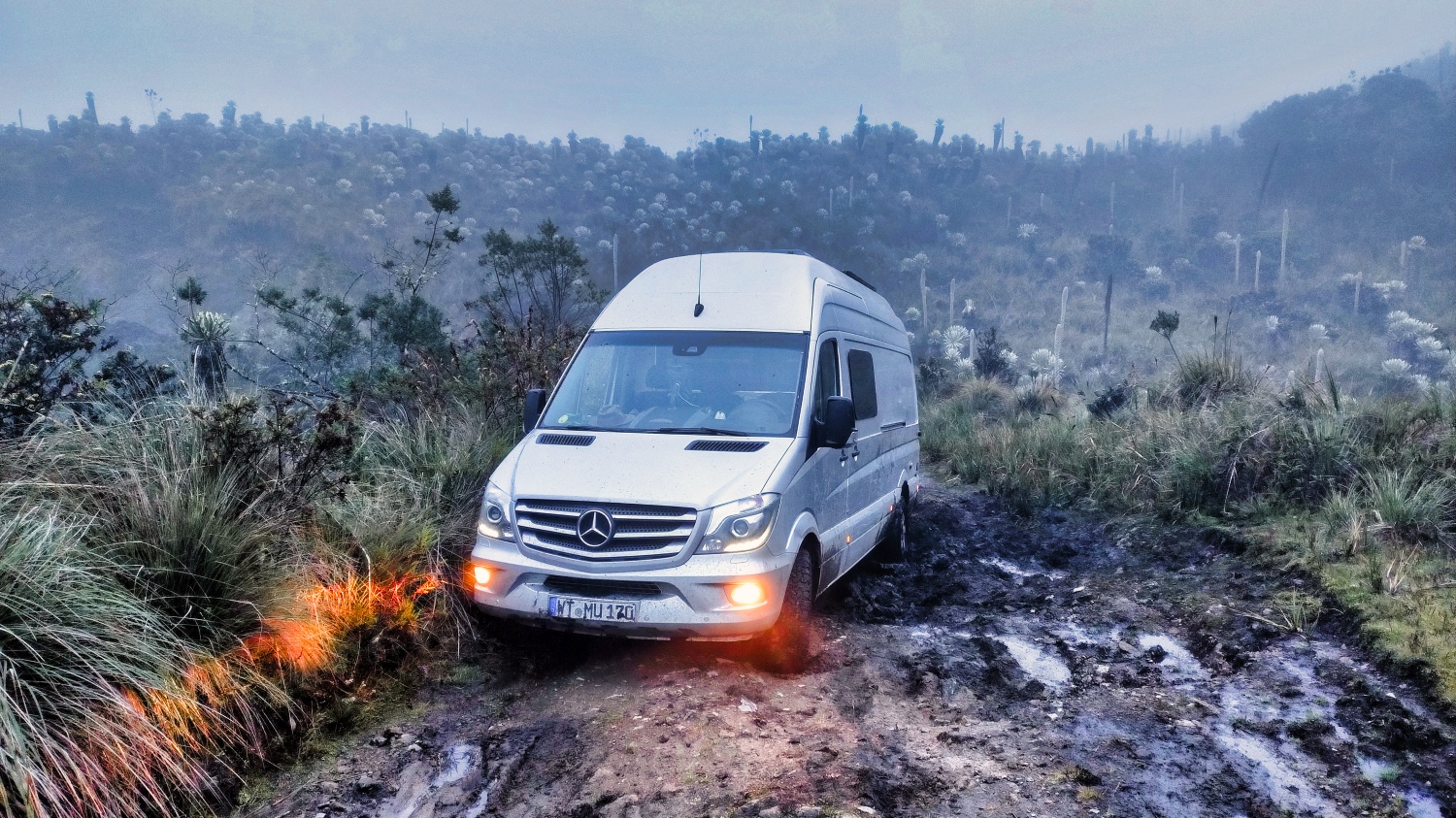
Filthy and frustrated, I gave up as night fell. I sent a few WhatsApp messages to see if anyone could pull me out the next morning. Around 8:00 p.m., it was now pitch dark, a bright light illuminated the motorhome. A few minutes later, I knew that Sebastian was trying to get to Tulcan with his wife and toddler in a Chevy 4x4. We realized that he couldn't get any further without pulling me out. And so I was lucky once again.
At 9:00 p.m., I was standing 10 meters in front of the mud hole and Sebastian was on his way home. The next morning, he told me that it had taken him over two hours to cover the 25 kilometers.
I cleaned my sand plates and tidied up the motorhome aéarly morning. I managed the 10 km to the east entrance without any further problems. The ranger on duty that day told me that the road was impassable. A small sign or barrier would have spared me another experience.
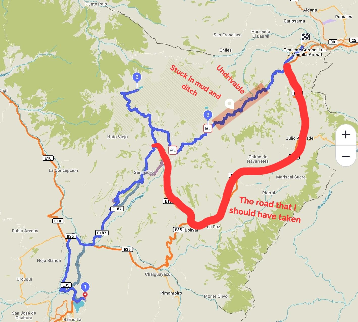
At noon, I was standing at the Puente Internacional de Rumichaca on the border with Colombia. I had skiped the Cementerio Municipal de Tulcán as (a) I was not impressed by the city and (b) would have had to stay in a parking lot dirty as I was.
It was a busy border, but after 75 minutes, I was in Colombia.
The Stage

More Pictures
Videos
Latest Posts
-
 Closer to the end - South Colombia till Medellin
 -
 Ecuador - La Balsa to Tulcan
 -
 Lima to Ecuador
 -
 Lima from beginning to end
 -
 Cuzco to Lima
 -
 From Lake Titicaca to Cuzco
 -
 Bolivia, in search of diesel


Post Info
Date | June 2025 |
Status | Done / Visited |
Last updated | 06 November 2025 |
Page read | 656 |